FOUR PARKS IN THE OAKLAND HILLS: Chabot, Redwood, Huckleberry & Sibley Provide Alluring Natural Attractions & Quick Escapes from the Madding Crowd
.jpg)
Only a bona fide urban creature – someone whose idea of a nature get-away is lounging on a grassy meadow in citified Golden Gate Park or jogging the asphalt loop around construction-choked Lake Merritt – could endure the passage of days without regular and extended forays to the wild places and open spaces abounding on the fringes of metropolitan Bay Area sprawl.
.jpg)
For the rest of us (accidental?) city dwellers who crave nature like a hit off the hookah, life in the Bay Area is only (and barely) tolerable because of the vast swathes of greenbelt preserved in our midst, places of refuge that offer soulful escapes and sanity-saving immersions in a variety of landscapes.
.jpg)
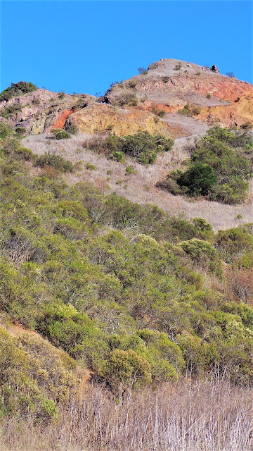
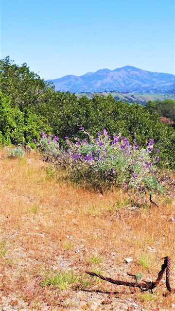
First, let us give thanks and praise to the wondrous workings of local geology. In the East Bay, ten million years of turbulent uplift, shifting, folding and contorting, punctuated by cataclysmic volcanic eruptions and explosions, have warped and tortured the landscape, defining the natural features that gave rise to unique plant and animal communities, and eons later, to the human diorama.
.jpg)
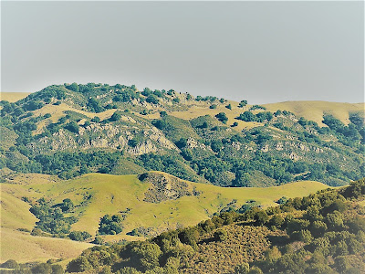
A Stegosaurus ridge spine, some 20 miles long, runs northwesterly along the urban boundary zone, jutting up an average of 1300 ft., with several 1700 footers, and topping out at Vollmer Peak, not the most dominating presence at 1905 ft. in the Berkeley Hills, but still an impressive rise of earth where civilization's relentless encroachment is halted and has nowhere to go.
.jpg)
From the air, the prominent greenbelt reveals a rollicking topography of ravine-cleaved hills, blown volcano tops, large boulder outcrops, and modest peaks and canyons.

The complex and varied landforms of the Berkeley Hills hold many surprises and treasures – sheltering second growth redwood forests and dense oak woodlands, alternating with chaparral, grasslands, and meadow environments; hiding tranquil lakes and ponds; harboring gentle riparian corridors; and nurturing sensitive ecosystems.
.jpg)
Truly, the Berkeley Hills greenbelt is an ecological treasure trove, an animal and plant sanctuary, an outdoor lover's recreational paradise, and literally the only thing that has kept small-town Gambolin' Man from going crazy all these years or flying the coop long ago.
.jpg)
Four special parks, each as familiar as an old lover by now, make up a contiguous stretch of the Oakland foothills ridge system.
.jpg)
Starting from the southern end, the regional parks of Anthony Chabot and Redwood are super-popular destinations, but often, you’ll experience only silence and serenity in their sprawling acreage and might find yourself remarking over and over:
.jpg)
"Six million people in the Bay Area and I've got the place all to myself! How can this be?"
.jpg)
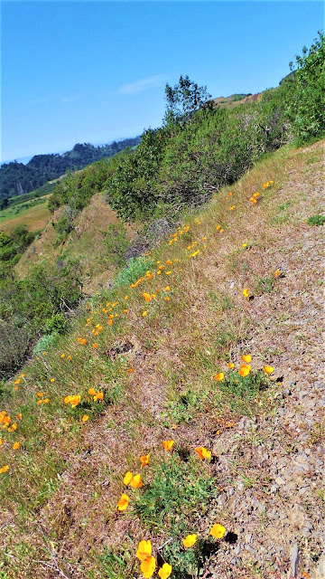
Moving northwest, the specially designated Botanic and Volcanic Regional Preserves of Huckleberry and Sibley are characterized by singular features found nowhere else – endemic and rare botany at Huckleberry, and geologic oddities and other surprises at Sibley.
So, lace up your hiking boots, grab your hat and shades, load up your pack, and head for them thar hills!
.jpg)
Anthony Chabot Regional Park
Lake Chabot looks like a jewel in a natural setting. Its gleaming presence belies the relative destruction of a once-intact ecosystem comprised of numerous biomes and multiple creeks – Moraga, Indian, Redwood, Buckhorn, Grass Valley, and Elmhurst – that drained a large watershed, now much of it water district lands.
.jpg)
The queen of the lot, San Leandro Creek, flows down southeasterly out of the rugged east side of the Berkeley Hills before looping to bay outlets and marshes near the Oakland Airport.
.jpg)
In his classic vade mecum, The East Bay Out: A Personal Guide to the East Bay Regional Parks, Malcolm Margolin remarks:
.jpg)
"The creeks no longer flow through our cities – at least not as living creeks – but the waters have not disappeared. The waters are waiting for us in the hills as artificial lakes, big calm bodies of water standing patiently behind their dams, willing to give comfort to anyone who comes looking."
.jpg)
Designed by Anthony Chabot – the man who invented the high powered and highly destructive hydraulic mining hoses used in the Sierra Nevada gold fields – the dam was a post-gold fever visionary scheme to bring a stable water supply to the burgeoning population of East Bay foothill cities.
.jpg)
In yet another environmentally sensitive affront in the name of progress, the Quebec native turned his water cannons loose on pristine hillsides to blast out cliff faces to block creek flow.
.jpg)
A reservoir was then created by damming the narrow confluence point where Grass Valley and San Leandro Creeks converged. Chabot Reservoir slaked the thirst of community residents for the next 65 years, until the late 1930s, and by 1966, with a fishing hungry public long clamoring for access, it finally became a recreational area.
.jpg)
Once considered "one of the wonders of California" Chabot's dam accelerated the pace of development and had the extra unintended tragic consequence of blocking egress for migrating steelhead and native rainbow trout – first identified as a species in Redwood Creek – forever trapping and isolating them physically and genetically in the upper reaches of the watershed.
.jpg)
But who knew – or cared – back then when the only thing that mattered was progress.
.jpg)
.jpg)
It can seem as if the busy world has disappeared from the face of the earth. For a different kind of enjoyment, rent an old-fashioned rowboat at the marina and spend hours burning fat and building muscle paddling like a maniac.
.jpg)
Or, if you prefer, just casually canoe about the shore's reedy edges, exploring islands and back channels alongside rolling eucalyptus-shaded hills, imagining that you are anywhere but in Alameda County with its 1.5 million population.
.jpg)
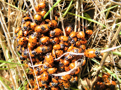
Prime birding opportunities await here – on any given day you will see flamboyant cormorants flapping their wings or diving deeply for a tasty tidbit; observe herons, great blue and green, and snow-white egrets, perched motionless in muddy flats, in silent hunt mode.

Track circling raptors, soaring vultures, and feeding waterfowl; furry flotillas of ducks and honking geese will delight.
.jpg)
All the while secretly hoping to catch a glimpse of the Loch Ness Monster that reputedly dwells in the chthonic depths. Some old-timers claim to have seen it; others say it is a released pet caiman that has grown to enormous proportions; others say hooey but relish the myth anyway for its exotic flavor.
.jpg)
You never know what you might see here. One day, floating listlessly in the hot sun, going nowhere in particular, we watched an unlikely creature – a regal Orange-billed Swan! – maneuvering back 'n forth across the rippling water, gliding in and darting out of reeds, chased by glittering dragonfly chaperones.
.jpg)
We followed this lovely animal around through mazes of reedy channels and across open waters, as though she were playing a game with us. Later on, I looked in my bird book and learned she was a Mute Swan, Eurasian in provenance, mostly at home on the East Coast, and rarely sighted in California.
.jpg)
But there she was in all her Cygnus glory, entertaining us with her graceful swan antics, yet another small and unexpected miracle of existence for us to behold in silent, joyous appreciation.
.jpg)
The lake, adjacent picnic facilities, the super-popular campground, and the noisy, obnoxious shooting range (ugh!), comprise just a portion of the 4700 acre park. From the McDonald Staging Area off heavily forested Redwood Road, you can hike miles of trail through fabulous nooks and crannies of nature.
.jpg)
Or why not challenge yourself on the 13-mile Chabot mountain bike loop, a real butt-kicker that’ll definitely test your mettle with a couple of lung-busting climbs out of Bort Meadow and Chabot valley to sweeping ridge top views.
.jpg)
Breathtaking, fun stuff. Yes, Anthony Chabot Regional Park defies all pretense – it is what it is – a simple but special place affording Margolin – and each of us:
" . . . the experience of cracking through what I've been programmed to see and catching a glimpse of the world beyond . . . when the murkiness of ordinary perception lifted and I felt that I could see things directly, immediately – as they really are."
.jpg)
.jpg)
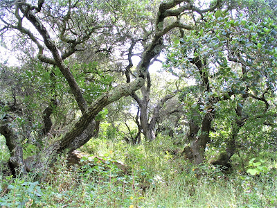
Next up the road – or down – depending on which way you’re coming or going – is Redwood Regional Park – first “discovered” by Gambolin’ Man in his early days in the Bay Area (1983). So enthralled was he by its understated grandeur and mind-boggling proximity, nowhere else mattered.
.jpg)
It took another several years to seek out and “discover” other “lesser” East Bay parks! Over the ensuing decades, I’ve no doubt visited Redwood Regional Park a thousand times (literally).
.jpg)
Whether running long-distance loops up and down tough hill grades among the giant trees and Western ferns or tromping through sun-dappled forests alongside babbling streams, or mountain biking my ass off through networks of rugged technical fire trails, each visit has been memorable.
.jpg)
I’ve covered every spec of this land, over and over, to the point where you could blindfold me and drop me in the middle of a deep gully, and I could tell you exactly where I was.
I could point to individual trees, rocks and plants that have become familiar friends. After a thousand visits, though, don't things inevitably tend toward the seeming prosaic and ho-hum?
.jpg)
But the minute I arrive at a favorite staging area or old familiar trail head, and disappear into the cool, protective understory of the towering trees, smell the pine duff, lay my eyes on sacred flowing water, I instantly regret my apostasies.
.jpg)
For I'm in no less awe and wonder, never let down, always uplifted and inspired anew by the beauty and wild nature that has remained in this tract of land situated directly above the 44th largest city in the U.S. – Oakland, California.
.jpg)
Make no mistake – this ain't wilderness, but it once was, probably looking much like the last remaining tracts of primeval forests in Mendocino County today. Grizzly bears, mountain lions, and condors and bald eagles prowled the ridges and patrolled the skies.
.jpg)
Before the sawmills of the 1860s wiped them out, this locale – right here in "downtown Oakland" (as I always joked) – supported the largest, tallest and most magnificent Sequoia sempervirens on earth.
.jpg)
Sixteen miles directly across from the Golden Gate, as history tells it, Sir Francis Drake and later mariners relied on the trees, which were visible from beyond the strait, to sight up their entry into the bay to avoid hazardous shoals.
.jpg)
Margolin describes today’s present crop of offspring as:
.jpg)
" . . . a race of adolescent giants rising out of logged off remains . . . With their great size and a botanic history that stretches back 100 million years to the Age of Reptiles, the Redwoods . . . seem aloof from the modern world."
.jpg)
Indeed, they are, and so are you when standing in their midst, lost and mindless to civilization’s buzzing, humming, whirring and mechanized noises down on the flats.
.jpg)
Fairy rings, or family circles of second and third generations of cloned offspring remind us of the prodigious dimensions of the original groves.

Within the sacred empty space, you can imagine the circumference of the fairy rings' original Mother Tree filling the area with millions of cubic feet of hairy woody tissue and rising so high that it strained the neck to glimpse just two-thirds of its height.
Girth-wise, it would take thirty individuals linked with arms outstretched to encircle the largest specimen. These fire-scarred arboreal behemoths, if left to survive to today, would be 2000+ years old, and likely would have attained their maximal height of 360+ ft. – older and taller than the North Coast's recently discovered dendro-giant, Hyperion.
.jpg)
But, alas, fate – and the saws of men – intervened and the trees were zealously chopped down by ruthless profiteers caught up in the San Jose – San Francisco building boom of the mid-1800s.
It's hard to imagine or excuse the ignorant mentality it took to just blithely wipe out this great forest!
.jpg)
.jpg)
John Muir, who worked so tirelessly around the turn of the century to ensure the salvation of the famous groves in Marin County’s Muir Woods National Monument, proclaimed:
.jpg)
“These kings of the forest, the noblest of a noble race, rightly belong to the world. We cannot escape the responsibility as their guardians.”
.jpg)
Unfortunately, Muir was about fifty years too late to do anything to help save Redwood Regional Park’s millennia-old trees from the killing fields of a dozen mill shantytowns that sprung up in the Oakland Hills.
.jpg)
What you see and experience today, however, is nothing to scoff at. Stands of princely 175 ft. tall Redwoods adorn the restored banks of burbling Redwood Creek and the lower flanks of steep hills, such as you’ll encounter on French or Chown Trails.
They remain impressive specimens that will stop you in your tracks as you marvel and gaze skyward, grateful that at least some remnant of the original glory remains.
.jpg)
Check back in five hundred to a thousand years from now, and they will be:
.jpg)
Kings of the Forest once more.
We hope.
.jpg)
Huckleberry Botanic Regional Preserve
.jpg)
Thank God for this tiny but splendid sylvan haunt right off Skyline Boulevard situated between Redwood and Sibley parks. Margolin proclaims it:
" . . . a completely authentic remnant of native California."
.jpg)
Greatly heralded, but often overlooked by the hiking masses, the preserve offers a self-guided nature tour and a footpath leading into ecologically sensitive territory "that threads almost apologetically through the 132-acre preserve” and is home to "relic" plants found in just a few other places in California.
.jpg)
That's owing to a specialized habitat that has somehow managed to avoid man’s destructive handiwork. Among the interesting species finding root and refuge here are the California hazelnut, Pink flowering currant, Dwarf chinquapin, Huckleberries, Western leatherwood, Silktassel, and rare ferns.
.jpg)
An endangered variant species of manzanita (Arctostaphylos pallida) is found no where else on earth but the Bay Area, and in most abundance here. About 2500 of them have long flourished atop exposed rocky knolls, in poor soil, low in nutrients,

A colony of A. pallida found at Huckleberry is now on the decline due to fire suppression tactics, unnatural shading, and other deterrents to life for a tree struggling to survive in an increasingly unnatural world.
.jpg)
Some of these old trees are half-dead with lifeless branches eerily outstretched like sun-baked skeletal arms, and half-alive, vibrantly thriving with chocolate-colored trunks, waxy leaves and pretty pink flowers – the perfect metaphor for the eternal rhythm of the life/death cycle.
.jpg)
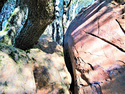
Bid the gnarled specimens good-bye and safe tidings, and head down a trail leading into the moist bowels of the dark, dank, bay-scented forest. It is spellbindingly charming. Hours pass investigating and trying to identify sprouting mushrooms and all the plants. You might chance upon curious packrat huts.
.jpg)
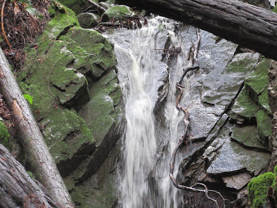
More hours slip by inspecting dewy spider webs, or staring intently, as though absorbed in a Picasso painting, at colorful splotchy patterns of lichen eating away at sandstone and serpentine rocks, or marveling at the miniature grandeur of ephemeral waterfalls and bouncing cascades.
.jpg)
After a while, you become lost to the incessant hubbub in this secluded world beyond the urban boundary zone, and, hours later, muddy, sweaty, thirsty, and hungry, you emerge with what Margolin describes as:
.jpg)
“ . . . a feeling of clarity, sharpness, and strength this land can bestow on those who become intimate with it."
.jpg)
Sibley Volcanic Regional Preserve
.jpg)
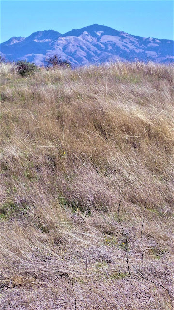
Sibley is a favorite and easy get-away in the Oakland Hills. Despite its seeming confined and hemmed in feeling, it is an amazing place, really. Site of a 10,000,000-year-old exploded volcano – 1763 ft. Round Top, with transmission towers, is all that remains – long-necked camels once grazed alongside saber-toothed tigers and other mega-fauna.
.jpg)
More recently, it was the domain of herds of pronghorn antelope, mountain lions, and grizzly bears. No doubt Ohlone hunter and gatherers made their rounds collecting acorns from big oak trees, and stopping to camp, tell stories and dance and sing creation songs.
.jpg)
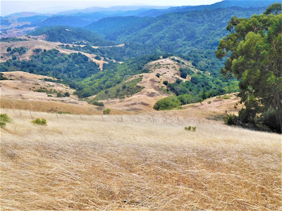
Today, covering a mere 700 acres, Sibley is an outdoor museum of sorts, not a place for any major hiking, per se, although you can work up a lather climbing up and down the canyons, and once up on the blasted ridge top, you can extend your destination by hooking up to the Bay Area Ridge Trail and East Bay Skyline National Recreational Trail.
.jpg)
Recently, a long-off-limits section was opened, giving the park a bit more breathing room. Mostly, though, Sibley is a place to slow down, let your mind drift and your imagination wander as you check out each signpost on the self-guided tour, noting some outstanding geological feature or event.
.jpg)
Every so often, superlative views open up of Mount Diablo, Mount Tamalpais, and even the tiny rhomboid formation of Mount Saint Helena appears on the distant northern horizon, and beyond that, far away, the high country of inner coast ranges is visible on clear days.
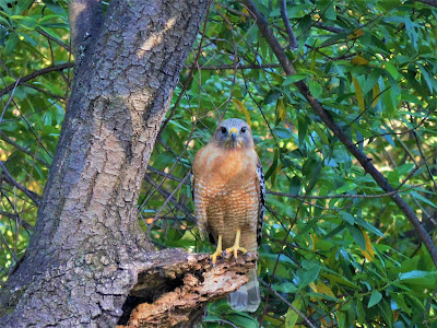
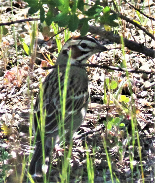
On your walks, you'll see darting rabbits and scurrying lizards and sun-struck snakes. The meadows and open rolling hills of Sibley provide ideal habitat for rodents to proliferate, which sates the appetites of soaring Red-tailed Hawks, Kites, Golden Eagles, and, not unheard of, you might even catch a glimpse of the King of Birds – a Bald Eagle, who nests nearby at San Pablo Reservoir.
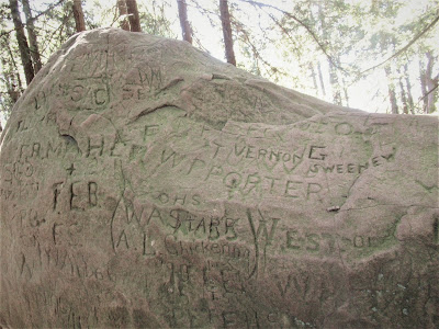
Below the ridge, down in a hidden canyon, a small reedy pond is ideal for exploring and seeking out newt eggs. And then there are the inscrutable labyrinths of Sibley, whose builders remain a mystery.
.jpg)
Spend some quiet time listening to the wind whistling, while meditatively walking the circular pathway to the center of this little universe, giving thanks and praise and wonder evermore.
.jpg)
So there you have it!
Four of the loveliest parks, out of 55 owned and operated by the East Bay Regional Park District, right within cycling distance or public transportation on the fringes of a county with a population of 1.5 million!
.jpg)
Truly pause to give thanks and praise and wonder evermore about!
In a strained effort to imagine life in the Bay Area without the 90,000+ acres of wild places and open spaces bequeathed to us by eco-visionaries in the 1930s, Margolin writes:
.jpg)
"I shudder to think what the East Bay would be like . . . Without the East Bay Regional Park District we would live in a more crowded, ugly, vastly impoverished area – if we cared to live here at all."

Read about the wonderful world of birds at Sibley Volcanic Regional Preserve & Redwood Regional Park @
And take a few minutes to watch some of Gambolin' Man's admittedly horrible but memorable live-action footage @
posted by Gambolin' Man at Tuesday, May 12, 2009
5 comments
![]()

