MOUNT HAMILTON: Cycling Desolate Back Roads to Summit the South Bay’s Big Mountain (Not an Insignificant Feat for Two Over the Hill Weekend Warriors)
.jpg)
Time for a change of pace.
.jpg)
Your ankle’s been killing you, and you’re itching to cover some big ground, do something athletic. After days of inertia, badly needing an adrenaline flush, and desperate to cop an endorphin rush, you're hell bent on chasing heart-racing thrills (even if it kills) that only speed can provide.
The prospect of an all-day workout / adventure is good medicine, well-deserved punishment, and just what the doctor ordered for you – a ball-busting, super-fun, and grueling ride to clear out the cobwebs of complacency and laziness, to see if you still have it.
.jpg)
. . . whoever you are and whatever it is.
You will need all day and you will need lots of energy, and you will most certainly need to call on your deepest will power resources and muster every ounce of reserves left in you to drain at critical late-hour stages of collapse and denial and pain.
.jpg)
No worries, eh?
.jpg)
You’re a weekend warrior and this is kids’ stuff. Especially once you grok the key to withstanding the rigors of a little all-day outing like this – by turning the grunts and groans into concentrated, focused breathing, and clearing out your mind, you’re able to slip into "the zone".
.jpg)
In this state, effortless achievement occurs, where mind control trumps body mechanics, where you're in a spacey yet lucid and hyper-focused state of awareness and intent, and you’re able to perform effortlessly and longer, at a higher than usual capacity.
NOT an easy or intuitively natural state to achieve just like that, you soon find out.
.jpg)
Forget about the sweet meditation of walking. Forget about the simple joy of hiking. Gear up, instead, for the sheer masochistic pleasures awaiting you in the saddle for a little all-day road cycling – a total of 108 miles between you of rhythmic, repetitive, joyful pedaling.

One revolution at a time.
A little all-day ride not for the fainthearted, lazy or out-of-shape (even though you qualify for all three).

Yessirree, indeed, time to gear up, and suck it up. Every self professed biker’s gotta do it at least once, and now it’s your time to conquer Mount Ham by bike . . . or let Mount Ham conquer you. This is no easy climb, despite what they tell you. This is no mellow Sunday afternoon loop in the cool Berkeley Hills.
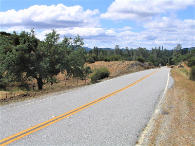
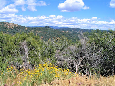
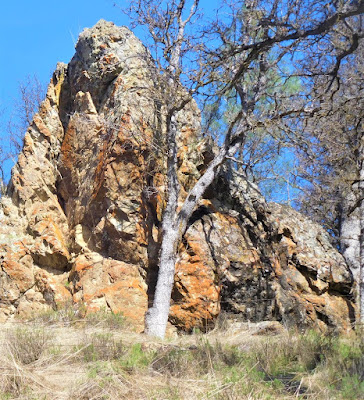
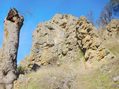
Rather, this little all-day outing takes place in big, hot, dry, tough, rugged Diablo Range country, a world away from the cool Berkeley Hills, traversing tough, unforgiving terrain, where professional racers train.
This is a place S.F. Chronicle outdoors writer Tom Stienstra describes, not gratuitously, as being:
“ . . . out in the middle of nowhere, that's because it is . . . it is wild, untouched country, and the farther you go, the wilder it gets.”
.jpg)
Coming from Stienstra, hiker / outdoorsman extraordinaire, the seemingly over-inflated description of grandiose isolation does not lose currency, for you’re really impressed, it truly is big territory, remote terrain.
.jpg)
. . . for being in Alameda County . . .

.jpg)
The route up to the summit – a 2000+ ft. anfractuous climb to ascend to relatively stratospheric realms higher than 4000 feet – is an absolute must-do, a favorite of the biker entourages (less Hells Angels types and more, definitely older suburban guys and gals out for a weekend spin on their monster Harleys or souped up dream machines).
.jpg)
Surely you exaggerate! Surely you jest!
.jpg)
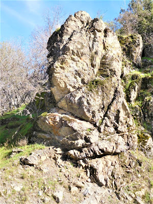
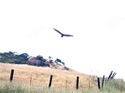
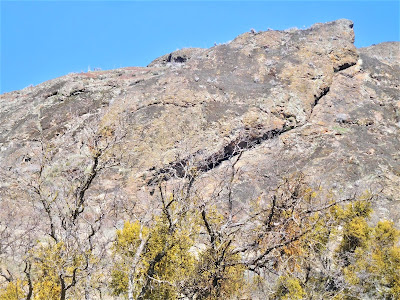
Out here, rugged land formations are defined by 30-mile-long contiguous ridges – Crane, Cedar Mountain, Man, Mesa, and Burnt Hills – giving rise to relatively lofty eminences surely no one has heard of, many exceeding 3500 feet tall:

"Little old nothings" such as Cedar Mountain @ 3670 ft.; Eylar Mountain @ 4089 ft.; Mount Boardman @ 3593 ft; and Red Mountain @ 3654 ft. exist untouched, unclimbed, largely unknown by humans.
.jpg)
Out here, four counties – Alameda, Santa Clara, San Joaquin, and Stanislaus – find a common juncture a few miles east of Mines Road:
. . . in the middle of nowhere . . .
Little wonder that among the two-wheeled cognoscenti this route rules big time.
.jpg)
All this open space!
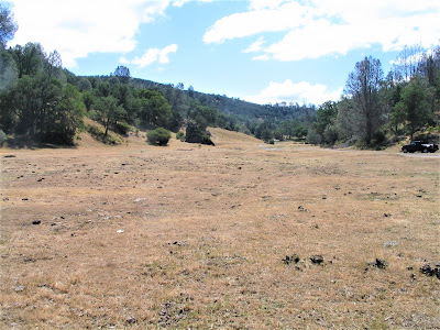
Why, the massive and sprawling Henry Coe State Park lies, as the crow flies, a mere few hugely inaccessible miles to the south – it is all quite a contrast from urban sprawl so close yet paradoxically so far away.
.jpg)
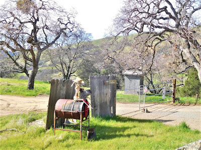
But remote or not, the natural surroundings seem more like a picturesque backdrop – which is fine and beautiful and all – than inviting wild lands to romp and camp and explore in, for virtually the entire length of Mine’s Road, Upper San Antonio Valley Road, and Del Puerto Canyon Road, is fenced off, contained within private “no trespassing” parcels, and largely off-limits for anything but pavement-based activities.
That is, unless you're like Gambolin’ Man and you refuse to let a little old fence or NO TRESPASSING SIGN stop you from checking out an alluring “off-limits” creek or hidden pond.
.jpg)
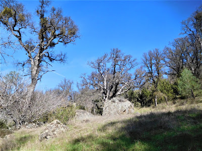
Notwithstanding, it qualifies as gorgeous, lonesome country, providing excellent long-distance views of surprisingly isolated rugged and wild beauty.
.jpg)
You wonder, how can such a place exist in the immediate Bay Area?
.jpg)
Well, geographically, it may be associated with the Bay Area and its 5,000,000+ population centers, but deep in the heart, it’s actually so far away – Alameda County is surprisingly BIG! – that it takes up to 90 minutes to drive there from Berkeley, or about as long as it takes to drive to big river / Gold Rush country in the Sierra foothills near Auburn up Interstate 80. (Going 80!)
.jpg)
Certainly, big enough country to feel stranded and isolated should an accident occur, and yes, you could die out there, but thank God for the motorpsycho dudes, who would come to your rescue every five minutes.
.jpg)
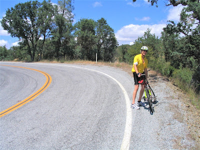
Brock Stoker, your riding partner, is fixated on knocking out some kind of ridiculous century run; he wants to start riding from the Pleasanton BART station, and ride all the way to the beginning of Mines Road, maybe 15 city miles, then continue on for 44 more miles to the top of the Mount Hamilton / Mount Isabel / Copernicus Peak ridge – attaining heights of almost 4400 ft.
.jpg)
And then blast the hell down the west side for 25 more miles into Do You Know the Way to San Jose, up to Fremont and catch the BART back to Berkeley. Brock, you plead, you need two days to do that, and besides, you’re not a young man anymore.
Brock finally comes to his senses and abandons the ambitious plan, settling instead for a “mere” 65 miler he will tackle with aplomb and alacrity.
. . . until the bitter end . . .
.jpg)
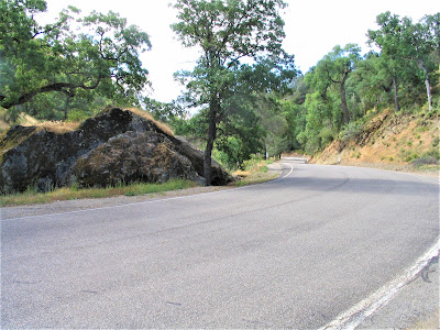
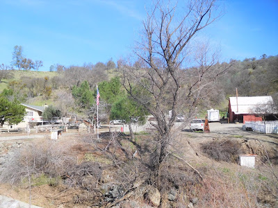
Sanely (for once), you insist on setting off from a more reasonable starting point – 25 miles south of Livermore, at the fabled Café Junction. The place is a dive but nonetheless a very popular road stop, doubtless owing to it being the only establishment of its kind for thirty miles in any direction!
.jpg)
Here, Mines Road obscurely hits California Hwy. 130 – heading west, it’s called Upper San Antonio Valley Road; heading east to hit Interstate 5 out in the stinky agricultural flats near Patterson, it’s known as Del Puerto Canyon Road.
. . . You know it as the Holy Highway to Heaven . . .
. . . Or Hell . . .
. . . If you’re aching and dead spent . . .
.jpg)
. . . and hell-bent tired on your last legs . . .

Early this May morning, bikes piled in Brock’s car, you drive to Mine’s Road south of Livermore, passing through pretty vineyards on the outskirts of the city notorious for its federal nuke lab facility.
Thankfully, it’s becoming more renowned for a par venue wine scene . . . surprise! – there are around 40 wineries in the area! Located about an hours’ drive from Berkeley, you get beyond the city limits and it’s like Tuscany.
Sounds crazy, but it’s true.
.jpg)
At 8 am, it’s chilly and bright, with no one about. In your bones, you sense it’s going to be one of those long-overdue, irrepressible, infinitely promising days, with no agenda or responsibility other than to let loose and have some big kid fun in the local badlands. And get your ass kicked by Mt. Ham.
.jpg)
You drive and tail Brock for a while, teasing him about his initial struggle to break wind, ribbing him for excessive huffing and puffing – easy for you to laugh and make fun, sitting fat and cozy in the driver’s seat, nursing a hot cuppa joe and chowing down on a scone – but the first couple of miles are serious stuff, gaining a tough 800 ft.
.jpg)
It makes you pale.
.jpg)
You offer Brock a ride, joking how this place "ain’t nothin’ special", and how it’s just another "bitterly cold, fogged in, overcrowded Bay Area day." (NOT!) Turns out, poor Brock nearly freezes his ass off in those first miles, that's how cold it is.
.jpg)
And how unprepared Brock is! But you bid adieu, zooming off down the road in his hot little Saab to see what you can see in the pretty Arroyo Mocho valley, your lackadaisical destination for the next 90 minutes, or however long it’ll take Brock to notch the 25 miles to the Junction.
.jpg)
He knocks it out pretty quickly, admirably so.
.jpg)
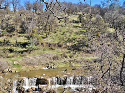
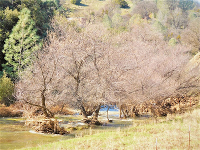
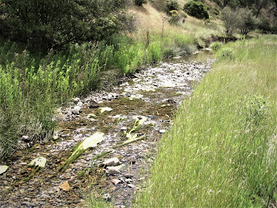
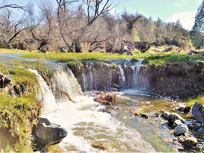
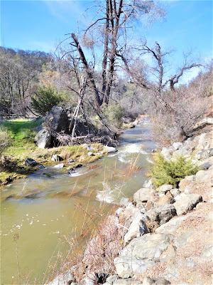
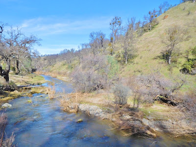
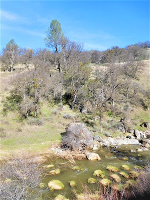
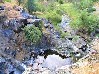
Late May, things are still green enough to proffer a hint of springtime, and the creek – Arroyo Mocho – is flowing, almost like a miracle in the dryish surroundings.
.jpg)
At various pit-stops along the way, you park off road and half-stumble down an embankment to the creek, charmed by seemingly nothing, mostly to get out and get a breath of fresh air, have a look-see. Wildflowers are out, tall grasses hula dance in a gentle breeze.
.jpg)
The angle of the sun is perfect this early morn, shining pellucid rays upon a ribbon of water, a dazzling cobalt blue stream in desert-like conditions.
Downright lovely! Right here!
So easy to miss, especially when you're speeding by in your mechanical contraption! At this time of year, Arroyo Mocho is a winding, moving oasis of riparian habitat in an otherwise forbidding landscape, offering, amazingly enough, permanent and protected refuge and habitat to native resident rainbow trout and ocean-running steelhead.
.jpg)
It’s so beautiful and so peaceful – there are no unnatural sounds of airplanes overhead or motorcycles roaring by at the moment – that you just want to stay here and explore all day, forget biking. The simple beauty of water flowing in the least expected of places is what ultimately captivates and enthralls you.
.jpg)
This is where it’s at!
.jpg)
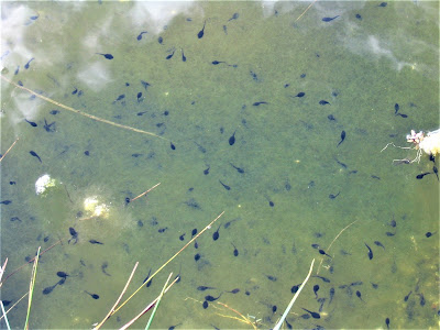
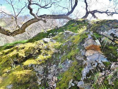
Your perambulatory roadside explorations of this unnoticed – until today! – water course lead you rock hopping up and down lazy stretches of the ol’ crick, to spot a turtle on a log (the year 1927 is carved into its shell – gotcha!); masses of chubby squiggly pollywogs in a moss-cloaked pool; a sunning snake; a darting skink; fence lizards; sketchy water striders; and pools of minnows.

Lying there whitewashed as alabaster on a rock you discover an unidentified small skull. All kinds of flies are out and about – dragon, butter, deer and black.
Unexpected, pretty little pools, zen-like in their effect on your mood, appear like veritable mirages down short hillsides around bends in the road. Easy to miss slices of paradises. At one pull-off, a stunning ledge / stair step waterfalls lies hidden out of sight, unknown by 99% of everyone zipping by in car, bike or motorcycle.
.jpg)
To see it, to appreciate it, you have to stop, look, listen; you have to be willing to recognize the prosaic, take it in pedestrian, seek out the commonplace, notice the overlooked and admire the unheralded – and mostly forget agendas, and live for the moment.
There is, you will find, nothing prosaic or commonplace or pedestrian about Mother Nature in all her lovely, infinitely fascinating guises, no matter her venue . . . you just have to stop, look, and listen. Then you’ll sing the praises of a nothing little riparian ecosystem like Arroyo Mocho.
.jpg)
In an hour, Brock catches up, asks how you’re doing, says he nearly froze his ass off early on. (Was it that cold?) You ask if he wants a lift to the Junction. No way, Jose! So you figure you have another half hour or so to explore Arroyo Mocho . . .
To do nothing but stop, look, listen, take stock of the small miracles.
.jpg)
And that, dear reader, is Mines Road for ya . . . but it's really not all that bad . . .
.jpg)
Even though half of the ride is, in theory, downhill or flat, a 40 mile round-trip summit-bagging ride proves to be inordinately punishing; 65 miles for Brock is pure torture. It’s a brutal slog up, and the day is just beginning to get hot.
.jpg)
Over the final seven miles of vertiginous elevation climbs, on what turns out to be a pitiless day of blazing sun and sirocco-like winds, the heat-radiating macadam curves and winds up, one hairpin bend after another, in a relentless grade that taxes you to the max.
.jpg)
It’s all you can do to just push and push, one revolution at a time, trying not to think about it, aching to get it over with, dying to stop, look and listen instead of pedaling your ass off, aching and drenched in sweat.
.jpg)
At some point, you want to just throw your bike over a cliff and hitch a ride up. But you persevere and persist and keep struggling – after all, you’ve done Mount Diablo, on fire road, eight gut-wrenching miles and over 3,200 ft. elevation gain . . . so what’s so difficult about this road ride, seven miles, and maybe just under 2,000 ft. gain?
.jpg)
They say it’s steeper than Mount Diablo, but you don’t know. Blame it on advancing age, the beers at the Junction, the excessive mileage, not enough food, or under-hydration due to the oppressive heat of the day.
But truth be told, you are bonked by the time the great observatory domes come into view. You’ve clocked a respectable 20 miles, Brock a ridiculous 45 already . . . and hello, you still have 20 miles back before the comforts of the Saab at the Junction.
.jpg)
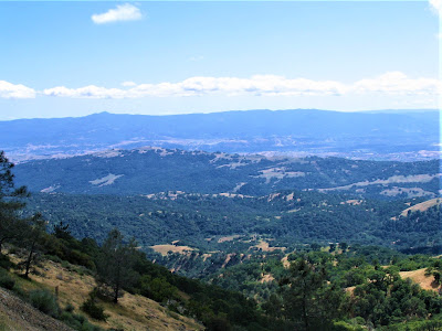
Mount Hamilton, Mount Isabel and Copernicus Peak are to the South Bay what Mount Diablo’s twin massifs are to the East Bay, but the 4000+ ft. peaks east of San Jose just don’t stand out, dominate, or have that telescopic appeal that the free-standing Tuyshtak (Mount Diablo) has on a clear, crisp day of being a truly huge mountain.
.jpg)
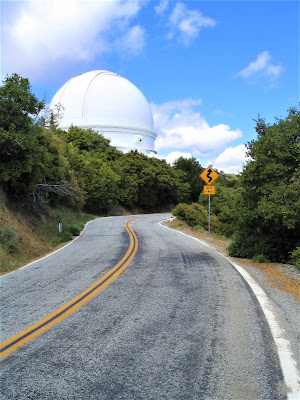
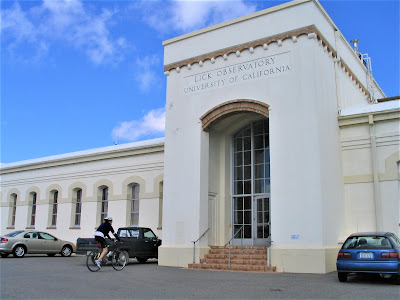
But speaking of telescopic appeal, atop this ridge system are the U.C. managed observatories, several of all sizes, chief among them the famous Lick Observatory where mysteries of the universe are plumbed through spectacularly powerful optical instruments.

You park the bikes outside, and enter the scholarly building, dutifully obeying the “remove bike shoes” sign at the entrance. You’re plainly too gassed to give much of a shit about Uranus at this point.
But Brock, before he realizes he’s tired, hungry and delirious, plainly licked, decides to check it out. You sigh and groan, and step outside to hang near the fence overlooking the high inaccessible upper headwaters of your beloved Alameda Creek.
.jpg)
Down there is the birthplace of this wondrous creek that flows, in a wild state, most prominently and accessibly through Sunol Regional Wilderness. As far as you can cast your gaze, the mountainous vista inspires, and oh how you yearn to find the very hole from which the creek emerges.
And how you wish to bushwhack down from there, down, down, down to discover unhidden, unreported on, unknown cascades, chutes, miniature beach heads and sacred soaking pools, all there in the big Mount Hamilton / Mount Isabel / Copernicus Peak watershed.
.jpg)
Soon, a wobbly Brock joins you – you’re a bit unsteady yourself – and after several moments admiring the scene, gulping down water and eating some goo, he indicates he’s ready to roll and make the 20 mile descent. Should be a piece of cake, if you can kick it into the highest and hardest gear of 'em all:
THE ZONE!
.jpg)
The whole way down is a blur, and finally, you make it back. No thoughts of beers or anything but getting home and in a hot shower and eating big carbs. You end up thrashed, chewed up and spit out, but somehow, it’s all morally rewarding.
You’re exhausted, barely able to stand up, but by God, you’ve had your big adventure and workout.
.jpg)
You wonder, how much more of this kids' stuff can you take?
.jpg)
. . . surely, you realize, you’re no longer 21 or 41 . . .
. . . not even 51 years young, anymore . . .
.jpg)
Hell, bring it on!
It’s never time to grow up!
.jpg)
Never time to grow old!
 |
| Dry Fork Creek, Utah (2019) |
Check out some vids of lovely Mocho Creek that cuts and winds its way up and down and then away from Mines Road:
 |
| Sheep Creek Canyon, Utah (2019) |
posted by Gambolin' Man at Tuesday, July 03, 2007
1 comments
![]()

