BRIONES REGIONAL PARK & RESERVOIR: Paying Respect & Homage to Two Unheralded Gems of Nature in the East Bay Hills
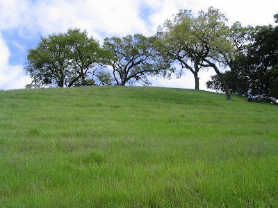
Just ahead, below the crest of the hill, she stands facing me, sniffing the air. I get off my bike, exhausted from a grueling climb up Lagoon Trail through the John Muir Nature Area.
This is the first time I’ve ever encountered a puma. She’s surely a beauty, but suddenly she seems uncomfortably close.
.jpg)
I remain still, raise my arms, as she continues to sniff about; hopefully, she’s catching the scent of a deer and not that of a tired, defenseless and no doubt tasty human all alone in the middle of nowhere.
.jpg)
The big cat paces, sniffs some more, appears to spray, and then, without warning, pounces away down the hillside and out of sight in two leaps, leaving me rubbing my eyes at the mirage of a 6 ft. long, 120 lb. beast staring me down at the fifty-yard line.
.jpg)
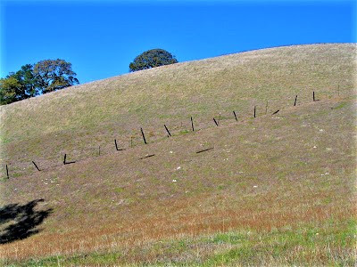
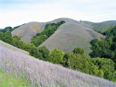
Welcome to a place I call Brionesland – a wild patch of preserved greenbelt in the East Bay's rangy hills comprising 6,117 acres of protected parklands and watershed lands set aside as early as 1906 (Briones Reservoir) and 1957 (Briones Regional Park) for the public good and enjoyment.
.jpg)
Located west of Mount Diablo, whose dominating contours are admired from many a fine vantage point along Briones Crest and Table Top Trails, Brionesland is a genuine ecological island zone sandwiched on four sides by intense urban encroachment.
.jpg)
To the north is the Alhambra Valley, the Carquinez Strait, the Sacramento River Delta, Mount Vaca, and the Cache Creek Natural Area bluish ridges at the southern terminus of the inner Coastal Range.
To the east lie the densely populated cities of Martinez, Pleasant Hill, Walnut Creek; to the west, the widening sprawl of Contra Costa County communities; and to the south – southwest, Lafayette, Orinda and Berkeley.


Yet exist it does – as a mere splash of green on the map, but in reality, the territory is much bigger, wilder, and more remote than at first glance.
And serves, more importantly, as protected habitat, and a trusty redoubt for tired, harried urban souls seeking to escape grey, oppressive overpopulated cityscapes.
But Briones Regional Park, owned and operated by the East Bay Regional Park District, has earned a controversial, even scorned reputation among some, a place "real hikers" scrupulously avoid.
.jpg)
Blame it on cows and mountain bikers. Cows get a bad rap because who wants a cattle grazing operation on public lands? The poor beasts (not to blame) trample sensitive habitat, terrorize passers-by, and disgustingly muck up the land with copious splattering pies dropped all over the trails and meadows for you to have to dodge like landmines.
.jpg)
On the other hand, park ecologists advocate cattle grazing as the perfect remedy for weeding out non-native “pest” plants which threaten and kill off California native grasses and wildflowers; cattle also have the added benefit of helping to reduce fire hazards by their extensive grazing.
.jpg)
Mountain bikers deserve a bad rap because who wants to hike in an amusement park for outta control macho thrill-seekers? On the other hand, not all mountain bikers are outta control macho thrill-seekers.
When I – first and foremost a foot-to-the-Earth guy – climb on the saddle for back country mountain biking, I’m not just on an adventure, I’m also acting as an ambassador of the sport.
.jpg)
I'm trying to give it a good name, by slowing down around hikers, actually stopping and dismounting for equestrians, doing the unthinkable, waving and saying hello to fellow trail users. It’s so simple to just be polite and get along; there should be no controversy!
.jpg)
Purist / idealist types – and I’m one of them, but of the weaker variety – would love if Briones Regional Park were true “wilderness” . . . but it ain’t, and so word gets out, what’s so great about it.
Besides there are outta control macho mountain biker thrill-seekers and repugnantly mucked up trails from cattle grazing; so before you know it, it’s off people’s radar; there are plenty of other, better places to hike and gambol in nature.
.jpg)
Well, folks, Briones Regional Park is what it is – love it or leave it (alone)! The good news is that neither cows nor mountain bikers are allowed on the reservoir lands, where you’ll encounter about a hundredth fewer people than at the Bear Creek Staging Area in the regional park.

So, what are you waiting for?
.jpg)
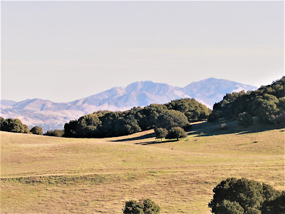
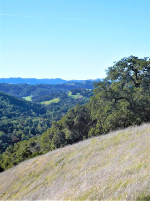
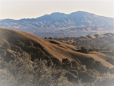
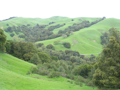
Brionesland rambles provide superlative views from the highest points in the park – Briones Peak tops out at 1483 ft. – encompassing a near 360-degree panorama of the Bay Area’s most prominent geological features:
From Mount Tamalpais, Mount Saint Helena, and Mount Vaca, to Mount Diablo, Las Trampas Ridge, Grizzly Peak, Round Top, and the miles long Sibley / Huckleberry / Redwood Ridge system.
.jpg)
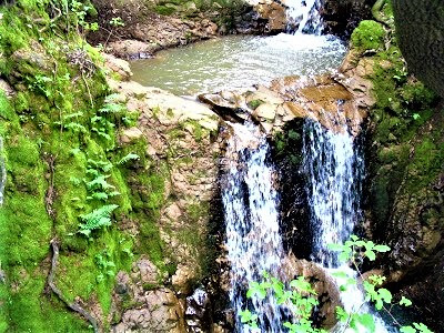
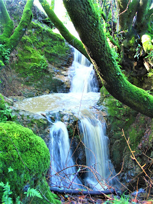
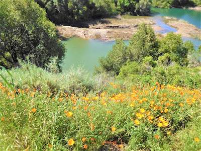
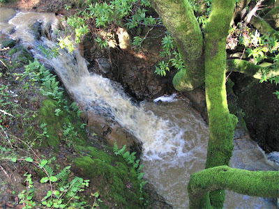
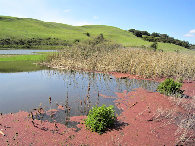
Unexpected beauty awaits at seasonal creeks, pools, and secret waterfalls.

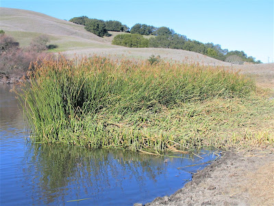
Cattail fringed marshes and ponds, and lake environments with tremendous bird and waterfowl populations, divert you endlessly from your non-existent agenda.
I’ve seen more reclusive creatures at Brionesland than anywhere else in the Bay Area.
.jpg)
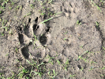
Besides the puma spotting three years ago, I’ve tracked lion imprints alongside deer’s on muddy canyon trails numerous times. I’ve seen bobcats: my second best sighting ever occurred yesterday near Lagoon Trail – a raggedy-ass coyotes, a grey fox.
I witnessed the noble spectacle of a nine-point antlered buck leading a family of four across a hillside, and once espied a doe and her newly born fawn learning how to walk in a misty morning meadow.
.jpg)
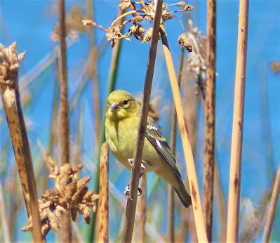
Commonplace sightings of birds include turkey vultures, various hawk species, quail, black birds; I’ve seen kingfisher, golden eagle, and once, a Great Horned Owl; along with a cornucopia of waterfowl and shorebirds – ducks, egrets, herons, terns, cormorants.
.jpg)
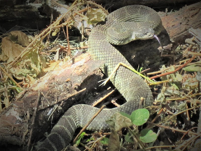
I’ve seen baby rattlesnakes curled up like little turds on the trail, and more than one very large Mother Western Diamondback sunning on a rock, and first time ever – a California Kingsnake!
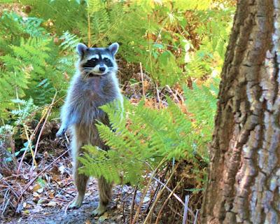
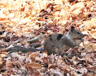
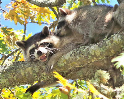
Also spotted: newts, frogs, skunk, raccoon, and Western Pond Turtles. The truly patient and lucky can hope to see the California Tiger Salamander and the Alameda Striped Racer. (I’ve encountered neither.)

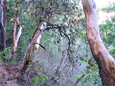
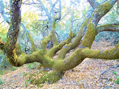
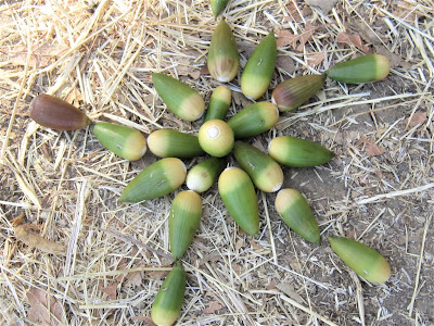
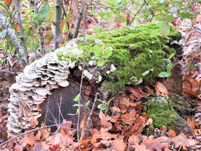
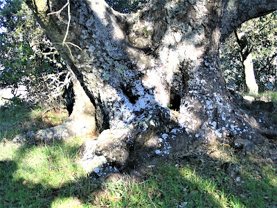
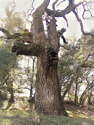
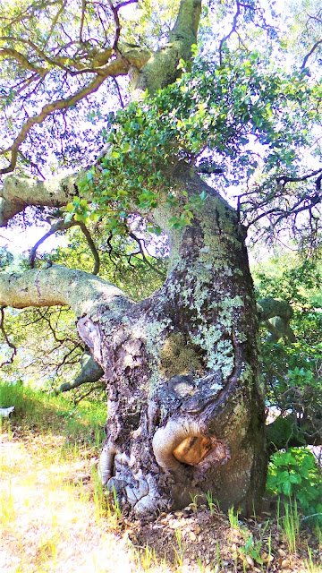
Brionesland is probably one of the richest biotas in the entire Bay Area. Also, a tree-lover’s delight, with a healthy mantel of forest cloaking the land, home to modest stands of coast redwood, several varieties of pine and oak, bay, madrone, buckeye, elderberry and walnut.

Other habitats – coastal scrub, grassland, chaparral, and riparian – provide sanctuary for countless species of plants and animals, many threatened and endangered.
.jpg)
Good God, don’t let the seasonal cow grazing or – heaven forbid! – dangerous mountain biker thrill-seekers stop you from experiencing glorious Mother Nature at your doorstep!
Get out and explore!
.jpg)
.jpg)
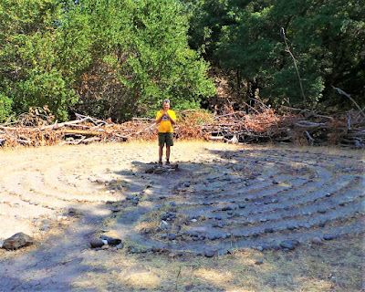
Brionesland will always be a favorite venue, a nearby escape, for a city suffocated, pent-up Gambolin’ Man desperate for a frivolous experience, a hedonistic escapade, a quasi-adventurous exploit or two right in his backyard.
You get the picture: hiking up sweet little Deer Creek canyon in light drizzle; mountain biking the crest trail loop on a brisk bright morning; amateur birding along lush riparian corridors; 'shroom hunting in the secret places J.B. showed him in magical oak / bay / madrone forests teeming with chanterelles and other fungal delights.
Or just lazily picnicking by burblin’ Bear Creek is enough to satisfy Gambolin’ Man’s soulful yearnings to be in nature.

One hundred and fifty years ago, the Alhambra Valley was transformed into an important wine and orchard growing area. John Muir, founder of the Sierra Club, eventually settled in Martinez and took up successful farming and agricultural pursuits, having inherited the wealth / land in his 1880 marriage to Louisa Wanda Strentzel (after whom nearby Mount Wanda is named).
Surely, Brionesland provided this wild, peripatetic man with a much-sought after haven from the madding crowd.
.jpg)
We’ll never know, for Muir wrote little if anything on his findings and feelings. Surely, he must have thought his surroundings resembled the Scottish landscape of his youth – green steep cut hillsides, hidden glades and hollows, high rocky windswept ridges, scenic canyons, steep ravines, broad valleys and lovely flower-strewn meadows.
Yet nary a written word . . .
.jpg)
Perhaps Muir was too busy farming and engaged in the workaday pursuits of domesticity and running a business to give it just due.
Or, perhaps, after his countless writings, explorations, and adventures in his beloved Range of Light, Brionesland’s modest natural phenomena – in comparison to the grandiose, majestic Sierra Nevada mountains – held minimal appeal for him.
.jpg)
Yet surely, he who was inspired as much by the unheralded creek as by the most majestic Sierra peak, took great refuge and rejoiced silently and often in daily tromps up and down the ridges and throughout the pretty land.
.jpg)
Given how much there is to explore in Brionesland today, imagine how gloriously wild it must have been in Muir’s day, when grizzlies, elk, and bald eagles still reigned, when there were no transmission towers, spewing oil refineries, air traffic or car pollution, mountain bikers or cows – well, maybe there were cows, I don't know.
.jpg)
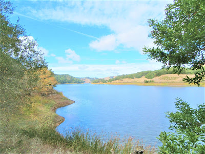
One of my favorite “best kept secrets” for exotic local hiking is the East Bay Municipal Utilities District (EMBUD) owned and managed reservoir lands. The 725 acre artificial lake (gorgeous and painterly) is tucked away in scenic, rolling, oak-studded hills, and thankfully, is exempt from the detractions of intractable cows and obnoxious bikers.
.jpg)
To think, all these years, I never once checked the place out. Drove by it a hundred times, looked out, admired it dutifully, remarked often that S.F. Chronicle outdoors writer Tom Stienstra described it as:
“ . . . the bluest body of water in the Bay Area.”
But that was about the extent of my curiosity. I knew I’d get there someday.
But I didn’t know what I had been missing all these years. Until twenty years later, eager for something new, and with permit finally in hand, we hiked Oursan and Bear Creek Trails on separate occasions.
We were instantly blown away by the unspoiled character and peaceful nature of the place, the sky-blue waters, and extravaganza of waterfowl and bird life, the pervasive far from the madding crowd feel.
.jpg)
It seemed like a veritable paradise, a cool retreat on a hot summer day.
From the Overlook staging area, Oursan Trail winds down to San Pablo Creek and San Pablo reservoir, Bear Creek Trail takes you in the opposite direction, winding up and down through thick forest with beautiful views for four miles all the way to Briones Regional Park.

Down on the lake, it’s Duck City – buffleheads, mallards, canvasbacks, and mergansers abound. Here and there, ample evidence of the comings and goings of deer, bobcat, coyote, or dog. Not many human footprints or much evidence of any human presence period, that’s why you gotta love the reservoir lands.
.jpg)
Boating, swimming, any contact at all with the water, is verboten (except the Cal Rowing Team gets to practice in this paradise), rendering the postcard lake a “mere backdrop” . . . but, oh, what a picture-perfect backdrop it is!
.jpg)
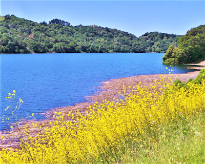
Out 'n back or long loop hikes take you into a lost world almost amid sweeping blue sky vistas and azure water canvasses against green or golden oak-dappled hills bursting with wildflowers and harboring secret waterfalls in springtime.

The water is hypnotic, dazzling, alluring for sure, and who knows, on a particularly hot day, I might immerse stealthily for a quick refreshing dip, but don’t tell anyone!
.jpg)
Briones Reservoir is where we escape to, not so much to hike our butts off, but to simply get in a good walk and be out and about in beautiful Mother Nature.
Where we can observe our surroundings in unhurried reverie, lose ourselves in thought, seek out our sweet spots at shore's reedy edge, to kick back and relax, take it all in, and melt away harmful stresses from the pressure cooker of everyday life just up and over the other side of the ridge.

BRIONESLAND BONUS: A Rollicking Mountain Bike Ride On Crest Loop for Table Top Views of the Bay Area’s Back ‘o Beyond
This morning – January 12, 2007 – I hit the trail alone at 8:30 a.m. for my first bike ride at Briones Regional Park in two years.
The morning is knife-sharp cold; hoarfrost collects along the trail in shaded valleys and the ponds are lacquered with a thin layer of icy shard.
I’d forgotten how tough the climb up to the crest is, or maybe I'm just gettin' old. My lungs burn from the frigid air.

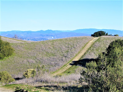
Yet it’s invigorating to the core. I soon get a breathing rhythm going and persevere up my chosen Sisyphean path: Bear Creek to Seaborg to Briones Crest to Table Top, past Sindicich Lagoons, and back down gorgeous Abrigo Valley, for about an 8 mile challenging loop – sections of the ride test your mettle.
At the crest, huffing and puffing, I stop to take in jaw-dropping views of the big Diablo valley. It’s a crystal-clear day, the sun is shining brilliantly, warming things up, but still, I’m wearing my full-fingered gloves.

To the northeast, I’m amazed to see snow-capped Sierra ranges, at first believing them to be low cloud formations because I‘ve never witnessed such a spectacle from Briones before.
Mount Diablo looms gigantically to the east, a sparkling vision of a sacred mountain telescoped in immensity and magnified in intensity due to the clarity and dryness of the crisp, cold air.
Las Trampas Regional Wilderness dominates to the south, and beyond lies the Ohlone massif. The San Pablo / Tilden / Sibley / Redwood Ridge system to the south / southwest creates a perfect barrier to the millions of people just beyond.
At the lagoons, I scare off sitting ducks who fly away fast and furiously; a blue heron is quite on to me and acting very cautious and suspicious; scores of other birds scatter at my presence, as do the young cows.

I feel like an intruder. I am an intruder. At the lagoon’s shoreline, a half inch thick mantel of ice has formed! It got down to the low 20s last night, which is amazingly cold for these parts.
.jpg)
Colder than I can ever recall. The ephemeral frozen water won’t last long as the day continues to warm up, but this is the first I’ve seen of a naturally produced slab of ice at 1000 ft. or so above sea level.

Preparing to mount my bike after a forty-five-minute delay observing and fruitlessly photographing the flurry of avian activity, I happen to turn around just in time to catch a fleeting glimpse of the shaggy hind end of a tawny bobcat disappearing into the brush.

I drop the bike and set off on foot down Lagoon Trail, intending to head off the cat at the ravine's edge. To my amazement, I look down and notice the bobcat crouched below in a small opening, appearing to be asleep, but probably fully aware of and paralyzed by my presence, lying in camo.
.jpg)
I watch for half a minute, then the cat springs to life and bounds agilely into the forest. I drop down and peer into the gash / ravine, too steep to descend, and no trace of the cat. I’m stunned at the encounter, don’t quite know why.
.jpg)
Back up on the high trail, I stop to watch kestrels hover in the wind currents above hillside meadows, occasionally swooping to land and snatch up a grasshopper or vole. They’re amazing little hawks, really, and I spend over half an hour in trance-like admiration watching them do their aerial antics and whizzing loopy fly-bys.
.jpg)
The rest of the ride, thankfully, is an easy and leisurely coast on the ridge, affording great 180 views of north and northwest coast ranges, big west Marinscapes, and green rolling hills.

Not too muddy yet, and I don’t encounter a single other person until two hours into my ride, and only a handful of well-behaved and photogenic cows, and for the record, not a single other mountain biker.
What a morning!
What a place!
What a ride!
What thrills!
Praise be and long live Brionesland!

Read additional bird-related posts about Brionesland:
Take a peek at some live-action shots of Brionesland @

posted by Gambolin' Man at Monday, January 15, 2007
7 comments
![]()

