Sunday, December 18, 2005

COYOTE HILLS REGIONAL PARK: Ohlone Spirit Abounds in Ancestral Lands on Fremont Bay Shoreline

I was veritably stunned on my first visit to Coyote Hills recently. This gem of park – more a cultural and ecological resource – is located only a little more than half an hour south of Oakland / Berkeley.
But you have to navigate an infamous stretch of dangerous and industrial highway, Interstate 880. To be avoided at all costs. No wonder, then, that it took me so long – nearly 25 years! – to finally make the trip. (Lame excuse!)
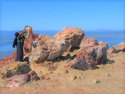
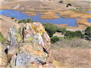
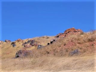
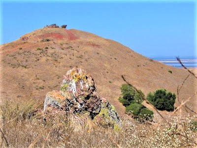
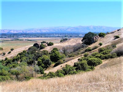
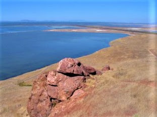
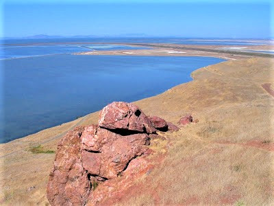
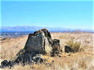
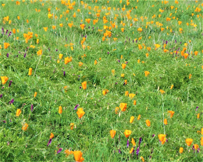
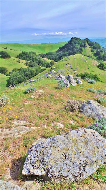
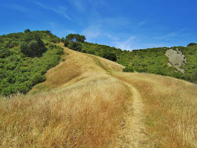
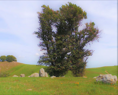
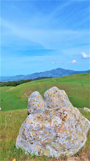
After first checking out the visitor center, up we scrambled to the top of a grass and chaparral covered hill no higher than four or five hundred feet. I gained perch on a lichen-encrusted boulder, thrust my face into the warm air, sniffed the littoral breeze carrying whiffs of sea, salt and kelp weed.
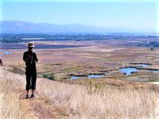
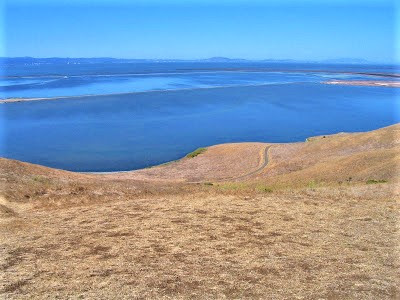
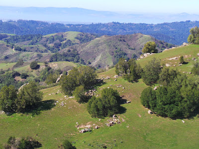
Expansive views in all directions unfolded beneath a flawless blue sky. This is “Silicon Valley East”? I thought. San Francisco’s skyline glittered distantly northwestwards across the calm blue bay, a regular old surreal apparition.
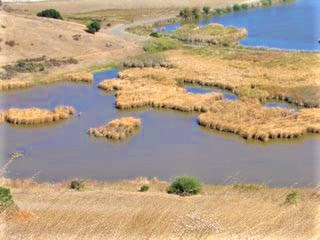
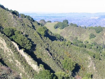
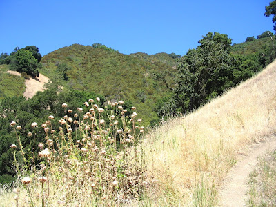
Behind me, wetlands have been preserved along Alameda Creek, and the long views of her rugged headwaters / watershed lands were pleasing.
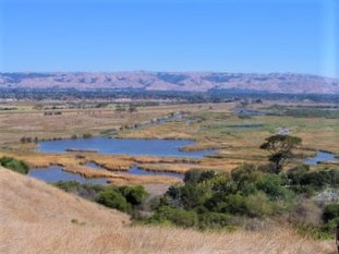
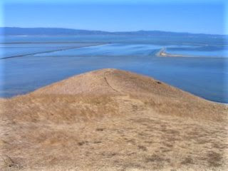
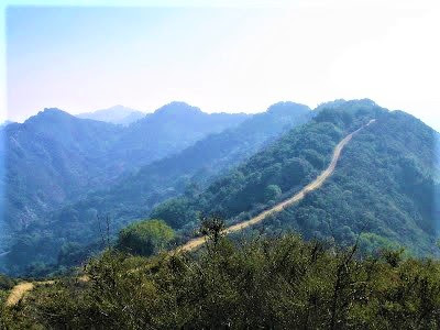
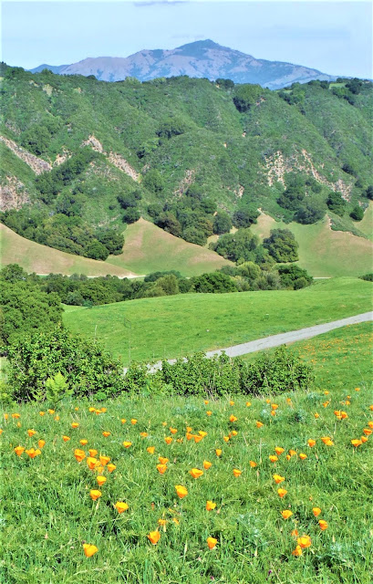
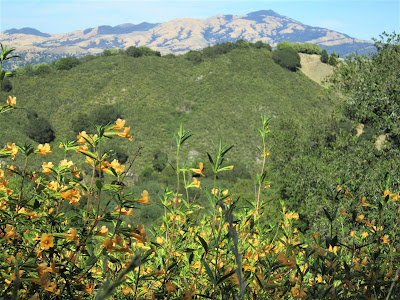
Crescent shorelines, thin ribbons of brown sandy beach, extended far outward into San Francisco Bay. Was that Mission Peak over there? Could that really be Mount Hamilton I’m looking at?
Welcome to Coyote Hills, Gambolin’ Man! Better late than never! 
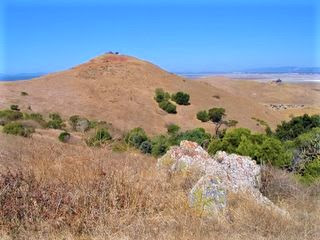
Coyote Hills rises from the Fremont Bay shoreline out of a flat landscape. The hills are the eroded tips of a tilted fault block; they actually manage to poke up several hundred feet out of alluvial deposits from Alameda Creek, right out of the bay like its own little kingdom.
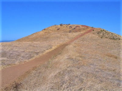
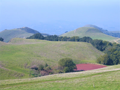
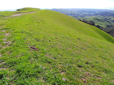
Indeed, the 976-acre park makes for a surprisingly exotic setting, offering up historical and cultural tidbits of interest, plus a delightful landscape with sweeping views of San Francisco Bay and beyond, atop Red Hill via Bay View Trail.
The Marsh boardwalk provides easy access for all to enjoy a remnant of the wetland / marshland environment that once dominated. A leisurely stroll takes you in to the reedy interior of the marsh.
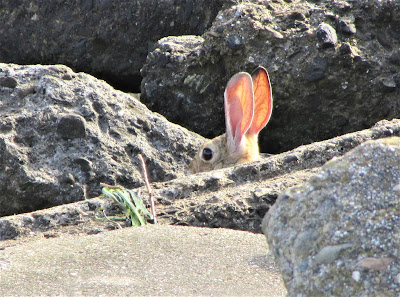
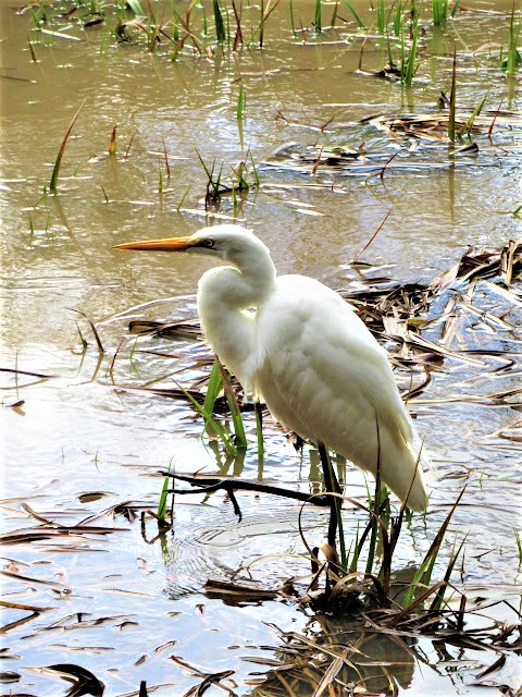
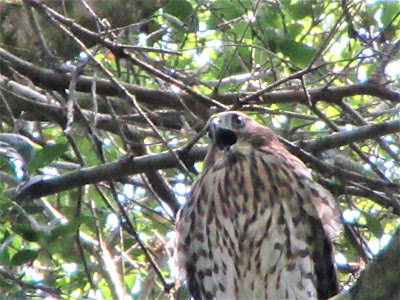
Red-winged blackbirds congregate on the fringes, singing up a ruckus, whilst the lovely marsh wren reigns queenly among the tule and cattails. Terns, gulls, herons and many other aquatic fowl can be spotted.
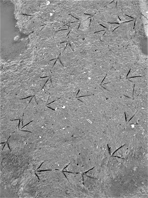
Benches allow one to sit, stare, listen, observe, meditate, spit sunflower seeds in deep contemplative musings . . . what could be more peaceful, more relaxing, more satisfying, than that? Right here in this simple place.
Interrupted only by the sudden swoosh of an egret alighting nearby. An excellent visitor center / museum lends an educational aspect to the park, with dioramas of by-gone hunter/gatherer lifestyle depictions of Ohlone basketweavers, toolmakers, and mythic storytellers.
It’s a familiar story made famous in Malcolm Margolin’s masterful The Ohlone Way. Various tribes of Ohlone peoples flourished here in widely scattered encampments up and down the Diablo and coastal ranges of Central California.
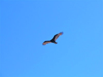
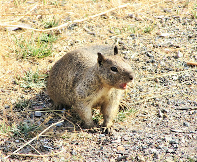
The Bay Area was an entirely different place. Magnificent bald eagles and condors patrolled the skies. Predators like grizzly bears, wolves, cougars and humans hunted salmon, otter, beaver, deer and tule elk.
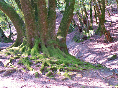
Whether bivouacked creek side in rolling hills heavily forested with oak, bay, and madrone, or banded together for a bountiful season on tidal bay shores, inlet rias and deltas, wherever they settled, Mother Earth sumptuously offered up an inexhaustible cornucopia of varied food sources, from esculent plants to large and small "game", to tasty banquets to be had in the sea, river, and bay.
Both two and four legged denizens of this land had it made, it was such a rich biota. In terms of the natural bounty just "there for the taking", there was probably not another place on earth that compared to pre-Columbian Bay Area for its sheer “inexpressible fertility.”
Up until a couple hundred years ago, human societies had managed to devise a simple formula for living in spiritual harmony with the sacred rhythms of life – they had the relationship down for millennia.
Until this timeless pattern of eternal moons was rudely interrupted by conquistador / Spanish missionary zeal – one part proselytization / assimilation, three parts mass extermination / genocide. (The sad, familiar story.) Seemingly a small place, Coyote Hills surprises with a variety of activities that could consume an entire day.
From inspecting rock formations and wandering about aimlessly, to picnicking, bird watching, hiking, biking, or fancy yourself setting up an easel and painting. Take Bay View Trail up for a super-loop and amazing views. Check out the side trail leading to a crescent moon of a shoreline for a very unusual bayside stroll (of course my camera’s battery died right then).
Take in the marsh wetlands, add another short loop to an adjacent section of the park to see Ohlone lifestyle recreations, and a mile or two along paved but interesting Alameda Creek Regional Trail, and you’ve got a full day on your hands (and feet!).
Ah, yes, what better place than Coyote Hills to experience a soulful connection to the original native inhabitants.
To honor their spirit in their own land.
To know a place for the first time.

Monday, December 12, 2005

LAS TRAMPAS REGIONAL WILDERNESS: Chamise Trail to Las Trampas Ridge, Elderberry Trail to Rocky Ridge & the Devil’s Hole (Sycamore Trail Loop)

In the mood for a day of hiking tough terrain with lots of elevation gain, but don’t want to drive more than 40 minutes?
Prepare yourself for the reward of grueling ascents up tepui-like ridges, topping out on oak-studded roller coast summits offering amazing views of remote East Bay watershed lands.
Looking for a chance to spot diverse flora and fauna, investigate intriguing, hard to get to placesakes packed with history and mystery?
You’re there in under an hour. The first all-around choices in the East Bay for such an enticing destination are Mount Diablo State Park, Sunol-Ohlone Regional Wilderness, and the “third sister” of the Diablo/Ohlone Range, Las Trampas Regional Wilderness.
It’s a landscape that encompasses thousands upon thousands of acres (27,000 of them) of the East Bay Water District’s (EBMUD) watershed territory between the Berkeley / Oakland Hills and far Eastern Contra Costa County.
It lies beyond the purlieus of the more heavily populated regions, but as the crow flies, the regional wilderness is ridiculously close to the metropolitan scramble and sprawl.
Las Trampas Regional Wilderness (Spanish for the “Snares”, homage to its heritage as a land ‘o plenty when traps were once set in the chaparral of the hills to catch elk and antelope) is of great geological interest to rockhounds, history buffs, and nature freaks.
Essentially, it comprises an ecological island of diverse plant and animal communities, a singularly rugged and unspoiled place, a surprisingly remote place in the truest sense of that word.
Even though its nearly 3800 acres are directly east “just” across the Berkeley Hills, you have to drive to get there from Berkeley, forced by rugged East Bay hinterlands to veer south on I-580, then northeast on Crow Canyon Road.
Then turning west on Bollinger Canyon Road to access the trail heads west of the I-680 corridor leading south to San Jose. (One could, if one had sufficient luxury, devote an entire day to hiking there and back over several ridge systems from Berkeley – hey! Why not?)
Oddly, Las Trampas has always been one of those places (in my mind only) “too far away” and “not exotic enough” to have courted it much. This sad misconception has prevented many a fine romp in this Diabloan wilderness.
Given half a chance, Las Trampas provides a wonderful escape from urban pressures, right there for the taking (providing you have a car or a loooong day to bike or hike there).
But prepare yourself for solitude  you won't encounter too many folks. Where else can you enjoy lung-busting climbs to rocky ridges offering breathtaking 360-degree views of Ramage Peak at 1401 feet, Mount Diablo at 3849 feet, the Ohlone Ridge out beyond Livermore, and Grizzly Peak and Volvon Peak dominating the Berkeley Hills horizon? Pick and sniff some super-sweet lemony black sage, rejoice in the chaparral, chamise, and grasslands?
Give praise to the oak-bay-madrone-manzanita communities, and love those eagles, hawks, and buzzing buzzards (turkey vultures, cousin to the more glamorous California Condor) patrolling the deep blue skies?
Shake off the frisson of adrenaline rush, knowing that bobcats and mountain lions are skulking about or sleeping nearby in the sandstone cave outcroppings? Give thanks for lovely seasonal creeks cutting the divides between the ridges creating the life-sustaining riparian zones so vital to many species’ – fox, bobcat, mountain lion, deer, coyote, skunk, weasel, fish, newt, birds, insects – existence, indeed, survival?
Where else? Certainly, plenty of places – the first and second “sisters” doubtlessly – otherwise I defy you to find such a place under 40 minutes from two million people. A major attraction (for me) of Las Trampas is the lore associated with the place – of black panther (yes, black panther) sightings in the Devil’s Hole area for starters.
San Francisco Chronicle Outdoor writer Tom Stienstra has wildlife scientist and mountain lion expert for the East Bay Regional Park District, Steve Bobzian, on record saying, "We're getting at least one or two black panther sightings a year."
Wow! Better hope you’re quick to the draw to get that on film! Then, there are swashbuckling tales of hidden loot stashed by the Robin Hood like bandit, Joaquin Murrieta, secreted high in remote sandstone caves.
This makes for sheer good fun just scrambling in and among the pockmarked outcrops poking around looking for a clue of treasure; or hoping for a million-dollar glimpse – at a respectable distance – of the mysterious big black cat.
Bollinger Creek dissects the park. The west valley is walled by Rocky Ridge at 2,024 feet. The east valley, Las Trampas Ridge, tops out at over 1900 feet. Two major faults – the Las Trampas and Bollinger Faults – account for the uplift and exposure, holding remnants of ancient shoreline and fossiliferous bedrock.
Fertile soil provides habitat for coast live oak and bay laurel trees, as well as buckeyes, big leaf maples, canyon live oak, black oak, and scrub oak. Ferns abound. Grasslands and meadows unfold. Field mice proliferate.
Accipiters and raptors do their swooping thing all day long. Seasonally, Las Trampas undergoes personality transformations (as does the entire Bay Area).
Summers and early Fall bring tinder-box dry conditions, golden hills, inferno heat. Winter brings the life-bearing rains (maybe lucky to get five to ten inches a year), and then Springtime, the loveliest of seasons, arrives with Hibernian hillsides strewn with profuse wildflowers and sweet songs of running brooks.
And always, the eternal longing sense of rebirth or rediscovery in the magical epiphanies of nature animism.
Check out another Gambolin' Man post on the amazin' wonders of Las Trampas:
A couple of live-action snippets of this wonderful place: