HENRY DAVID THOREAU: A Deep in the Weeds, One-on-One Conversation with the "Genius of Concord"


 |
| Walden Pond, 1908 (Wiki Commons) |
 |
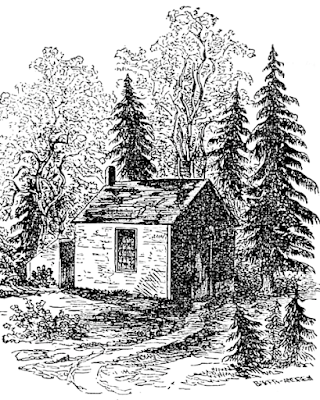
| Replica of Thoreau cabin RhythmicQuietude at en.wikipedia, CC BY-SA 3.0 <https://creativecommons.org/licenses/by-sa/3.0>,via Wikimedia Commons |

.jpg)
.jpg)

 |
| Ora and her pal, Henry |
 |
| Pen & ink drawing by J. Kevin Erwin, ca. ' 71 |
Before we get started, Henry, please do tell: is it possible to know the real you? The purpose of our conversation is to establish to the truest degree possible the nature of your thoughts and your philosophies, and how they inform your personality.
Ah, a wish to provide a true-to-life biographical accounting of my time on this Earth, I take it.
Yes, Henry, that being the hopeful outcome.
Alas, sad to say my time on Earth was cut short by the contraction of a disease for which you surely now have a miraculous cure. But, to address your question, I would surmise each of us is endowed with multiple personality manifestations, making it difficult to single out the one that stands true. I am not the less different. We shall begin here, and leave the remainder to discover along the way as tho’ following a trail of sugar crumbs dropped in the path of fire ants.
Well spoken, Henry! Let's dig in and see where the sweet path may lead, and try not to step on any ants along the way.
Ah, I am quite taken by the allusion to legions of Myrmidons and their ceaseless battling over all the hills and vales in my wood-yard! Many an intriguing hour I have spent in focusing my lens on their activities and movements. Ants are the perfect metaphor for the vain and fruitless struggling of humans who never fought so resolutely nor at the same time lived in such synchronous selfless harmony. But perhaps we are getting off track.
Henry, if we are to truly understand you, we must grok you. This is an invented Martian word from a fantasy book you’d definitely relate to called "Stranger in a Strange Land". Grok invokes a meaning of "to drink."
So you must drink of me, I see, in order to apprise the nature of my being. Yet the simple act of gazing into the depths of my soul window will convey intuition, and you will know empathy, my dear fellow.
Quite right, Henry! In the parlance of the Martian tongue, grok means to establish rapport with a person to gain the fullest experience of joy.
I have no qualm with the notion. Do proceed, my dear fellow!
I feel you and I have such a rapport and grok one another on the earthly plane. Would you not agree, Henry?
You do not overly presume much on this point. I would add that fellowship is never attenuated by death, that it must also extend to the spiritual / karmic realm. Carry on!
Let's talk about your legacy, Henry. It is fashionable to call you out and hold you to account, to hate on you, as it were. But defending your legacy, or tearing it down, remains an exercise in subjective speculation, biased interpretation, particular perspective, and personal opinion – from all sides.
Would that I have become fashionable ere fashion is one thing I can hate on! Beware of all enterprises that require new clothes, I say.
I don’t disagree, Henry, but it’s not exactly what I’m getting at.
True to spirit, I am playing with you a wee bit, my Friend. But of myself and my life's work, I acknowledge that some complexity and contradiction may be inherent.
There are those who think it troubling, Henry. The depth of your literary talent and scope of interests encompass variable viewpoints of character, politics, ideology, and philosophy such as to sow doubt and confusion about the “real you” as it were.
Ah, must the world grapple to grok me! I quite like that grok word. Let us grok, rather than mock and defrock! Let us look into each other’s eyes and drink in the spirit of the person.
Sounds perfectly reasonable, Henry! Cheers!
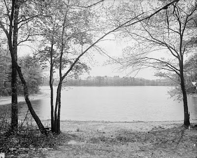
|
Walden Pond, 1908 (Wiki Commons) |
Your essay “On the Concord & Merrimack” delves into the topic of Friendship, of which you alternately wax rhapsodic and cynical about, gracefully concluding that it is like botany to flowers.
Ah, yes, that passage speaks well of my sentiments regarding the concept and duty of amity. Foremost, the only danger in Friendship is that it will end. And tho’ Friendship is a relation of perfect equality, we do not know our friends much at all when it comes down to it. For how can the understanding take account of its friendliness?
Henry, it is generally believed you can count your true friends on fewer than the sum of the fingers on one hand?
Poppycock!
Even with but a solitary friend, that counts for something. One good friend is better than five bad ones.
I can’t argue the point, Henry. I recall you referencing Confucius on this count: “Never contract Friendship with a man that is not better than thyself.”
Such is the merit and preservation of Friendship on a level higher that matters. As I love nature, as I love singing birds, and gleaming stubble, and flowing rivers, and morning and evening, and summer and winter, I love thee, my Friend.
Beautifully stated, Henry. I love thee, too, my friend. We will have more to say about this topic later. For now, I think people overlook the hidden gems in your writing, for they are often buried in the dense thickets of your rich prose. People read what they read, or half-read, and draw their own conclusions. I think our conversation will help set the record straight about –
My dear fellow, I am no fair to middling mystery, the world should know, despite impressions to the contrary.
That is precisely what we aim to clarify, Henry. Your writings brim with contradictory statements and allusions to opposing views regarding –
Whom I deign to pretend to be? Are we all not actors on the stage? On my side, I require of every writer, first or last, to own one’s life straight away, and not merely so that the world should think it has heard the frills and bells of my life. I don't grok the nature of the problem.
The problem is fathoming you, Henry, grokking the full measure of you in all your glorious messiness and wonderful complexity!
Tommyrot!
Have I not laid out a simple and sincere account of my life aright and as clear as the dawn breaks on the dewy meadow? What more would people have to know of my likes and dislikes, my inclinations, my habits, and dispositions. May the woodcock and porcupine know so much about me.
Henry, I love your lavish, if cryptic, responses. And your sense of humor, too! You are not given enough credit for your subtle wit. The reader’s antennae really have to be up to discern when you’re being facetious and funny, otherwise you will be taken literally for a snob, a boor, a preachy arrogant know-it-all, if you’ll forgive my tone.
I must confess, the droll line oft channels through an unconscious pen and may on first glance appear to be of impeachable worth. But since boyhood, my brother, my mother, an uncle, all have remarked on a vein of levity. So much for want of not trying to inject such into my prose, dear Friend.
Let’s talk about your aspirations, inspirations, lifestyle choices, and moral philosophy that guide your every action and serve as a roadmap for living a life with principle.
Naturally, I endeavor to proceed confidently in the direction of my dreams. How else would I expect to meet with success in an uncommon hour?
Nice, sure, but there are inherent contradictions in so much of what you write that are ripe for misconstruing.
What can I say other than to invoke the riposte of my dear compatriot:
Do I contradict myself?
Very well then
I contradict myself.

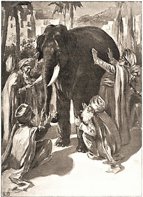
You most definitely contain multitudes! Whitman really nails the idea that we are not quite as we appear. To grok the full measure of you, Henry, reminds me of the old story of four blind men, each unfamiliar with an elephant, all groping various body parts to gain a perspective of the pachyderm. One caressing the trunk, another rubbing the legs, another stroking the tusk, another feeling the broad rough side, each coming away with a description based on his limited, subjective experience.
A fine parable, indeed. This world is but canvas to our imaginations. Who is able to grok the true nature of the elephant? Not you, not I, perhaps not even the elephant himself knows of what flesh and bone he consists!
Henry, it's no fault of yours that you are so . . . misremembered and misunderstood. You are a multifaceted public figure of many guises and talents, though it is often said given to a grouchy, morose temperament –
More tommyrot,
such as to be unfair
to my sweeter nature!
– also given to prolonged contemplative spells –
Lo, a bit more on the mark, my dear fellow! Perhaps reveries and ruminations more likely to describe my mental forays into ethereal realms of speculation. But the question yet persists as to my identity, I am to gather? This corpus lately decayed of flesh and bone, this caliginous spirit and disembodied imagination that persists through misty time in the air of mind in which it lives and breathes? THAT, my dear fellow?
Yes, Henry, THAT! Let’s touch on your legendary reputation a bit. You’re remembered as the "hermit of the woods." Unfairly or not, this label has contributed to the popular notion that you are – well, no mincing words – a curmudgeon and misanthrope. A grumpy guy who shuns society and companionship to better enjoy your own exalted company.
Stop the Heavens!
If this is what THEY think of THAT, then no one will ever grok me, I daresay! He who truly knows me will know I am naturally no hermit, but, tis true that I might deign to sit out the sturdiest frequenter of the bar-room if my business called me thither. Or perhaps send away a garrulous bore on some pretext.
I'm with you, Henry, but you are equivocating. There are passages scattered throughout where you talk about loving and needing companionship, then in the next instant finding it "wholesome" to be alone the greater part of the time.
A general truth, it is, that to be in company, even with the best, is soon wearisome and dissipating. I do not abnegate my love of solitude, and loneliness neither, whilst in Nature's sweet bosom, where we may find harmony and peace in the company of her sounds, the pattering of raindrops, every little pine needle expanding and swelling with sympathy and befriending me. Now, do you see, dear fellow?
I infer you are saying that human companionship is over-rated.
.jpg)
Tis true, as such when nature provides a more beneficent society in its place. I prefer the beauty of Nature when I can have it, but what value is it when men are base, not serene, absent of principle? The best company prevails when the heart is open to Nature’s surprises. The chickadee alights like an epaulet on the shoulder. A snake curls up by a log and engages in a staring match. Perchance a fawn appears at the doorstep. Nonesuch company ever fails to comfort and suffice when the blathering has not surceased and taken its toll. I no longer have to pretend to take an interest in the dull affairs of the farmer who says to me, “You cannot live on vegetable food solely, for it furnishes nothing to make bones with.” Tis truly a weary enterprise struggling to make impecunious talk.
Henry, these are perfect examples of how you show repeated disdain for your fellow citizens of Concord, and for the world of gilded society at large. It is difficult to deny that, on the whole, you view their lives with contempt.
Perception may appear reality, tho’ reality be another thing. It may hold true that I have written the best men that I know are not serene, for the most part, and flatter for want of substance. But do grok, my dear fellow, that in the full context you will see that I clearly rejoice in the company of others and look forward to convivial discourse. I most assuredly relish gregarious companionship and stimulating conversation with a mate.
That is reassuring, Henry, at least to me. I’m not so certain about your critics.
Tho’ again, I must advice from faith and experience that our ordinary conversation, for the most part, is just so hollow and ineffectual and tends to degenerate into mere gossip. I can barely deign to admit into my mind the details of some trivial affair, to permit idle rumors and incidents of the most insignificant kind to intrude onto the sanctum sanctorum of the mind which should be a repository of sacred thought. Such is my wont to avoid petty discourse in the main.
For sure, Henry. While you may exhibit some tendency toward being a curmudgeon and misanthrope, as your critics contend, you have written of amicability with tender feelings as you’ve strongly argued here.
Many times over, my dear fellow! As for Friendship, the most I can do for my friend, any friend, even an animal friend, is simply to be his friend. Is not Friendship divine in this?
It is, Henry. As the old saying goes, No man is an island. We all need one another. We’re all in this together. The twentieth century polymath pundit, Marshall McLuhan, said there are no passengers on Spaceship Earth; we are all crew.
This McLuhan fellow, he must have been ahead of his time, too, tho’ only through intuitive powers do I grok what he means by Spaceship Earth. I appreciate the fine metaphor, however.
Yes, truly. But I’d like to understand more the reasoning underlying your oppositional concepts of humanity.
Of course, the whole world has it that I went to the woods primarily as an effective means to avoid the spiritual coarseness of society and to be free of the banality of my fellow citizens. I speak not of those men of strong and valiant nature, besides, but direct my derision at the mass of men who are discontented. Am I to be scorned myself for medicinal truth telling?
In no way, Henry.
But truth be told, I only wished to live deliberately, to front the essential facts of life, to see if I could not learn what it had to teach, and not, when I came to die, discover that I had not lived.
Timeless and passionate words, those, Henry!
There is more I wish to speak of regarding this motivating factor to temporarily sojourn and partake of a singularly novel experiment of living in the Temple of Nature. I wanted to live deep and suck out all the marrow of life, to live so sturdily and Spartan-like as to put to rout all that was not life.
And yet, Henry, you write that another motivation for going to Walden Pond was not to live cheaply nor to live dearly, but to –
Ah, that part, admittedly I wrote fluff about transacting some private business with the fewest obstacles. I have always thought that Walden Pond would be a good place to conduct my affairs of business and trade but –
Yes. But. Such claims further fan the flames of doubt as to your true purpose and motivations, Henry. To realize such expression of the first noble aspiration, in contrast to the latter, helps bolster the claim that you’re a hypocrite!
Methinks it a baseless claim none the more. And not a bit unsavory for its worthless assignation as to my motives and reasoning. So be it, if one day I proclaim such and such an intention, and the next I declare a contrary opinion.
Your "experiment of living", noble enterprise that it was, will be shot down as so much tripe. Your famed "independence of character" will be scoffed at as frivolous gimcrackery. Your never-ending quest for truth and "Higher Laws" dictating ethical choices in your life will be regarded as haughty prescriptions for rules of living you dodged when convenient. Your esoteric philosophies and moral stances will be laughed at as claptrap of a fake scholar, at best an immature schoolboy.
Harsh and untruthful words, you speak! Where is the proof to back these claims? I see no pudding into which it may be extracted.
It is easy for some to read between your erudite lines, Henry.
I disavow libelous allegations as such they tend to sting to the core. Are we not merely fallible human skinbags? Such reproachful ignorance begs mercy for Divine Intervention!
Well, Henry, I am not divine, but I am here to defend your legacy. However, I must pose some difficult questions in advance of issues raised by your doubters and dissenters. But don't say you didn't see this coming. It is not I who blasphemes you; it is others, the critics who would tear you down and call you to account for your contradictions and what they perceive as willful artifice.
Ah, I see clearly now that the dust is settling. Thus, the whole measure of my person is subject to interpretation and judgment from blind fools feeling up a poor elephant! The appalling error and grossness of it!
You know as well as I, Henry, this is what critics do, like a leopard pouncing on a wounded gazelle. They draw fallacious conclusions about your character, your nature, who you are, your very being, based on things you've written about your life and whatnot.
Cherry picking the low hanging fruit! That lesser ones would fain cut me down like a weakened beetle-infested pine for – what? Sins of omission? Wont to exaggerate and expose thinly veiled lies? Soul quest in service of uncovering steadfast truth? To grok wisdom and drink from its eternal fountain?
Henry, this ruffles your feathers a tad, I can tell.
It does tend to raise my hackles! If tis true such slanted disregard, tho' how worthy of a good chortle it is! To shrug it off and laugh when no other recourse, perhaps but silence, presents itself.
Henry, myopic critics have declared you "guilty" as charged! Indeed, it is worthy of a good chortle.
If it were not for want of a good chortle, I might well deign to silence the myopic critics, be it for my own peace of mind, or else remain silent myself. Silence is the universal refuge, the sequel to all dull discourse and all foolish acts, a balm to my pride wherein no indignity can assail.
Another thing your harpy critics seem incapable of grokking, Henry, is your subtle expression of perceiving the miraculous in the commonplace; your inward eye to encompass greater significance and truth in pedestrian manifestations; your ability to extrapolate small worlds at your feet to macrocosmic realms of higher perception.
Aye, a rare genius one might say, yet it is mere poesy which allows it, an opening of the heart and mind’s eye to vaster pastures.
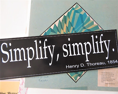
It’s like your perspicacious mantra about living simply and desiring less. You know the one I speak of, Henry. It is a clarion call which rings true in our modern capitalist-gone-awry society of super-sized everything, of excessive consumption and –
Ah, yes, one of my favorite mantras as perhaps echoed down through the ages from Hindoo sages:
Simplicity . . .
Simplicity . . .
Simplicity . . .
– as such it represents your natural and unbounded love for nature and all creation to be found in simple pleasures, simple living, simplicity as a means to a more fulfilling life absent of the burdens lading us down.
Certainly, a topic worth elaborating on, my dear fellow, for it is mostly a great deal of trumpery which has accumulated from long housekeeping we have forsaken the courage to burn to weightless ash. Nothing is more important than a person's instinct toward a higher spiritual life which is to be found in the path of simplicity. Such is my desire and aspirations, personally and for mankind.
A soul brother of yours, Mohandas Gandhi, put it years later:
Live simply so that others may simply live.
He took a page out of your playbook of non-violence advocated in “Civil Disobedience” for his lauded acts of same in the struggle for his country’s, India, independence from colonial servitude.
A most winning sentiment expressed in the profound language of native wisdom. P’raps this Gandhi fellow was himself a sadhu from ages past? Where was he when I needed him for soulful companionship? Where was I when he needed me by his side for moral support?
One thing I’d like to mention, Henry, if I may be so bold to point out, and I agree with you about simplicity for simplicity’s sake, but it’s easy to see how someone might seize on this as an indication, proof as it were, of your stinginess or aversion to enjoy finer things, or that you are a tightwad, perhaps. No one wants to be seen as a tightwad, Henry!
Alas, this misguided notion that frugality is somehow immoral or misplaced or to be equated with holding on dearly to our coins! That we must labor ceaselessly to gain frivolous possessions which clutter and defile our houses! That to accumulate excess, we are so occupied with the factitious cares and superfluously coarse labors of life that its finer fruits cannot be plucked by them! I, for one, would rather sit on a pumpkin and have it all to myself than be crowded on a velvet cushion!.jpg)
I appreciate your exclamatory points, Henry, regarding how your ethical choices and humanitarian politics are guided by the precepts of frugality and simplicity –
– so as to felicitously promote the gradual improvement of – nay, to propel positively forward the perfection of – the human race! And not merely guided by, my dear fellow, but dictated. Truth above all is to be valued and cherished. And Nature is the dwelling place of Truth where our higher calling resides. Do we not see how men destroy the forest for the short gain of its timber? And make getting their living coarse and cumbersome so as to leave little if no room for simple pleasures?
Henry, I suspect you’ve just given us another reason why people like to beat you down.
Come again, my dear fellow?
Because of highfalutin declamations like this. But keep bringing it, Henry!
Ah, it is a veritable relief you do not consider me an insufferable blowhard!
No, Henry, nothing of the kind, dear Sir; perhaps a hair loquacious . . .
I can sustain the notion, my dear fellow. You see, I am perpetually astonished at the singular pertinacity and endurance of our paltry lives. Are not you? Is not the woodchuck, even? Or the Jay. The miracle is, that what is IS, when it is so difficult, if not impossible, for anything else to be. Do you not subscribe to the ethereal notion that a subtle magnetism exists in Nature, which, if we unconsciously yield to it, will direct us aright? Do we not forget that each day contains an infinity of miracles, each moment an eternity of possibilities?
I believe it, Henry. Nature is the key to our happiness and salvation! You have a serendipitous, if somewhat sesquipedalian way with words, as you have acknowledged. Sometimes, though, all it requires is eight words to impress upon us your pithy brilliance:
In Wildness is the preservation of the World.
He would be a poet who could impress the winds and streams into his service, to speak for him. In short, all good things are wild and free.
Henry, this has been a wonderful introduction getting to know a bit about you. To listen to your heart speak to many things. To soak in your wisdom and take in a universe wider than our view. To grok your essence.
My dear fellow, tis merely a matter of directing your eye right inward, and there you'll find a thousand regions in your mind yet undiscovered.
Most are not capable of this feat of imagination, Henry. I fear, as you have aptly noted, we know not where or who we are. Until we figure that out, how can we know others?
Besides which, we are sound asleep nearly half our time! Tis tho’ we are dream walking through an impenetrable fog bank, unable to break free of the lemmings headed for the cliff. My dear fellow, our truest life is when we are in dreams awake. Not sleep walking or dreamily languishing in idle thought. But above all, we cannot afford not to live in the present, aware, aware, of the mystery, in touch with eternity. That is all one can ask of a friend.
We are getting lofty, Henry. Please share more on this.
Travel inward to those thousand regions, my friend, and be expert in home-cosmography. Believe in the forest, and in the meadow, and in the night in which the corn grows. For how near to good is what is wild. And then you will discover in your mind-travels that you have built castles in the air; now put sturdy foundations under them.
Henry, that’s a lot to unpack. But let's switch gears and get down to brass tacks: what to make of your critics who would taint you and your legacy. A creative genius named Andy Warhol, lately passed of my day, slyly notes, "Art is anything you can get away with."
Hear! Hear!
Methinks I would cotton to this Warhol fellow!
In such case, though art being his reference, the same idea might be expressed of revisionist history and biography, if the exercise is approached carelessly and with deceitful intent.
Are my critics honorary members of some Society of Useful Ignorance? What shall it take to debunk their bunkum?
Quite funny, Henry! Your first detractor to lob pot shots your way is James Russell Lowell, just three years on the heels of your bodily departure. In 1865, he wrote an essay for The Atlantic Monthly calling you on the carpet for just about everything under the sun. He undertakes to diminish your stature by telling us you “discovered nothing” and that you are not a "strong thinker, but a sensitive feeler."
Tell me more about this James Russell Lowell character who so chastises my manliness. I have heard tell of him through acquaintances, and understand his lyrical voice lacks a certain, ah, gravitas. And yet the fuddy-duddy has such nerve as to call my name out!
You are contemporaries. He’s two years your junior, born in 1819. He is a literary critic with a law degree from Harvard, also an editor and later a diplomat. He expresses biting sarcasm, irony and cynicism about new trends and fashionable thinking of the day, such as Transcendentalism, abolition, woman's rights, and temperance. He was suicidal in early life, and in later life expressed racist views towards freed slaves and Americans of African descent. I am not wholly sure the two of you would hit it off.
My dear fellow, on the single count alone of his misguided views on the African race and doubtless Abolition as well, I shall not hold him in much high esteem. Methinks we might elevate ourselves a little more.
I am with you, Henry. His stature was such, however, that his contentious reading of your six volumes set the stage and tone for future attacks on your life, writing and philosophy.
Oh, shall it be known that the scholar may be sure that he writes the tougher truth for the calluses on his palms! But go on, tell me more about what this cowardly contemporary has written of me upon my Earthly departure.
Well, Henry, right off the bat, you would get the impression of a haughty, authoritative, no-nonsense, imperial man, typical of someone of his class in the mid-19th century, a guy considered by academics to be a vital force in American letters and thought, belonging to an elite academic caste in society not prone to suffer fools –
Tis not without a slight shudder I duly consider this suffering of fools! P’raps because I cultivate poverty like a garden herb . . . or because I do not trouble myself much to acquire shiny new baubles or clothes . . . or that I compare myself on equal terms existentially with a spider in the garret? Oh, a Fool that in vain I may strive to be!
– nor is Lowell the kind of man likely to entertain mystical notions about reality –
God in Heaven, my dear fellow!
Who knows anything of reality given the vast and profound subtle powers of Heaven and of the Earth that we seek to perceive and hear, yet perceive and hear not?
– nor is Lowell bound to accord an ounce of respect to the dewy-eyed romantic traipsin’ through the countryside in tattered raiment –
Oh, would thou doest pair me in the company of nonesuch a creature, any day over the sober rationalist or hard-headed empiricist who has yet to live a whole human life! Give me a man that looks on glass, where on it may stay his eye, or, if he pleaseth, through it pass, and the heavens espy.

– nor does Lowell have a good word to speak of the dewy-eyed romantic transcendentally immersed in nature’s wild bosom seeking holy communion with the spirit of rock, tree, sky, animal.
Unadulterated rubbish!
Pass that along to the old boy if you are able, ere I am reminded how much fairer and nobler all the actions of man might be, and that our life in its whole economy might be as beautiful as the fairest works of art or nature. If that the old boy in his stuffy parlor might grok as such.
In other words, he sucks air, right, Henry?
This unbridled contempt has my head in a spin, but I shall not allow myself to be alarmed by baleful influences intended to be played on. It is all dissipation. The high road of humility, like darkness, reveals the heavenly lights.
I couldn't have said it better, Henry, if someone were attacking the very substance of my being. Now, I hate to be the bearer of bad news, but Lowell’s just gearing up.
What on God's green Earth is the old boy gearing up to?
For starters, he suspects you lack a "healthy mind" because otherwise you "would not have been so fond of prescribing."
Drink of thy moonshine,
old boy!
While I offer suggestions for good living, you in turn may accept such portions as applies to you alone. Have I placed a gun to your temple? Or but merely ask of you to consider your body and spirit as a holy temple?
He critiques you in the same breath for "prizing a lofty way of thinking . . . not so much because it was good in itself as because he wished few to share it with him."
For want of beans!
Any writer, poet, or essayist worth his gross necessity of salt would naturally prize elevated thinking! It is an open source to plumb and drink from.
All true and good, Henry, but Lowell is not willing to give up, nor give in, so easily. Possessed of a high-handed opinion, he belittles your mental health to an unnecessary and unfair degree. He says that you, dear Henry, suffer from a sort of sickness of mind.
Assuredly, Henry, and in fine physical form, too.
Aye, my friend. If you would get exercise, go in search of the springs of life, out of doors, in the sun and wind, the fields and woods. Who needs the swinging of dumb-bells!
In Lowell's view, you must be a dumb-bell, Henry, for your childish susceptibility to "modern sentimentalism" of nature. He inexplicably believes it reflects a "mark of disease."
Fiddle-faddle!
No man loses ever on a lower level by magnanimity on a higher. I shall not deign to stoop so low as to bend a knee ere I misperceive his dim-witted comments which are so meaningless as to be ridiculous; nay, so ridiculous as to be meaningless.
He keeps piling it on, Henry. He reserves an especially poisonous pen regarding your literary capabilities, disparaging your writing style, subject, tone, and substance.
Such flapdoodle.
What has he written that may compare, even to such puffery as I may have penned:
Great God, I ask for no meaner pelf
Than that I may not disappoint myself,
That in my action I may soar as high
As I can now discern with clear eye.
Not at all puffery, Henry, but a profoundly expressed sentiment! As for Lowell, he cannot compare. Emerson has said he “pumps too much” to force a poem. His stabs at creative composition are deficient, as noted by critics upon publication in 1841 of his first volume of poems, “A Year's Life”. A source I have uncovered, authored by the Poetry Foundation, cites “technical infelicities and irregularities, didacticism, obscurity, and excessive literariness.”
Well, let us put the good man, then, to rest.
Not quite yet, Henry. While he barely has time to catch his breath after castigating your style, he loses his train of logic and concludes his tirade by bubbling in admiration at your "nuggets of the purest ore.” He praises your sentences “as perfect as anything in the language.” He relishes over “clearly crystallized” thoughts. And gushes how your metaphors and images “are always fresh from the soil." Go figure, Henry!
I doubt there exists a mathematical formula for such figuring to account for the illogic of first condemning me and next praising me to the Heavens. Am I to rest contented now that vindication is in sight?
Henry, if you know anything at all of this man Lowell, you would know he despises your worship of nature above all. Evidently, being of the dualistic Cartesian view holding that mind is separate from body, it is a short leap for him to hold wild nature – the animism of savages, no doubt – as threatening and antithetical to tame civilization, no doubt, which he esteems as the highest noble attainment of humanity.
I am of the rude mind to guffaw, my dear fellow. You mentioned the old boy is listed among the Romantic Poets of the Ages, correct. And yet in principle he knows nothing of the sweet scent of angels nor the music of the fair Muses!
So you’re saying, how dare he be associated with the Romantic movement?
To that point, exactly, my dear fellow! Does he ignore restraint? Is he free in his emotions? Does he embrace and champion individualism? How often and with what abandonment does he immerse himself in Nature? Would he bare his naked soul to the Heavens? I am not struck with confidence that he is so.
To be fair, Henry, I suppose we would have to read his works to judge. Perhaps another time. It’s not our cause nor purpose here to come crying to Lowell's defense.
No matter where, no matter how much or how little, then.
Because, Henry, in the narrow constricts of his view, you are a grave offender of perpetuating a radical notion –
Not without a speck of facetious wit, shall it be!
– the notion of Oneness in mind, body and nature, a new gestalt of integration, as it were. Consciously or not, Henry, the concept is about eighty years ahead of its time.
Grok that!
Your word gestalt is intriguing, my dear fellow. Methinks you are saying that such a way of perceiving the world encompasses so much more and all we cannot actually perceive with our senses in this mean Earthly realm.
Precisely, Henry! Your mind is quite prescient with the perspicuity of a perfect poet!
Why, a big thankee from this Yankee, for the graces of your fine alliterative sensibilities. And yet this man Lowell has the temerity, perhaps audacity is the word, to dismiss my "lofty way of thinking” as protoplasmic slush? I have half a mind to lash him with a sarcastic tongue whip and show the old boy how soon his own work as poet and critic, at least, should be swept into such a dust-hole as might never see the light of day!
Henry, the worst of it is he considers you merely "a preacher-up of nature, we now and then detect under the surly and stoic garb something of the sophist and the sentimentalizer."
A preacher-up of nature is it! Sophist shall it be? What witless hokum to bestow the sentimentalizer title on someone such as myself who would not be so lily-white in this regard. Romantic, yes! Transcendentalist, yes! Dreamer, p'raps! But sentimentalizer, methinks not! Tho’ to be fair, of a balmy summer night, when wont to gaze upwards and dreamily drink in the starry firmament, an occasional sentimental rush might infuse my being.
Henry, methinks Lowell is just trying to get your goat. He’s probably jealous.
Why, sure, it sounds oh-so-precious to the ear, does it not. And a goodly distance from reality! But let him have at me. I cannot be goaded into belly-aching and end up despising someone I have no relation with. An undeterred poet am I, actuated by pure love.
Yes, Henry, apparently his ammunition stock is so low he can only bait you and resort to mockery and belittling broadsides:
O Dreamer!
O Romantic!
O Sentimental Transcendentalist
that you are, Henry!
I who would foolishly idealize and personify nature in such atavistic fashion! Show me the goods.
Trouble is, Henry, he offers no goods. Only his words which we are to take at face value for their merit.
My dear fellow, I am not so gentlemanly as to be indisposed to combative riposte, and if given half a chance, I would be up in his face! What a twisted route it must be that leads to all such dead-head notions about me and the world!
He reasons that "from Petrarch down" the sentimentalizing of nature by weak minds has a long association or tradition with "unreal men, misanthropes" – can you believe such tripe, Henry. He holds forth that "the divine life of Nature is more wonderful, more various, more sublime in man than in any other of her works." Thus, he relegates nature herself to merely an incidental backdrop in the pageantry of civilization’s ascent, deemed subordinate to the paragon of all creation – man!
Codswallop, my dear fellow!
If I had room and inclination enough, I might well turn over in my grave! I would fain confront the old boy and have at him with all the piss and vinegar I can muster. But why level downward to our dullest perception always, and praise that as common sense and noble virtue in our action? I shall leave vitriol for lesser temperaments.
No, go ahead, Henry, have at it. Shout your barbaric yawp over the rooftops of the world to anyone listening.
Mere folderol.
We should ne'er want to stoop to being "real men" who despise Nature, and as such elevate them to some Divinity. Nor bow so low as to scrape the carnal encrustations accrued to civilization’s hull and glorify “real men” as the paragon of all creation! Tis farcical apotheosis only!
I'm with you on that count, Henry, but keep a cool head. It is 1865, after all. The world is still dull and mean. Lowell has largely been wiped from the slate of memory. What merits mentioning again, is just how far ahead of your time you were! And still are!
Time! – Time? So what is Time?! They should someday put Time! on the cover of a quaint journal. Then idle Time ran gadding by and left me with Eternity alone. Time! is but the stream I go a-fishin’ in. I drink at it.
Fair enough, Henry, but our time with Lowell is not up. Just when you think he's finished with his bruising litany of complaints and shortcomings, he slathers it on thicker than molasses.
What to make of such a man? A wastrel, he surely must be! No friend of mine. I cannot countenance types such as this Lowell who would be so frivolous and careless in a parlor conversation, no doubt, unable to filter a kind word through his pie-hole.
Keep it coming, Henry.
How trivial and prosaic the mind to devote reams of ink to the unwarranted disparagement of persons! The universe seems bankrupt as soon as we begin to discuss the character of individuals. All discourse runs to slander, our limits grow narrower as we advance.
Tis utter claptrap!
True, Henry, taking blithe liberties in cherry-picking "facts" without actually delving deeper into your writings is just taking cheap shots. In the full context of any criticism, it is easy to dispel the argument.
Aye, and oft a gleaming nugget buried deep like a buckeye in the ground proves he is more often than not plain dead wrong! Let light’s shaft of truth illuminate veracities and dispel fraudulent claims.
Absolutely. Just to give one small example, Lowell states you have "no humor." I mean, c’mon! You have busted my gut several times during our conversation!
No humor!
How rich, my friend! It is he who must lack humor, despite word he also has a risible wit. Tho’ it oft be a dry scroll, mine is not absent of droll. One day then my ear picked up on a rumor: better to stab at humor than fester with a swelling tumor, tho’ the result in either case may end in groans and agony!
Henry, only someone incapable or unwilling to grok you would be unaware of your humorous proclivities. It is fairly well-known that your wit is of exceptional quality and that you enjoy all manner of jokes and teasing.
And let us not overlook my propensity for paronomasia, my dear fellow, that playful sentiment to “Thoreau” out a good pun when least expected! Can we say as much about Lowell? P’raps, but there is nothing clever nor funny about his dismantling of me!
Not to mention your delight over a clever saying or ludicrous turn of phrase or your reputation as a speaker capable of "bringing down the house.” And that you are “a lecturer of some humor” at the lyceums of your day.
No humor, indeed! Case closed! I take it that my Thoreau-ly comic sense needs no further elaboration nor embellishment!
Certainly, the old boy has some bug up his butt about you, Henry. He probably feels insecure and threatened by the rarefied air of your genius, your down-to-earth poetic and rhetorical skills, of which it is known that he is notoriously self-deprecating and insecure about his own mastery of such. I suppose that makes you an easy target, Henry, because you hear a different drummer and step to your own music, however measured or far away.
Yes! Yes!
A thousandfold times!
Yes!
For there is no just and serene criticism as yet, insofar as my powers of discernment allow. What I do smell is the rank odor of flim-flammery and the sanctimonious mumbling of holier-than-thou preaching down.
Truth spoken, Henry. Lowell ends his diatribe with an onslaught of head-scratching assertions and baseless exaggerations, without so much as a molecule of charitability, nuance, context, nor inkling of full scope.
My dear fellow, I give not so much as the ass end of a skinned muskrat about his stodgy exercise in demeaning my character. But, that I may taste of their unsavoriness to disprove his slanderous words, my ears are open, so that our intercourse might go forward to something better.
I concur, Henry, because the old boy saves the worst for last in a burst of unwarranted character assassination. In his high and mighty tone, he bombastically concludes that you are an egotistical poseur top to bottom. You are "a man with so high a conceit of himself.” You possess only a “little active imagination” while your “critical power, from want of continuity of mind,” is “very limited and inadequate.” You are “not by nature an observer”; you only see what you look for before your eyes; and you are “less poet than naturalist.” You have no spontaneous attention nor genius. Finally, you “discovered nothing.”
God's Blood!
Shall that be all? Some would find fault with the morning red if they ever got up early enough! But in this tangle of insults I sniff his ill humor. I for my part resolve to denounce it and let it be the oil to my water, for it doth expand my privacies to all, and leave me single in the crowd. Know what I'm getting at, my dear fellow?
I grok you, Henry. So much for Lowell, never your equal, forgotten in the dustbin of history. Let's move on to your next critic.
Please, my dear fellow, first allow me to catch my breath and sip a mouthful of water to wash down the grit and grizzle of this unpalatable nostrum intended only for the gullible or ignorant.
[Brief Pause.]
Forty-three years after Lowell, along comes the writer, ornithologist, and folklorist Fanny Hardy Eckstorm with a questionable corrective to the mythic and heroic reputation you enjoy as a hardy self-reliant woodsman.
Mythic and heroic in legend only, my good man, for self-reliance requires, first and foremost, an ability and means to be independent from the stringencies of one’s fellow man and constraints of society ever pushing to impose duty and morality. Even then, we can only console ourselves with the bravery of minks and muskrats.
I will keep that in mind, Henry. In 1908, The Atlantic published her essay taking you to task for the many perceived pretensions, contradictions, and false pieties (she perceives) peppered throughout your book, “The Maine Woods”.
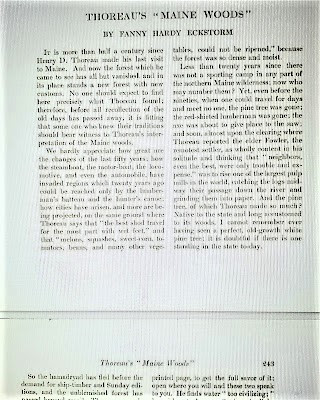 |
| Copyright of Atlantic Magazine Archive, property of Atlantic Monthly Group LLC |
Ah, yes, recounting my three trips there in ‘46, ‘53 and ‘57. I am sorry I was not able to get it off to the printers in time.
Just so you know, Henry, it was published posthumously in 1864. Smile, Old Sport!
I am gratified. I hear you have written up your own account of the fine land of Maine and posted to your – what do you call the tool of your press? A log with a B, a blog? Please share – how do you say? – the linkage (?) to such. Word of the press has it you have the talent of a poetic writer extolling nature’s beauty with a keen eye as well to the minute inspection of some of Nature's works.
Thank you, Henry, thank you so much! I am quite honored. Meanwhile, back to Eckstorm. She was herself the object of scholarly revisionism and eventually "outed" – that is, Henry, "exposed" – as a racist for her depictions and descriptions of Penobscot natives.
Just to wonder, is there no accounting for the context of the times for how she crosses her t’s and dots her i’s? Are we not all products of our time and see through the lens of unfiltered learning or knowledge yet attained?
Well, Henry, it’s a cruel and unsparing world today. A whole movement exists to castigate people of past ages who didn’t, but “should have” known better, who didn’t but “should have” had more evolved ethics, who didn’t, but “should have” recognized the wrongness of their backward and unevolved thinking, personally and institutionally.
Then what to make of anything, but that we all commit mistakes, grow and move on to a better life from them, do we not? Or does the wisest soul not learn anything of absolute value by living? Should we not live in all the ages of the world, then, in all the worlds of the ages, in an hour, so we might see! Alas, tho’, we are of our own time, of our culture, just a little worldly with but skill to live coarsely and serve the Devil. I believe it impertinent to assume a man of my time or five-hundred or one-thousand years ago, or hence, can so easily have the hindsight, or foresight to –
Let’s save this topic for later, Henry. I get your drift. But back to Eckstorm, she who so breezily calls you to account for many minor discrepancies and errors, basically branding you a fabulist, phony, and fraud.
Why, such a scold! Wither the authority and audacity to so label me? I fear chiefly lest my expression may not be extra-vagant enough, know what I mean?
I know, I do know, Henry. Trust me.
And may not wander far enough beyond the narrow limits of my daily experience, so as to be adequate to the truth of which I have been convinced. What nerve as to deny it with holy conviction!
I hear you, Henry!
Extra vagance!
It depends on how you are yarded. Do you grok, my dear fellow?
Yes, Henry. Hers is a flimsy "straw man" argument in a long line of them used to prove your unfitness for the label of woodsman, among other slights. It sounds rather trivial to me.
Ah, yes, I am familiar with this “man of straw” you talk about. The term goes back to the year 1620 to describe an easily refuted imaginary opponent in an argument. I never would believe I to be the object of such derision.
 |
| Ora and her pal, Henry |
I would surmise you don't really think of yourself as a woodsman, Henry. You know, the lumberjack / hunter / survivalist type. My guess is you just fancy yourself as a man who likes being in the woods, surrounded by trees and water, amongst the animals and birds chirping, listening to the wind. Rapt in thought. Lost to the madding world.
That is right and true, indeed. I went to the woods, not to be a woodsman, though I employed the axe as a necessity, and fished for sustenance on the rarest occasion when down to a morsel, but I endeavored my utmost to avoid actually living like a woodsman. Rather, I sought out how to live with the license of a higher order of beings.
Maybe if Eckstorm actually read page 108 of your book, she would grok you, Henry! Yet all she can manage is to point out trivial omissions relating to certain details of observation and inadvertent factual errors in your compendium making.
I daresay that she exhibits a well-spring of ignorance, neglectful of limited means and resources at my disposal while conducting research in the field, as it were. In any event, give me ennobled truth over dull facts.
Henry, she takes special delight in haranguing you for this, that and the other; positioning her argument to remonstrate against any and all labels applied to you in the popular imagination. In her view, Henry, you are neither scientist, botanist, ornithologist, nor naturalist.
So much trifling, so little of deeper import. How might she defend her dismissal or ignoring of my seminal tract, “The Succession of Forest Trees,” which is rather, specifically, scientific, tho’ I admit a turn toward the scholarly in my latter day. So, what then does she propose I am, or should be known for?
Why, Henry, "merely" a poet.
Then the poet will write for his peers alone. He will remember only that he saw truth and beauty from his position.
That is all that matters then, Henry.
Truth be known, my life has been the poem I would have writ, but I could not both live and utter it.
While Eckstorm discredits your scientific contributions as minimal, shallow, or worthless, in the vein of our old boy, Lowell, she also takes pains to compliment your supernal observational and writing skills. She reckons your talent more aligns with "art" than science, and yet somehow her tone is condescending. Henry, in her estimation, you are a mere "interpreter" of the natural world.
What happened to the poet? I suspect now I am the least talented of any.
She is treading shaky ground, Henry.
Tis obvious to face which we can give to a matter will stead us so well at last as the truth. Rather than love, than money, than fame, give me truth. That is my steadfast position. I shall play my own poet and let the world be my interpreter!
It is said, Henry, you have never particularly been drawn to the scientific profession with the rigor required. Instead of capturing and pinning specimens beneath glass, they say you prefer to inspect life in the natural habitat with a hands-on, down 'n dirty focus on the little unseen things of nature.
Dear fellow, may I ask, to what end does it matter so long as the outcome equals in the weight of knowledge gained?
It matters not, Henry. In no way does it diminishes your acumen for elevated poesy and scientific investigation of the natural world in all its majesty, magnificence, and mystery.
I like that, my dear fellow. You align with the poet Gods yourself! Never despair, for tho' the poet is no tender slip of fairy stock, your fainting companions will recognize the Divine in you when you hit the nail on the head and we shall not know the shape of your hammer.
Grok that, Henry! But going back to your alleged "sloppiness" in compiling, naming, and classifying endemic plants and trees, as well as your listing of birds native to regions where you dwelt and visited, you should know that your contributions have been valuable to generations of botanists and ornithologists.
Rest assured, tho' leisurely, my inspections of nature's minutiae are conducted with an eye toward understanding what lay beneath the rock's immutable pose; what scrap of bark contains the hieroglyphic tracing of some lowly worm; what muck beholds bewildering swarms of life at the bottom of the pond; what plant grows where; and which bird may alight to feed on its seed, with the higher aim to yield knowledge for knowledge's sake, less out of curiosity, tho' that counts for much.
Henry, what if I were to tell you . . . that the notes you took at Walden have proven indispensable to contemporary ecologists. Yes, you got it right, they are scientists who study interdependent biological systems. The term ecologist came into being in 1875. All these years later, in researching the reasons how and why our Earth is heating up so rapidly, they have established premises and data models, based on your detailed notes, to monitor and measure changes since your time on Walden Pond.
I am fairly gobsmacked, if I so may express my astonishment at the honor and recognition, and it would be grounds for false modesty to otherwise proclaim.
You’ll appreciate this catchy, modern-day expression, Henry, one I'm certain you'll use if you ever meet up with Fanny Hardy Eckstorm on the ethereal plane in karma's court of justice.
Put that in your pipe and smoke it a while, sister!
And what, dear fellow, would such an expression invoking the coarse tobacco habit be bound to convey to the recipient?
Basically, it means, your stance is vindicated. So shut up, you’re dead wrong. Accept it and move on.
Oh, that is a good one. I shall certainly deploy it when the moment is ripe for calling it out. But, seriously, what plagues this woman so?
In your vast trove, Henry, nowhere do you self-reference as a scientist or anything more, really, than an expressive essayist, a journal-keeping naturalist, a chronicler of what you see and experience in the world, ever observant to the small miracles often hidden in plain sight.
Hear! Hear!
That would be noticing her smallest leaf, and taking an insect view of its plain. That would be undressing Nature to sniff her finest fungal pungency, and breathe in the vanilla aromas of her delicate petal; to drink – grok! – of her humblest but most precious offering which is silvery streams of water spilling down from the sparkling freshet.
Henry, therein lies the rub, you see, the thing that rubs Eckstorm the wrong way. Too often you come off as merely the pesky poet-interpreter instead of the serious scientist she insists you be, who would report the facts of the leaf, dissect the entomological details of the insect, coax out the bioluminescent mystery of the algae and mushroom, extract the chemical composition of the water!
Sheer bunkum!
Shall I not have intelligence with the Earth and in my own way? Do not reproach for a little idle learning! Can we not leave all such painful rigors of scientific investigation to the scientists proper?
Yes, Henry. I think most of the world agrees, so don't get too, too riled up. Often, our greatest scientists have expressed heady concepts in poetic, even mystical, terms.
For my part, I would fain see those clouds; how they hang! That's the greatest things I have seen to-day!
Henry, your keen eye is tuned to the unfolding pageantry in the world of small things that you perceive with great vision and heart. You are eager to plumb mysteries of the natural world with a discerning eye and poetic devotion that foreshadows the later writer and naturalist John Burroughs, who fancied it as the "art of seeing."
Certainly! Another thinking fellow in my court. It is not so important what you look at, but what you see that matters.
And yet to Eckstorm you are a scarecrow, Henry! Imagine that, you, a flimsy unreal man with straw for brains! But let her ramble on. Let her falsely label you a fake woodsman. Let her question your competency as a naturalist, as though the issue is settled once and for all by her astute analysis.
On and on she brambles, exerting her mental capacities with anguished comparisons! Tell me, gentle friend, what is the basis for her accusations against me. Fake woodsman. Faulty scientist. Incompetent naturalist. I daresay!
Why, Henry, it's about not presenting correctly with precision and accuracy. Not playing the part, not dressing for the role. She loathes that instead you would prefer to versify and pontificate, speculate, and dream.
More of the same flapdoodle!
She scolds you for failing to properly identify several birds in your avian compendium in “The Maine Woods”.
Such piffle as I am wont to put in her pipe and let her smoke it for a goodly while! I painstakingly list thirty-seven birds, my dear fellow, and get four turned upside down. For that I am faulted!
And she berates you for neglecting to apprise us of the precise details of a partridge chick, such as weight and color.
Surely not! The weight and color of a partridge chick are obvious to any mere bird-brain, even a guess would be in the neighborhood of accuracy. Is it not more in accordance with childlike wonder and mystery and poetic nuance to remark instead upon the rare clearness of its gaze or the velvety sheen of its soft down coat or the sweet peep of its breathy exhalation?
Absolutely, Henry, without a doubt. Now, she tsk-tsks because you miscalculate distances and over-estimate your outdoorsman abilities, and exaggerate as well the abilities of your companions.
Blah-blah tomfoolery!
In case any doubt remains, Henry, she pounds the final nail in your coffin – oh, sorry about that one! – simply because she thinks you are incapable of caring for yourself in the woods.
Hogwash! Has she not scrutinized the details of my accounts?
Sneeringly, Henry, she concludes that your experiment of living rustically is a monumental travesty, asserting that the least that can be asked of a man to qualify him as a "woodsman" is to be able to care for himself in the woods.
Such sententious noodling, I such that I heartily disdain as the dread of some pious reformer knocking at my door with the conscious design of doing me good. I should fain run for my life at such a prospect.
Is there any truth, Henry, to what she says?
I shall say one thing, that I should have spoken of before, and it will doubtless bear repeating: Shams and delusions are esteemed for soundest truths, while reality is fabulous.
Put that in your pipe and smoke it a while, sister!
Buckle up, now, Henry, we're fast-forwarding to current times. In a 2015 article in The New Yorker – titled “Pond Scum” and later amended in the link as “The Moral Judgments of Henry David Thoreau” – a writer of considerable renown and integrity, Kathryn Schulz, diverges from previous excellent pieces and mounts her high-horse to mercilessly debunk your iconic status and reputation. Sound familiar, Henry?
My dear fellow, it is undoubtedly more of the same stinking twaddle, rank rumor and the gossip of garbage bins. But let's get on with it. I must admit my curiosity gets the better of me sometimes, tho’ in general, I am quite averse to the reading of things that nigh burden my attention to the insignificant details, for the news we hear is not news to our genius. It is but the stalest repetition.
I have no doubt, Henry, as you tell it, we should wash ourselves clean of it. But by attempting to take you down, she has put a gigantic bulls-eye on her own back as being the biggest Debbie Downer of them all.
Oh ho! Good one! I suspect this Debbie Downer to be channeling Lofty Lowell and his laundry list of grievances word for word!
Yes, it's as though she'd gotten her hands on his dusty old article and had an AHA! moment –
My dear fellow, allow me take a crack at it.
Go for it, Henry! This should be good.
AHA! Perchance her thoughts strayed toward a pea-brained notion to one-up the old boy by endeavoring to put me in my rightful place? Must she presume I am a musty decomposed white fellow?
You’re getting warm, Henry.
AHA! I shall take it upon myself to be the latest fashionable critic to defrock the over rated sanctimonious gasbag!
You're firing on all cylinders now, Henry!
AHA! Bring the old boy down a notch or three! Declare to the world what a fraud I must be!
You’re really cooking with gas now, Henry!
AHA! Color his halo bent and irreparably tarnished.
Henry, it occurred to Schulz that her unvaliant effort to take you down a notch or three, as you say, would elicit howls of protest from the Twitterati –
Say what, say who, my good fellow? What possibly do our Heavenly Birds have to tweet about the matter?
Oh, never mind, Henry, but you might get a twinkle in your eye thinking about her joking that on account of her unsympathetic portrayal she would have to go into a witness protection program.
Now, what would I therefore be in such case, if not a degraded criminal? Why, just the sort of sclerotic pabulum one might expect, tho’ doubtless tis a poorly-argued and illogical rant.
That's about right, Henry. In her hit piece, she spills much ink defaming your moral character, your unlikeable quirks, and annoying foibles. She takes personal offense at your contradictions and inconsistencies in real-world ethics and philosophy. She basically thinks you’re an insufferable blowhard, Henry!
Sounds to me like the same old straw man crap.
It is difficult to swallow, Henry. You do not deserve unwarranted opprobrium from people blinded to your fair and innocent genius.
Well, fair, but p'raps not so innocent, as it is more than mere knack. But, anyway, horsepucky on Genius! A man cannot wheedle nor overawe his Genius. I am not so arrogant nor foolish to think otherwise.
I grok what you're saying, Henry. Certainly she is unoriginal in her view, and resides outside the margins of respectability, merely rehashing straw man arguments about you in similar derogatory tone and language of prior dethroners.
Ah, that I am a hypocrite, a fraud, an unrepentant misanthrope! Have we not previously dispensed of this guff?
Schulz takes things into new territory, Henry. She crosses the line with a truly blasphemous and, if I may say so, half-cocked assertion that your beloved Walden is not memoir, but fiction chock-full of "fabrications, inconsistencies, and myopia."
With what nervous audacity does she stoop so low to elicit the shrieks and caws of protest from our Heavenly Birds!
Brace yourself for this shocker, Henry. No doubt with a smirk on her face, she smears Walden as "cabin porn"!
Cabin what?
Heaven's mercy! A careless accusation without merit, as we know from etymology studies that pornographos means "writing about prostitutes" – I dare not ponder if my salubrious mind deigned ever to entertain such a salacious titillation, tho’ once a charming lady of dainty build and robust appetite for a roll in the hay fairly came onto me in a least expected moment –
I'm sorry to interrupt, Henry, though I would enjoy hearing how that turned out, but for another time. Regarding the silly derogation of “cabin porn”, generations today would roll their eyes and sigh facetiously: "Whaaaaaaat-eeeeever!"
Indeed, my dear fellow:
whaaaaaaat-eeeeever!
The BIG QUESTION Schulz poses to sophisticated readers of the New Yorker, though, Henry, is the judicial-like inquiry: "Why, given his hypocrisy, sanctimony, and misanthropy, has Thoreau been so cherished?"
.jpg)
Words fail to materialize to defend my honor in the treacherous business of heretical and shaming allegations. To so impugn my good name nearly leaves me speechless.
I know, Henry! It’s terrible. This sounds like someone with a ragged bone to pick!
No, friend. A little bread and a few potatoes shall suffice; as such that I am averse and repulsed by the slimy, beastly life, I have no need to pick at bones!
Yes, Henry, I agree one-hundred percent – you are not a man to pick a bone with, given your ethical dietary preferences.
So you are with me on this count! Bravo, my good man. Too many have taken me to account on my eating, even this Schulz woman I suspect.
The trap is baited, Henry. She skewers you on the point.
Fine. Whaaaaaaat-eeeeever!
Whilst I prefer the world to see my way, for my part, I desire a life of peace and neutrality, neither prescribing nor proscribing to anyone how to conduct their affairs, for not every coat is tailored to fit the particular man.
The sartorial metaphor is good, Henry.
No points to defend. Live by example. And however mean your life appears, meet it and live it. Do not shun it and call it hard names. It is not so bad as you are. Love your life, my friend. But a shame lest we forget to love the animals equally and let them as well meet and live their lives without the prospect of the bloody abattoir.
That is beautiful, Henry. Thanks for the perspective.
I am not perfect in my mien, I never have been, and I never shall be. Perfection, tho' an ennobled ideal, is not humanly achievable. So the faultfinder will find faults, even in paradise. I can be my worst enemy and critic. I know of no redeeming qualities in myself but a sincere love for some thing, and when I am gravely reproved – such as herein – I fall back to this ground. This firm Earth into whose soil all returns, and from whence all things grow ever stronger.
Good game plan, Henry!
And yet I find myself taking umbrage at her incessant scolding of my better nature, wielding her battering ram to my reputation.
Assuredly, Henry, it is an unflattering, non-nuanced portrait of the complexities inherent in your personality. And nowhere fair game since you were not around to take her on. Evidently your words to her are mere Rorschach patterns to make what she wishes of –
Come again, dear fellow. Rorschach? Is that similar to grok?
Well, in a way, much like the blind men feeling up the elephant for clues to its nature based on their limited persuasions. In the early 1900s, a Swiss psychiatrist named Hermann Rorschach devised a test using ink blots on paper where subjects would see objects, shapes, faces, or whaaaaat-eeeeever (!) as meaningful to their individual experiences.
Quite on the money, this Rorschach fellow who doubtless grokked the thing that makes people tick from deep within a peculiar psyche – random images appearing in the mind from ink dropped onto a page from a blotter, as tho’ my own words to paper for her to discover the patterns which she might see in them.
You have a quick mind, Henry.
Ahem, as you might invoke, all the better to pick me apart like tender meat from a bone. Her words are savage tidbits strewn across the page!
Don't fret, Henry, I've got your back here. While she takes great pains to denounce your peculiar ascetic habits and austere preferences as needlessly monk-like to the point of boring, the world will not ignore your accomplishments and legacy. Her savage tidbits cannot ever diminish the power of your thinking, the brilliance of your philosophies, and the grace of your fellowship to human and animal companions alike.
It's not aright, insofar as I can judge, that one would be subjected to the scrutiny of a harsh light as though interpolated by a blind one feeling up but a single body part of a pachyderm. You know me, my dear fellow, I should not talk so much about myself (in relation to my isolation and lifestyle whilst sojourning on the Pond) if there were anybody else whom I knew as well.
How’s it feel being on the receiving end of a good thrashing, Henry, condemned for brusque manners, haughty judgments, unwanted advice and arrogant recipes for living a pure and clean life.
Might I interject, my dear fellow, that this ideal life to which you refer, I regard is a life absent of unwanted necessities, needless frivolities, and unabashed cruelty. The killing of animals and the incessant preparation of their bloody carcasses for the evening's repast. And what is so wrong with a life free of dispiriting libations such as alcohol and coffee? And so much salt, salt – that grossest of groceries!
But it is said, Henry, you liked your mama's freshly baked cookies!
Dear fellow, a man is entitled to his mama's freshly baked cookies on good occasion, especially when companionship may be at hand, or when the belly cries out for a sweet treat. The maple tree does not, after all, give so frequently of its syrupy delights.
I grok you, Henry, but consider how your words might be interpreted as in direct contradiction to your actions and desires. But – whaaaat-eeeever! – we are all flawed human beings in some respect or another.
Might it be prudent to infer that this infelicitous Debbie Downer takes such offense of my ideal life because it does not square with her own virtuous ethics, her personal behavior, and preferences?
Yes, Henry, that is quite true, at least in my reading of her.
Ah, and with such clever raillery she must think, the manner in which she dismantles my framework to live within means – to simplify for want of life's barest necessities – for are not many of the so-called comforts and luxuries of life purely dispensable? More so, I contend, they are positive hindrances to the elevation of our species.
That's right, Henry, and it's exactly why she delights in skewering your pretentions and presumptions (her words). She contemptuously pokes fun at your spiritual ascetism. She mean-spiritedly bashes your spartan food choices. She cynically mocks your disgust for excessive over-indulgence, materialism, and consumption as pious preaching!
But I fail to grok why this person should care to devote excessive mental energies toward condemning so the aspiration of cleaner living on a higher ethereal plane.
I don't know, either, Henry. Perhaps it’s that line you wrote, about living life so sturdily and Spartan-like as to put to rout all that was not life . . . I do know that people do not like to be preached or lectured to, or told what to do, admonished about their eating habits, et cetera. But she sure puts up a fuss and fight.
Good Lord!
May I finally be left to my immortality and rest in peace. Why must I be remade in her liberal image. Each of us, we all live meanly, like ants, anyway. But I am resolved, my dear fellow, to not let her hooey get under my skin or rattle around in my brain too much. Rather, may it finally slough off as so much scabrous dead skin.
Wise move, Henry, because if you think you've been dealt a bummer hand up to now, check out her outrage – we can only hope it’s mock, right? – over the most famous of your poster memes:
The mass of men lead lives of quiet desperation.
Poster meme? Now, there's a conundrum coiled around a riddle! What exactly do you mean, poster meme? I believe that I have committed to words merely a pithy observation that has stood the test of time.
All too true, Henry. Suffice for now to say that your pithy observation is a world-famous aphorism printed on oversized paper and tacked to many a dormitory wall.
Oh, the vaporous energy spent in idle deconstruction! But what of this extra special vehemence she reserves for my poster meme?
Perhaps, Henry, the deeper meaning of your words escape her mental capacity to grok, to drink in its fullness.
I shall concur and say so myself. They are words set to paper beyond her ken to grok unless possessed of an intuitive mind-set.
The problem is, she takes you literally, Henry. Because (in her mind) you’re a hopeless anchorite, so how the heck would you possibly know anything about that. Rather than accepting, or reading it in a broader philosophical context, that, yes, indeed, you realize that the mass of men do lead lives of quiet desperation!
Why certainly they do! The most insensate of persons may be oblivious, tho’. What is called resignation is confirmed desperation. In their haste to accumulate, accumulate, rush, rush about inane business, they are spiritually coarse for want of aggrandizement at the cost of their souls. I say a man is rich in proportion to the number of things which he can afford to let alone. Why, any one with half a wit about him may well nigh declare these discontented men deserve some credit for not having all committed suicide long ago.
Whoa now, Henry! I sense a heightened emotion and that your tongue is firmly lodged in your cheek! But you make some very good points.
Nay, nay, is all I can say!
Obviously, Henry, in your defense, you are free to express unpopular, contrarian and non-conformist opinions, even though critics will rain down the slings and arrows. They will try you in the court of their own subjective opinions and make the case that the life and actions you live and embody are irreconcilably in opposition to your nobly espoused moral philosophies.
And what of this claim to "comprehensive arrogance" you have cast allusions to regarding my poster meme and other such criticisms befalling me?
Troubling indeed, Henry. Schulz is making a mountain out of a mole-hill over your broadside swipes against humanity. Obtusely, absent of nuance or an appreciation for your artistic license and creative powers, she questions:
" . . . how a claim so simultaneously insufferable and absurd ever entered the canon of popular quotations . . . at once off-putting and empirically dubious. By what method, one wonders, could a man so disinclined to get to know other people substantiate an allegation about the majority of humanity?"
I can scarcely bear the blither and blather of desperation no more! By what method, she scratches her head in wonderment? I am not a soul disinclined to get to know other people. I have built my humble cabin with my bare hands and furnished it with three chairs: one for solitude, two for friendship, three for society.
So put that in your pipe and smoke it a while, sister!
By what method, indeed, Henry! A bright fifth grade student might well grok how you have the chops to write a line resonating with psychological truth about the motivations and drivers of the mass of ordinary men struggling to get by within the constrained morality and social constrictions of their day.
I would very well add that to arrive at such a conclusion is through the twin conceits of rhetorical generalization and philosophical conjecture. And not without the insight of a poet-interpreter’s visionary sense.
Touché, Henry! You live among such men. You are empirical witness to the farmers and townspeople whom you know and deal with, despite what people think about you being an anti-social boor.
An unjust characterization, to be sure!
To move on, I find it especially disrespectful and off the mark how she berates Walden as "adolescent in tone."
What are we to make of this? Am I to recoil in mock horror myself at her misobservance of my maturity and my sophistication as unrealized? Whaaaat-eeeeever, my dear fellow, whaaaat-eeeeever!
It gets worse, Henry: she pins you against the ropes next by comparing you unfavorably to Ayn Rand, a person who on the surface may appear to have some things in common with you –
Who is Ayn Rand?
She has made her name as a writer of fiction leveraging a cringing platform championing a particularly divisive brand of libertarian philosophy, promoting man as mythic anti-hero of society, elevating individualism, self-glorification, ego gratification and opportunism of the worst selfish kind to –
God's word!
My reputation must by now be in tatters if I am a bed-fellow to her!
I would not worry so much, Henry. Your place in the pantheon is secure along with your true spiritual compatriots, John Muir and Ralph Waldo Emerson, in the canon of great poet-naturalist lovers of nature.
Surely a slanderous claim, without the necessity of actually knowing anything about either this Ayn Rand woman or the other. Both sound like Debbie Downers.
Henry, words cannot describe how laughably off-base Schulz is in her comparing you to Ayn Rand! If anything, it is a superficial connection based on your anti-government screeds which some take to mean you are an anarchist, but at heart, we know despite the appearance to the contrary, you are not.
Emphatically, I do not espouse nor align with the no-government men! I ask for, not at once no government, but at once a better government. A government that recognizes the individual as a higher and independent power from which all its own power and authority are derived. Now, my dear fellow, answer me this, would Ayn Rand chide me for such a stance?
Henry, let’s leave it to others to come to your defense and set the record straight with a clearer reading and understanding of your political writings and leanings as they allegedly relate to Ayn Rand. I will say, you have written most critically of many things – society, religion, men, government – so as to lend, perhaps unfairly, the impression you are anti-everything! Except Nature!
As such to avoid mental anguish, good idea! We both know, and I dare suggest the world at large is aware of my stance on all such matters as you have brought up.
Honestly, Henry, I don't know what to tell you, but Schulz is out to nail you one way or another, however trivial her scornful objection. Take for example the bombastic sarcasm she slathers on about how insufferable a bore and prude you must be:
"I cannot idolize anyone who opposes coffee . . . but Thoreau never met an appetite too innocuous to denounce . . . because the act of eating bordered, for him, on an ethical transgression . . . as if our appetites were otherwise disgraceful . . . no slouch at public shaming, Thoreau did his part to sustain that irrational equation, so robust in America, between eating habits and moral worth."
As if that equation she facilely dissembles is more irrational than ethical! There is much to argue in favor of moral certitude when it comes down to the beastly eating habits.
Oh, believe me, Henry, I quite agree, yet she spares no mercy shredding your ethical stance and denouncing the moral lifestyle you profess to live by:
"His behavioral prescriptions are so foolishly inconsistent as to defy all attempts at reconciliation, while his moral sensibility is so foolishly consistent as to be naïve and cruel."
This is beyond the pale, my dear fellow! Indeed, it is an affliction of a stinking bug up her butt, which has dissipated all common sensibility.
I have three words for her, Henry:
Overboard. Unfair. Groundless.
And I might be inclined to add a fourth:
Humbuggery.
Well, Henry, I sense you are tiring of this. I am likewise spent of energy with all the taking to task and trashing of your life as inventive fiction.
Assuredly, my dear fellow! For do I not strive to live by example to achieve a life of simplicity and minimalism? It matters not whether sojourning at Walden Pond over the course of two years, or enjoying homespun comforts among friends and family. The aim is to simplify, simplify, and not to let our life be frittered away by details.
I’m with you on that, Henry. Yet along comes these bugaboos in the role of despoiler, as though alerting the world about some new revelation, not merely that your rustication is bogus, but that your complete life as a creative genius is a total sham!
Enough be enough!
How dare they unleash false whispers for the wind to carry them away to the four corners of the globe; such an unkindness to their manner and disturbing air of righteousness, I shall not tolerate.
Yes, Henry, it is obviously a load of crap what they all say about you perpetuating a heroic myth of self-reliance during your period of seclusion at Walden Pond. They seem not to get the bigger picture of what you set out to accomplish with your experiment of living, as you call it.
Oh, for want of an effort to shore up my character I must expend words, words, words! Is it not enough that with my own two hands (and admittedly a borrowed axe, though narrow, which I returned to its owner ever sharper) I labored in the woods for days on end felling pine, hewing timber, and also studs and rafters, and raised the frame with the help of some of my acquaintances, rather to improve so good an occasion for neighborliness than from any necessity. Oh, so it is I who am the despiser of humanity and despoiler of good company, after all?
An unfortunate bad rap, Henry. For every grain of truth that might exist in these revisionist attacks, there are sheaves of lies and misperceptions about you.
Narrow-minded blows of the ad hominem variety, I daresay. It is a mean-spirited chisel with which they peck away at my natural inclination to be expressive of who I am in the full range of my evocations.
Taking an axe to what your pal and mentor Emerson called your:
Oaken strength.
Then tell me, dear fellow, why do the likes of these persist in so taking me to task?
Well, you know as well as I, Henry, that it is not for the noble cause of contributing to Thoreauvian scholarship – did you ever consider your name would become adjectival royalty? – but rather just to knock you down a notch from the exalted pedestal upon which you have long reigned as an icon of wilderness, a pioneering champion of environmentalism, a voice of reason, as a historical trailblazing figure.
Am I alone in this regard, the object of revisionist scorn, the subject of merciless rethinking and contentious take-down?
Henry, it is the inclination of scholars and revisionists to (re)examine the lives of notable people, shatter myths about their character and accomplishments, dispel the very substance that define their creative genius, whether it be art, politics, or spirituality. It can also work both ways, Henry – taking someone down a notch or three because of some flaw or heinous act uncovered in their character, such as sexual abuse or wanton racist sentiment; or elevating a previously disparaged individual – such as, for example, the turncoat military general, Robert E. Lee – to hero / hagiographic status among fanatic believers of the ”Lost Cause” – that is, the idea that the Southern forces donned in rebel gray never lost the Civil War, a pernicious supremacist notion that persists to this day, Henry. And not just in the Dixieland of your day. So you see –
Who would have ever thought that the righteous Union forces could succumb to seditious slave-holding fanatics! And thank the good Heavens they prevailed! My flaws, if such as they exist, pale in light of the abuses and disgraces I am just now hearing about.
We could go on endlessly, Henry, but let’s get back to this notion of you that persists in the public mind that you are an honest-to-God woodsman!
My friend, may I in the main be remembered as a man of the woods instead.
Which leads to a question I've been meaning to ask, Henry. Is it true, or were you just fiddlin' with us, that you passed yourself off as someone who could find your path in the woods at night better by your feet than your eyes? At least that's what Emerson said you told him.
Oh, no doubt that Ralph Waldo misquoted me! I trod daily one-hundred paces to the pond's edge, laid down a track, and by moonlight or not, could find my way. I do not see the relevance.
In the parlance of today's culture, we might call the argument an example of DIY mythmaking – you, Thoreau the man, versus you, Thoreau the idealist and dreamer. I know it's not your fault, Henry, and your intentions have been nothing but honest and sterling, but, like it or not, defend it or ignore it, it is the linchpin on which revisionist critics rest their arguments and seize on as so many "Aha, I told you so!" moments – voila! – proof in the pudding of the creation of a legend, fodder for reframing your life and character.
What, pray tell, is DIY? Methinks an initialism for Divine Inspirational Yearning? Yes, that must be it! Do tell, tho', my good fellow.
Henry, it's a modern acronym for "do it yourself". Self-reliance! Quite fitting, in your case, I’d say.
So what is the point of this contortionist talk?
No one is arguing the point that you are a pretend hermit. You know, you can take the boy out of the city, but you can't take the city out of the boy. It is written, you had your mama do your laundry on occasion during your spell at the pond. Is such a claim true, Henry? And if it is true, why don't you tell us instead of us having to hear it second and third hand?
My dear fellow, I know not how such an unfounded rumor has made its way to your ears. The very fact that I owned so few garments would preclude the necessity of my mother’s assistance in having to wash them. I found that I was quite handy scrubbing my own underwear!
We know you helped manage your family's pencil manufacturing business, at the same time despising such enterprises as –
Ah, yes, the dreaded business! I went to the woods for many reasons, not least to escape the infinite bustle of nothing but work, work, work! I think that there is nothing, not even crime, more opposed to poetry, to philosophy, ay, to life itself, than this incessant business! Erelong I engage in such trade, tho', I fear then that I should probably be on my way to the devil.
Henry, this is not meant to be an insult, but from my reading of you, you are the original poster child for slackerdom!
#slacker! @slackerlife!
Ah, that word!
Which? Poster or slacker?
Why, slacking, my dear fellow. Again, because I write against shirking the desperate work of business does not imply I avoid exertion as evidenced by building my cabin in securing all the needs of living on the land. I should fain to pick huckleberries and herbs for a trade, yet I have learned that trade curses everything it handles. I prefer to ply a different trade and seek out the business of the birds and bees, my dear fellow!
But, Henry –
And that I built my chimney, dug my cellar, shingled my roof! Ten feet wide and fifteen feet long, that is the measure of my worth as a slacker! Need I further embellish?
Henry, you once said that you could meet all your expenses of living by just working six weeks out of the year. Easy to say, given your –
Given my what, kind sir? In short, I am convinced, both by faith and experience, that to maintain one's self on this Earth is not a hardship but a pastime, if we will live simply and wisely, not in the spendthrift manner of most industrious men. There is no more fatal blunderer than he who consumes the greater part of life getting his living.
I grok what you're saying, Henry. Simplicity. Simplicity. Simplicity. And in doing so we can all enjoy and value the freedom to come and go and do as we please when we please.
Most assuredly, my dear fellow. To seek out gentler mysteries, to reap the rewards of a higher calling. Who should wish to labor sun up til sun down living by the sweat of his brow only to earn rich carpets or fine furniture or delicate cookery or some fancy dwelling. Not I. I am content with my modest minimal stock. No curtain to block out the sun or moon. And certainly no door mat as a gift from the friendly lady come calling on occasion. It is best to avoid the beginnings of evil.
Good one, there, Henry! Perfect example where your words are taken overly literal, rather than humorously.
One final thought on this notion of – how did you put it – at-slacker life? Then that is the life I desire. For if a man spends his days as a speculator, shearing off those woods and making the earth bald before her time, he is deemed an industrious and enterprising citizen. And yet for the love of walking in the woods half of each day, it is so much of, ah, there saunters, Henry, the loafer. So be it, then.
For all your contradictions and inconsistencies, in the end it is petty nitpicking and subjective opinionizing in which your stances and statements, moral philosophy, and political leanings are said to belie your every action, thought, and comportment of character.
I daresay the bulk is removed from context.

True enough, Henry, but because you write boldly on diverse, controversial topics with creative license – ever in search of truth over facts –
I care not how obscene my words are, and yet each art is to itself a flatterer. It is not my fault, nor business, to worry about whether my words fall upon deaf ears or are devoured by the dimmest of wits. As for the graces of my expressions, a great thought is never found in a mean dress.
What is so unscholarly and churlish about your irascible critics is they are personally affronted by you, Henry. They are steeped in resentment, it would seem, crowing that you would have the gall to say such and such; belly-aching your chutzpah to proclaim this or that, as though you have writ your words as gospel truth.
The umbrage, dear friend!
Let it stick in their craw, not mine. It is pretentious bilge, no less, as to be so offended by a lofty ideal, a noble sounding opinion, a stern proscription against a baleful lifestyle choice.
We're right back where we began, Henry. Where the question must again be posed: Who really knows you? Who is able to grok your essence, drink you in?
Truth be told, dear fellow, in my own day and age, I feel misunderstood and illy conceived, ignorant even myself of my true identity. I am stranger to all humanity. Who am I, this Titan that has possession of me? Am I so inscrutable as to be an enduring mystery unsolvable through the ages?
Well, Henry, you are a man of contradictions; you do waver and change your mind; you spout variable opinions all the time about things, depending on how you're feeling any given day.
Why, quite right, my dear fellow, quite right, but do we not all! Who can be said to not one day greet the sun with a felicitous wink, and by nightfall reckon with the demons of self-doubt.
What? The excrement of a bovine? Taradiddle, taradiddle, tho’ tis no riddle, it be untruthful straight down the middle!
In a final insult hard to fathom, Schulz declares you are guilty of living “a complicated life but pretended to live a simple one. Worse, he preached at others to live as he did not, while berating them for their own compromises and complexities."
My dear fellow, if I knew so wise a man as could teach me purity I would go seek his counsel forthwith. P’raps it is the Hindoo sage who teaches how to eat, drink, cohabit, void excrement and urine, and the like, elevating what is mean, and does not falsely excuse himself by calling these things trifles. That is all I know.
Henry, let's be truthful. It's said you can be an unpleasant person to those who do not know you well. Even your idol Emerson, who holds you in high regard, his affection is tempered. When asked about you, did he not respond:
"Henry is – with difficulty – sweet."
There he goes again. What am I, a medicinal nostrum to go down the windpipe? Sweet, that is how we describe the tremulous melodies of a bird, not fallible humans, and their volatile moods.
Be honest, Henry, and peer into your soul-mirror. Are you as "brusque, rude, repellant" as Eckstorm would have us believe? Are you arrogant, condescending, judgmental, scolding, impatient, and narcissistic as we are reminded in character study after character study?
Flap-doodle through and through!
If only instead of my writings, they would get to know the man! Mere grains of truth, but not the full stalk of wheat. What good is it to judge the character of a man to the detriment of staining one's soul?
Profound, Henry. I infer it means you agree, after all, you are more misremembered than misunderstood, or perhaps both.
Of what use the friendliest disposition even if there are no hours given to Friendship. I would that I were worthy to be any man's Friend. And Friend to the Animals.
Yes, Henry, you once said a true Friendship is as wise as it is tender. I do not sense the misanthrope in you much at all when I am reminded of words like these.

If I may interject here, my dear fellow, who among us is so ethically upstanding, so absolutely right, so spiritually pure, given to perfection of the highest order? No person, no Friend, no body. I may criticize the commoner and the knave alike, but it means not I love them less, tho’ too, tis wise to keep in mind that fiend is but one letter short of Friend.
Yes, Henry, it is true we all have a spectrum of undesirable personality traits and various tolerance levels for people. And it's not as though you would be a target in today's quick-to-judge and condemn cancel culture. In time we would come to recognize –
Piffle.
I will always march to the different drummer. But go ahead, explain this term, "cancelled".
It means your actions, words or behavior have crossed some arbitrary line and you have been ruled wrong by –
The dreaded Reformers and Do-Gooders, no doubt!
Yes, that's about right. There are those who proclaim a moral ideal of "wokeism" and "political correctness" –
Wokeism? How many mornings, summer and winter, before yet any neighbor was stirring about his business, have I been about mine! I am of the opinion that the noblest virtue is to wake before the dawn and embrace the day whilst it rouses to life!
Uh, not quite what I am getting at, Henry, but I prefer your idea. As for political correctness, well, it’s related to the concept. In your writings –
Oh, to be sure, I oft wonder that we can be so frivolous, I may almost say, as to attend to the gross but somewhat foreign servitude called Negro Slavery or impress upon polite society the injustice of levying taxation to support the heinous Mexican war, I dare proclaim it is not too soon for honest men to revolutionize.
Henry, I'm certain you have the insight to grok how these terms are levied in today's world. But let the record show, for your stodgy day and age, you are woke and politically correct. You are a fierce abolitionist. You are pro-humanity. Long before it was fashionable, you are a compassionate advocate for the rights of animals to be free of violence and oppression.
Hear! Hear!
Let that hold ever true first and foremost for human beings held in chains and sold as chattel for labor. May Emancipation prevail in its noblest course toward justice and equality.
And let the record show you are far from being antisemitic, racist, sexist, or misogynist.
Though doubtless some grudge-bearing Jonathan has already made the case I must be one of these abominations!
Henry, rest easy; your legacy is intact. It will take a lot more to bring you down than this. I've got your back, brother. I hope you have Thoreau-ly enjoyed our conversation as much as I!
Good one, my dearest fellow! The pleasure has been all mine, tho’.
May we have a final thought, Henry?
On my deepest honor, you may. It is my noblest duty to purport, however late it may seem, that ne’er a more opportune time exists than now to set aside our prejudices and blind injustices. No way of thinking or doing, however ancient, can be trusted without proof. What everybody echoes or in silence passes by as true to-day may turn out to be falsehood to-morrow, mere smoke of opinion emanating from the pipes of disingenuous falsehoods.
There is more day to dawn, Henry! Until we meet again. My you rest in peace, my dear friend, my soul companion, my fellow nature lover and worshipper of our precious planet Earth.
Godspeed, my dear fellow, and to the world and all living souls, even to the doubters, the critics, and the dissenters, may the Greater Benefactor and Intelligence that stands over us all shower us with blessings and eternal good grace. May we live together in peace one world at a time.

Read Gambolin' Man's write-up of time spent in Baxter State Park in August 2019, in the footsteps (barely!) of Thoreau's 1846 trip "roughing it" in the Maine backwoods exploring and discovering an enchanting but terrifying wild land of moose & Indians:
On the Trail of Thoreau in the Maine Backwoods
Surely a meaningless coincidence? Or, a mysterious encounter, the workings of Providence, that the insect appeared twice more in the pages of the book as I was mind-melding with Thoreau. Then, nearing completion of my endeavor, the insect vanished and was seen no more.
posted by Gambolin' Man at Friday, June 02, 2023
0 comments
![]()

