OH, OREGON: Road Trippin’ Your Scenic Byways & Feastin’ on Your Panoply of Natural Wonders (You Amazin’ Beaver State!)
Warning! Curmudgeon on board. Unexpected detours, rough road ahead. Watch for prolix potholes, periphrastic palaver, narrative avalanches, and circumlocutory cloverleafs of deconstruction. No exit for 8,000 word miles. GPS possibly required (Good Perambulatory Skills). Do not attempt without high-clearance mind-set or 4-Wheel Drive ambition.
– Blog Author's Disclaimer
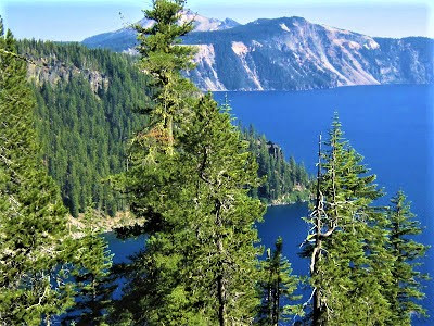
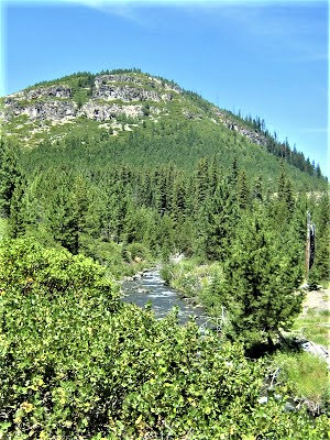
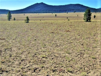
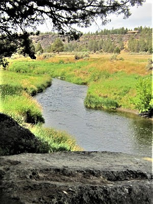
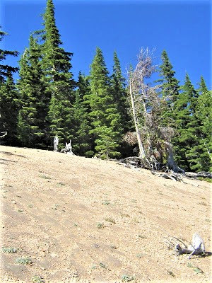
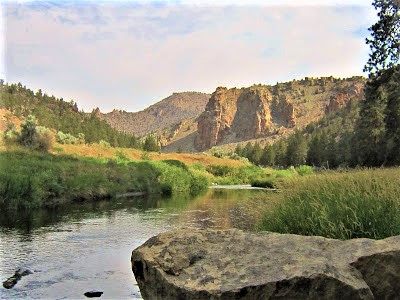
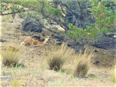
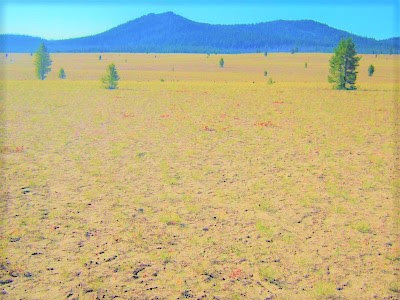
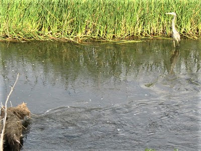
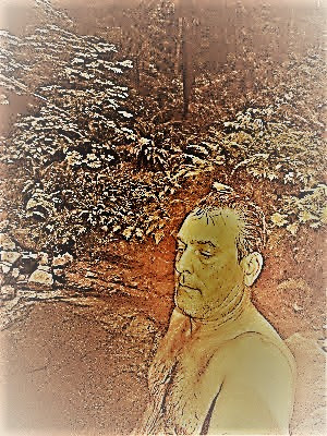
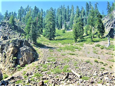
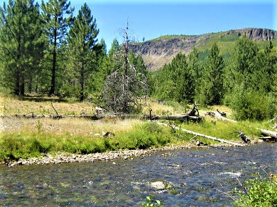
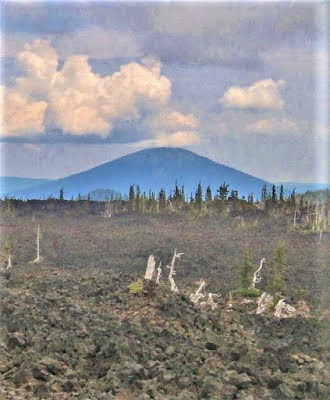
The threat of a summer downpour brings drama and a peculiar aroma in the air. Braving tenebrous conditions without tent or tarp, the Gambolin’ Duo is camped on a bluff overlooking Oregon’s Crooked River in high desert country east of the Cascade Range.
A lone Ponderosa Pine grows midway between our perch and a backdrop of jagged red rock tors, their vermilion luster muted by thundery cumuli rolling in.

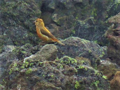
When suddenly two Golden Eagles alight on their massive stick nest in the treetop bough. The Big West’s rare Falconiformes, Golden Eagles are iconic denizens of arid and lonely realms.
We had espied the pair down on the river, hearing their excitable high-pitched cries in flight – “unk unk” – but now it looks like they’ve returned with the remains of a jackrabbit or rodent, hard to say. The thing is meticulously skinned as though fresh from the butcher’s shop.
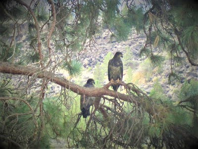
Over the next several minutes, the avian duo pick away at the primeval victuals, leisurely eating and sharing small bits and pieces, their behavior notably absent of the expected gluttony of, say, a hawk gobbling down a snake in two gulps.

These big brown gawky birds are polite, socially engaging diners, tearing off fleshy cutlets, taking their sweet time enjoying the succulent repast. It all seems most civilized. I’m amazed and privileged to be witness.
When suddenly out of nowhere, a Bald Eagle, also earlier espied and heard – "k'k'k'kip'kip'kip" – swoops down like nobody's business and lands on an adjacent branch. This brazen act of territorial infraction is the equivalent of a stranger barging into your house without knocking during the supper hour.
The bird sits motionless – yet impossibly ignoring the sumptuous feasting before his beady eyes – holding back disguised contempt, or perhaps nonchalance, occasionally feigning a move. More audacious chutzpah follows. When suddenly without warning, ol’ Baldy darts from the branch and traces a long, high course above the river.
Long gone, no doubt, but to my utter amazement, the regal eagle boomerangs back toward the tree, swooping down with fierce elegance smack dab onto the occupied nest, an obvious “in-yo-face” gambit you might suspect would engender a tad consternation among the Golden Eagles, but their feathers are hardly ruffled.
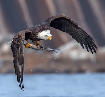
After a round of polite scuffling, with ol’ Baldy making an unsuccessful stab at a cutlet, they shoo away the scavenger, remanding him to an outcast branch. It’s almost as if the chastened boy’s pouting. Meanwhile, the Golden couple carry on as though nothing much has happened, pecking away delicately at the bloody morsel.
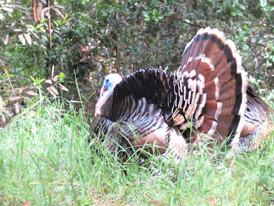
A full twenty minutes later, ol’ Baldy’s had enough and flies off to his own nest somewhere unknown and unseen. Deserved or not, Bald Eagles, as every schoolgirl knows, were reviled by Benjamin Franklin, who insisted that the morally sturdy Turkey be the national bird.
Of the noble Bald Eagle, Franklin disparagingly wrote:
“ . . . is of bad moral Character. He does not get his Living honestly . . . besides he is a rank Coward.”
OH, OREGON!
Land of pristine lakes, mountain streams, rushing “rill-vers”, crashing waterfalls, alpine meadows, luscious hot springs, endless hiking and biking trails, and a geologic legacy of volcanic wonders.
OH, OREGON!
Legendary “Golden Land”, a winner take all opportunity for a half million pioneers traveling the 2000 mile long Oregon Trail 160 not so long years ago.
OH, OREGON!

Welcoming with open arms to all: religious cults and hippies and new agers; enviro-radicals, renegades, poets and shit disturbers; neo-libertarian, liberal, compassionate medical marijuana assisted suicide stand your grounders; where instead of a mere passing “hello”, it’s “blessings” from a kindred soul.
OH, OREGON!
A surprising amalgam of eclectic politics and culture, the Beaver State has been beckoning for a mere couple of decades, and so – what else to do with a few days to spare in the thick of a fast-fading summer than pack up camping gear and bikes and head north on a long-overdue road trip to the place humorist Dave Barry called “278 billion miles from anything.”
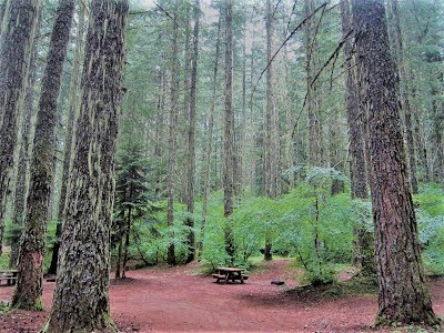
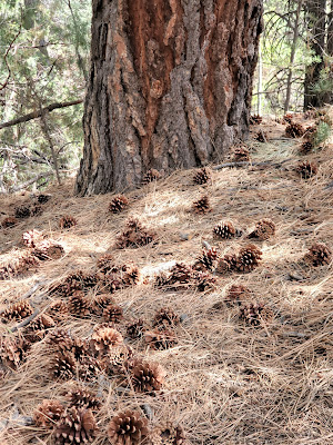
As plans are meant to unfold, ours entail heading up to the Bend area – who knows where after that. But first, a couple of nights camping out under the starry firmament at our favorite wilderness retreat, Clear Creek, located in the wild heartland of the Klamath National Forest / Siskiyou Wilderness near Happy Camp, California. (Thrice blogged, google if interested.)
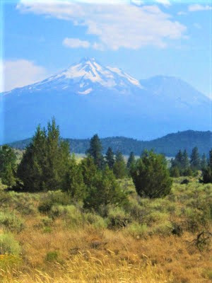
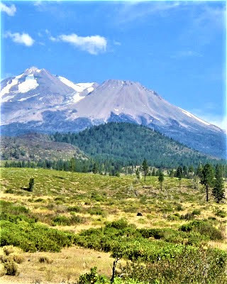
By the time Mount Shasta comes into (non-view), we’re in a permeating pall of smoke from dozens of fires in nearby mountains caused by lightning strikes the night before. Things are looking grim for all oxygen-breathing inhabitants of the vast affected area.
Our best hope to dodge the blighted air, we figure, would be to traverse 75 road miles, crossing over to the other side of the Marble Mountain Wilderness. Once at Clear Creek, things seem fortuitous, no ominous messages from any smoke signals.
Happily, but warily, we throw down camp, and sneak in a refreshing dusky dip in a cold green pool fronting camp, remaining ever optimistic as we prepare grub . . . but soon faint whiffs of smoke fill our nostrils and dampen our spirits.
O’er yonder, the western sky’s lighting up, diffusing pink, orange and lavender hues in a stunning puesta del sol. It’s awfully pretty, but indicative of hazardous air quality. We have little choice but to abandon the premises.
Decamping faster than a Sherpa in a blind-out at twenty-four thou, we heroically stuff our stuff in the car and drive a truly interminable 75 return miles through a darkening miasma, kept awake and entertained by flaming KGO yell radio host Karel whose risible rap on the dating scene over 40 has us in stitches.
In a distorted time warp, we eventually merge onto I-5, Ashland not far away. (Home of Ann Curry, Winona LaDuke, Ty Burrell, Jack Elam, and, of course, Gangaji.) Getting there late, we drive endless minutes up and down a strip ‘til we’re rat’s ass tired, finally settling on a place that turns out to be not half bad – the Flagship Inn.
Thankfully, it does not have “motel stink.” Still, is any place worth a hundred bucks for a few hours of shut-eye? (You bet! Gambolin’ Gal’s so exhausted she sleeps right through a fit of snoring!)
Next morning, the air quality seems decent enough that we’re able to stroll around the historic, hip town without a bandana wrapped around our faces, looking for a breakfast joint to sate our hunger from not eating decently last night.

We stumble on the amicable Greenleaf Cafe serviced by perky young waitresses overlooking sweet little Ashland Creek, sourcing from 7533 ft. Mount Ashland. The creek’s perennial burbling presence infuses a laid-back riparian flavor to the community once inhabited by other free-spirits – Shasta, Umpqua and Klamath tribes living in harmony with the land, the animals and each other for thousands of years.
Up until the 1850’s, life was hella good. Then came the “mountain men” – hunters and trappers – paving the way for an influx of sod-busting, gold-thirsty white settlers, streaming in along the Siskiyou and Applegate Trails by the thousands. Conflicts inevitably ensued and tribal peoples – entire cultures and ethnicities – succumbed to the debilitations and degradations of the “white man’s disease.”
By scrumptious breakfast’s leisurely last cuppa joe, we’re jitter-jumpin’ and rarin’ to explore Rogue River country and Crater Lake. But it’s a bitter pill to swallow on top of those blueberry pancakes to see that wind patterns have shifted – yep, we’re back in the thick of it, on the run once again from smoked filled skies.
Sighs, sighs and more sighs. We drive and drive, and drive some more, right on by so many alluring places, stopping just once in three hours to get out and stretch and pee, and once to liberate a big buzzing bee trapped in the car somewhere.
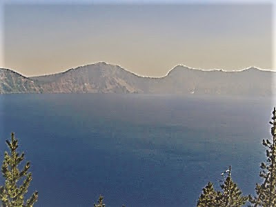
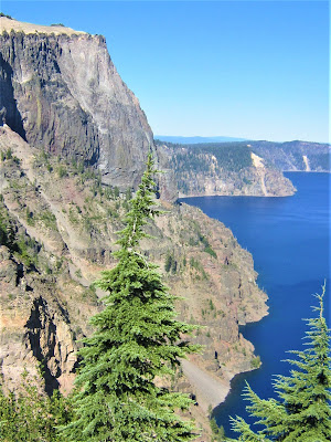
Climbing to the ever higher ground of America's deepest lake (and seventh deepest in the world), we are relieved to see feathery blue skies and breathe in fresh mountain air.
OH, OREGON!
At the entrance station, I inquire with a friendly Ranger about the air quality; yesterday was horrible, she says, waving out there; today, she shrugs, handing over our map and validation pass, you never know.
OH, OREGON!
We have entered hallowed territory – an outdoor cathedral – a shrine of sacred wilderness – I submit. But Native American creation myths invoke a more sinister spin, casting Crater Lake, in the words of the Crater Lake Institute website, as:
“ . . . a realm inhabited by spirits of the dead, dangerous to the living, and safely accessible, only to powerful shamans . . . evil man-people were killed, and their souls were sent to dwell in lodges at the bottom of the lake.”
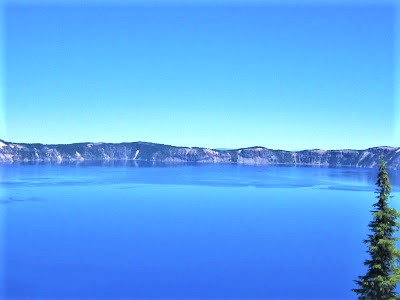
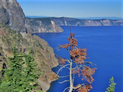
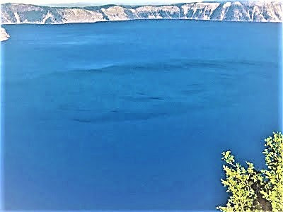
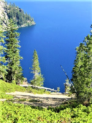
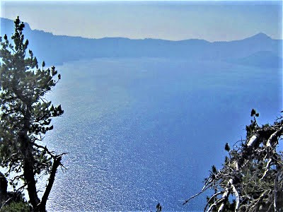
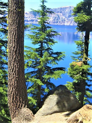
Eight millennia later, no evil man-people in sight, and Crater Lake appears as a gentle, vast, shimmering mirage, a gigantic blot of blue from an otherworldly palette, a surreal tableau of pristine views prevailing in all directions.

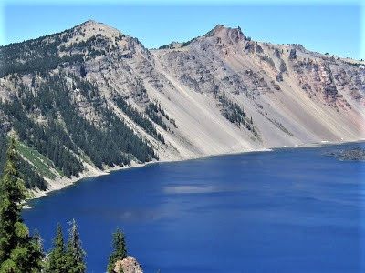
The famous caldera was created by a volcanic explosion so forceful that it blew 12,000 ft. Mount Mazama to smithereens, spreading ashy debris and devouring pyroclastic flow for miles around, utterly altering the landscape.
The resulting basin (1943 ft. deep) took centuries to fill with the cobalt blue water seen today, whose unmatched purity is due to its rugged isolation from any watershed (no streams debouche silt into it).

The mind struggles to imagine the titanic forces underlying North America’s largest eruption in 640,000 years. With a high point on the rim of 1978 ft., the tranquility of the lake conceals the devastation of Mazama's blast which pretty instantly created 4,000 feet of topographic relief.
Amerind people no doubt witnessed the myth-making destruction / creation event, something that happened again and again the length of Northern California, Oregon and Washington in pre- and historic times.
In the Cascade Range Volcano line of fire, seven historical eruptions have occurred among the thirteen volcanoes in the system, including well-documented explosions of Mount Saint Helens, Lassen Peak, Mount Rainier, Mount Shasta and Mount Hood.
The “Volcanic Legacy” is commemorated on scenic drives up and down the Cascade Arc. The placid deception of extant Mazama belies the fact that the earth is constantly moving, ever shape-shifting – and one day, who knows when, it will erupt again, and that fathomless hole, currently holding the five trillion gallon Crater Lake, will disappear, reduced to a chaotic heap of volcanic rubble.

Mother Nature’s way of saying, “What a blast!” and “You ain’t seen nuthin’ yet!” and “Here one eon, gone the next!”

On West Rim Drive, we pull over at Discovery Point – where I don’t even care who first espied the lake in 1846, stumbling on it searching for game. Dozens of rubberneckers are milling about, gazing hundreds of feet down the steep escarpment and out across six miles to a picture perfect postcard view, sans smoke.

Everyone, to a child, woman and man, is visibly impressed and in awe. We hear “Wow!” and “Amazing!” a lot, including out of our own mouths. Hypnotically under a spell of prolonged communion with the lake, I only occasionally glance up at the tall Whitebark Pines hoping to spot a Clark’s Nutcracker.
Such an interesting high elevation bird who feeds on and caches the seeds – but really, serving as the tree's propagation strategy in a harsh environment. I spot what looks like one of the little fellas cracking open a seed! Indeed, another first sighting to add to my growing Life List!
We admire the lake for a good couple of hours, then, with no particular plan in mind to address where we’ll sleep come night, and who cares, really, we set off on East Rim Drive with hazy intentions to circumnavigate the 33-mile road, stopping wherever the map tells us – at 30 scenic pull-outs!

This summer marks the 100th anniversary of famed “Skyline Boulevard” (as touted in the papers at the time) – a crude prototype of a tourist byway that for years served as a “narrow, rough, dusty road with sharp curves and steep grades” that eventually paved the way for further development, opposed by many notable figures.
Oakland poet Joaquin Miller declared after a brief but memorable visit in 1903:
“ . . . well, so be it, if you must so mock nature and break this hush and silence of a thousand centuries . . . let us keep this last and best sacred to silence and nature.”
Although his plea allayed the inevitable altering of the landscape for thirty years, by 1931 the old Rim Road was paved, widened and rerouted so that motorists could safely enjoy the “boundless panoramas” along “the jagged crest of the world’s noblest crater,” as park superintendent C.G. Thomson envisioned in 1921 when he began spearheading development plans.
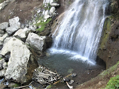
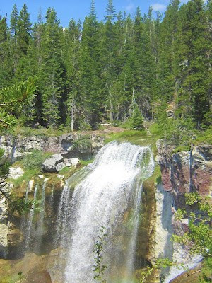
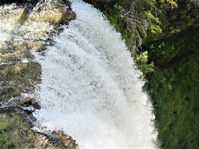
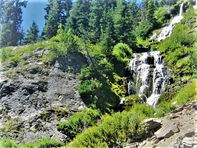
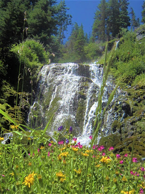
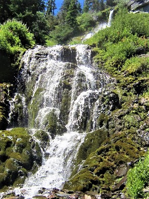
First up along our route is lovely little nowhere Vidae Falls, can you believe it, right off the road, for heaven’s sakes, handed to you bow-wrapped without any effort at all. In what turns out to be the first of (not quite 30) scenic pull-outs in our lazy circumnavigation of the lake, I barely put the car in park before charging up a crumbly hillside for a more intimate setting among colorful wildflowers, securing a fine perch to view the 100 foot tall waterfall.
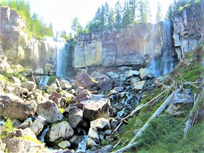
The creek, originating a mere 500 ft. back from the lip of the falls, emanates from a snow-melt fed spring, making it a challenging temptation to scramble up to see the birthing hole. Finding a route ascending not too steeply to the saddle, in short order I’ve crossed over into unseen country – a flat wasteland of pumice rubble, a few scattered trees breaking the monotony to the distant base of Vidae Ridge.
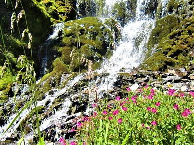
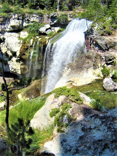
Next on the day’s agenda (are we bored yet?) is Plaikni Falls, off Pinnacles Road, situated in a cliffy area an easy mile hike through old-growth fir and hemlock.
Plaikni (a Klamath tribe word) is renowned for gorgeous scenery in a rugged back country setting, but gets low marks for people, noise and congestion. The thing is, it’s a surprisingly beautiful waterfall and just so damnably easy to get to.
OH, OREGON!
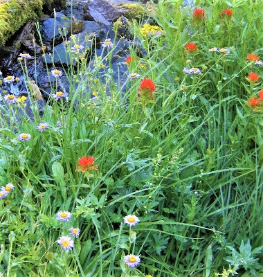
Dropping 100 feet into Sand Creek from a colorful cliff lip adorned with Scarlet Paintbrush and Lewis Monkey Flower, the hustle bustle of the hoi polloi is easily overlooked, for the waterfall provides a charming backdrop for lunch and hanging out on slippery mossy rocks near the roar of the curtain pouring down into a froth of ephemeral rainbow spray.

Everyone gawks up in due admiration, sticks around a few minutes, corralling kids and munching on jerky, before promptly marching right back to their cars.
Seen one waterfall, you’ve seen ‘em all, I guess.
One minute there's a dozen people swarming the place, the next half hour we have it all to ourselves. The magical energy of a sacred place, when experienced in solitude, without all the yammering, allows for full immersion in the bountiful mysteries and the . . . but then, oh, no – a discernible smoky quality is in the air – our cue to pack it up and leave.

Once cerulean skies are now shrouded in an eerie smoldering haze.
OH NO, OREGON!
The lake looks swathed in a layer of fog – how romantic if that were the case! – a vague ashy veil. Sure, it tote’ly sucks, but like anything, you gotta roll with it, pivot, do the next thing. And no complaining!

We drive on, determined to make the best of it and see the whole damn lake at this point. Where the guide book tell us to pull over, we emerge for quick peeks into the caliginous abyss, but it’s windy and overcast with gloom.
Finally, at sheltered Cleetwood Cove, surprisingly, views are clear and blue, and at Llao Rock (an 8049 ft. monolith), the air quality is near pristine again. Nowhere to go, nothing to do but let the lake work its spell on us for a few more hours. We pull up a log and silently stare into the blinding blue void of peerless clarity, agog at such beauty.
OH, OREGON!
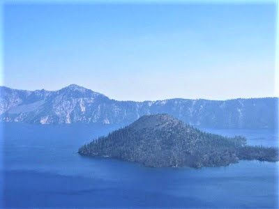
Between watching for birds and ogling at the lake – especially Wizard Island, an 888 foot tall cinder cone we never took the lake’s only boat ride to – time passes effortlessly. No birds to speak of, but I ask another binocular toting person what she’s looking at.

She points out a little known detail that takes a keen eye to make out – the whitish tip, barely discernible far across near the deepest point of the lake, of a dead pine tree, poking up just above the surface, bobbing there in the same place for a century, she says, held in place by an unknown force field.
Adios Crater Lake. Even though we’ve seen a lot of you, we’ve truly given you short shrift. We missed the Pinnacles (no friggin’ way!) and forewent the hike down to the only swimming spot (are you kidding me?), and didn’t explore alluring Wizard Island (next time!)
We get to Bend late, forced to drive up and down the Highway 97 strip, looking for a half-way decent place to plop down, but it’s just one dump after another. We end up having to check into an odoriferous motel that costs seventy unbudgeted dollars – the price tag a deal, I suppose, compared to several other $125 dumps we looked at.
We do our best in this room smelling of formaldehyde and cloying cleansers, monumentally irked by a glaring security light on the balcony that burns through the curtain all night long, and our central nervous systems on the blitz by one loud motherfucking soft drink machine down the corridor I come THIS CLOSE to unplugging – or vandalizing – in the middle of the night.
We valiantly ignore the unpleasant distractions, snuggling together in the overly-perfumed laundered bedding, falling asleep to a grim TV news report on increasingly dire fire conditions . . . dreaming about fire and rain and Armageddon outta here . . .

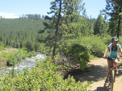
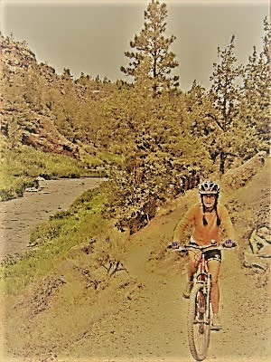
After our janky bout of unconsciousness, we’re elated to wake up to . . . clear skies! We grab a quick breakfast and plot our adventure du jour over wireless coffee on the i-Pad – gotstabe mountain biking on the Deschutes River, just a few minutes outside of Bend.

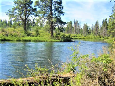
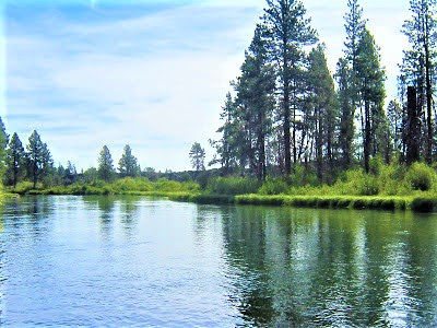
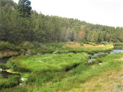
The Deschutes Paddle Trail, as it’s formally known, is the bomb for unrivaled fun and flat-out gorgeous scenery, whether hiking, biking or rafting. A protean river, the Deschutes charts a sinuous course alongside lava rock cliffs, eventually making its lazy way through Bend’s beautiful river parks.
The nonpareil bike and hiking trail through old growth forest requires, like all recreation areas in Oregon, a mere $5 day-use fee, and you can count on it pretty much being all yours. The bike outing finally sates our adventure craving, being the action-oriented junkies that we are! Along a three-mile stretch, we stop often to take in the river’s many different personalities.
At times a fast-moving torrent, in other places a slow moving still-life; now churning, frothing white water; now a languorous stretch perfect for a refreshing swim, ever on the lookout for birds and otters.
We don’t see any mammalian critters, but I do spot a ton of the avian variety, many identified – Black-headed Grosbeaks, Ospreys, Clark’s Nutcrackers, Varied Thrush, Red-winged Blackbirds – and many more that leave me scratching my head wondering and laughing at my inept ID’ing skills.
The wild free-flowing OH, OREGON! river is a fine sight to behold.

What a playground!
We tool along in endorphin-producing mode, milking a nice, leisurely pace, seizing every excuse to dilly, every opportunity to dally, each moment a calculated halt toward “progress” as we stop to check on some mysterious avian presence under a bush, or detour to inspect a marshy area of horsetail and ferns, or are drawn into the intricacies of a swarming anthill.

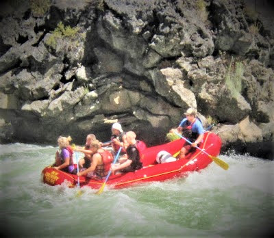
Three miles and two hours of this, we come to a primo spot – a jumble of lava boulders blessed with shade; here, a couple of professional photographers are ensconced, ready to capture action photos of the rafters shooting the rapids.
I strike up a conversation with a young kid earning decent coin just hangin’ out in this beautiful place for half the day, mostly doin’ nothin’, waiting for that ten seconds every hour or so when he’s actually busy plying his (water?) craft . . . not a bad gig, I say! Sign me up.
After the exhilarating bike ride, we head over to Elk Lake along the Cascade Lakes Scenic Byway. We’d missed it on the way up to Bend owing to a – you guessed it – fire and evacuation of campers south of Elk Lake.
With the day fast becoming history, we pull into Elk Campground, a not too, too inviting scene, as mainstream campgrounds are pretty much anathema to us. (How ‘bout you?) But what choice do we have? There aren’t many country roads to detour down to bush-camp, and we certainly are NOT going to shell out any more money for a stinky motel room!
Although not sardine-packed, the outdoor amusement park is jammed up with the usual gamut of “outdoor lovers” staking their claims to the cherry spots.
Young revelers playing their music and downing ice cold Buds; mom 'n pops attempting to back-maneuver some god-awful hulking payload into an under-sized spot; and boating and fishing buddies, huge families in tow, with every conceivable amenity from a suburban lifestyle in evidence, hogging up prime real estate overlooking the lake.
We find what we think is a decent spot, up and back from the jamboree, but no sooner are we semi-settled in, eager to munch down a delicious watermelon, than we smell the unmistakable odor of . . . OH NO! NOT AGAIN! SMOKE! We just can’t escape the nasty reek. UGH! (Gambolin' Man senses no sympathy.)

But this smoke ain’t from Mother Nature’s flame and fury, rather spewed into the atmosphere by campers building their infernal “comfort” fires. Christ! It’s not even six o’clock and already the air’s polluted. Don’t people know (care) that someone is always downwind from their smoke and will be forced to breathe it in.

Oh, well, ambient fires must inevitably, inseparably, be part and parcel of the “experience of camping" – still in humans' inbred caveman DNA – because camping without a fire, I guess, is like picnicking without a barbecue.
People cannot – will not – camp without setting fire to dry wood in a bogus attempt to recreate an “authentic” woodsman / outdoorsy ambience. Got to cook your hot dogs and roast your marshmallows and blather around the dancing flames all night, noisome air pollution harming asthmatic lungs be damned.
Am I a lone voice crying in the wilderness?
Who else has health / aesthetic concerns? Who else shares similar anti-sentimental feelings about campfires – or any outdoor burning for “comfort” or “pleasure” such as chimney smoke and barbecuing – that unjustly infringes on others’ personal health / space?
And so, unable to find a suitable off-road site to bush camp, we head back to Bend, back to another smelly motel room – the kewl McMenamins – Old St. Francis School Home booked solid – and now three bills over budget because we hadn’t planned to camp out in smelly motel rooms.
But we’re determined to have fun in Bend, a cosmopolitan city 80,000 strong, up sixty percent in a few short years. We overhear a real estate guy droning to someone in the Strictly Organic Café in the Old Mill District about the only sound you could hear the past ten years was the buzz saw, back hoe and hammer of hundreds of residential developments popping up.
Still, Bend retains a charming, small-town aura, with a high quality of life, the “playground of the West,” a place you could settle into comfortably and inexpensively, despite low wages and dearth of jobs outside the service and tourist sector, but if you’re in your twenties, thirties and forties, even, it doesn’t matter.
Especially if you’re an outdoorsy (campfire building?) type – Bend’s surroundings provide endless recreational options.
Or as “Visit Bend” (the Official Visitor Guide), puts it:
“Whether you ski it, ride it, hike it, bike it, raft it, paddle it, fish it, golf it, stroll it, shop it, dine it, or run it with a baby-jogger . . . live it yourself.”
And if you’re – well, approaching dotage – hopefully you’ve got a boomin’ retirement option that would go a long way here. But not long enough, according to the ex-pat-to-be who can no longer afford Bend’s growing pains.

Still, I can see living out enriching days of still promising youth, enjoying the bounty of a high desert / eastern Cascade lifestyle, in a land teeming with animal and plant-rich pine forests, surrounded by stunning lakes and rivers and snow-capped peaks, in relative low population density, with plenty of nightlife and culture for the taking, all just eight hours from the Bay Area, or half that to Portland.
The glossy hard-sell brochure goes on to tout the city as a place of “cosmo cool with homegrown friendliness.” And, “the hardest part about visiting Bend is leaving Bend” and “many people who visit Bend return to live in Bend.” Hell, I’m sold! Life IS too short – maybe it is high time to retire here, soon, like now! Sign us up!

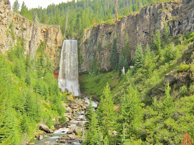
The following morning, on the prowl for sights and action – something to blog about, for Christ’s sakes – we head down a gravel road into the eastern extent of Northern Spotted Owl territory, hoping for a glimpse of the elusive bird or any number of endangered, threatened or rare species inhabiting the Tumalo watershed.
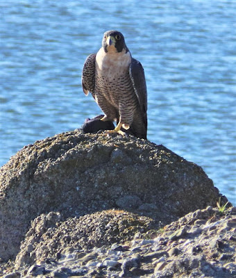
Peregrine Falcon, Lewis’ Woodpeckers, Pacific Fishers and Wolverines live here, but good luck spotting one.
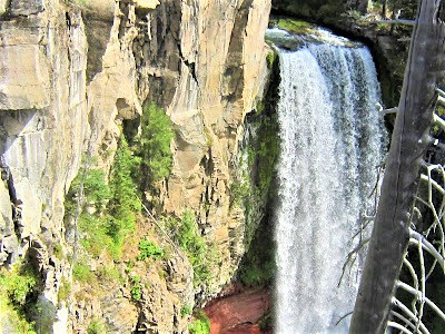
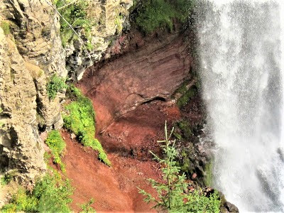
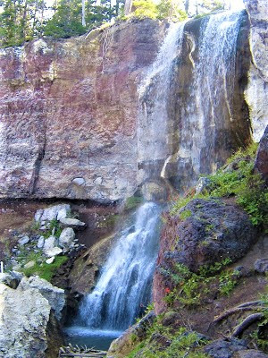
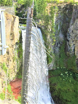
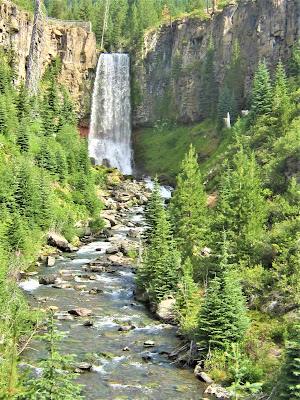
At the multi-use trailhead, we get our first look at Tumalo Falls, a not wholly unimpressive sight, despite the crowds that eventually overflow the parking lot, flock to viewing platform, and walk up the easy trail for more stunning views of the sumptuous Kaua’i like gusher dropping 90 feet from a cleft in a bluff to Tumalo Creek, crashing down multi-colored walls rife with lush vegetation.
OH, OREGON!
In no particular hurry, we find a nook off the beaten path here for the illusion of solitude, a hidden cranny there for the verisimilitude of distance. Returning to the viewing platform, informational dioramas catch our attention – about the devastating Bridge Creek Fire that swept through in ‘79, caused by a careless person’s – yeah, you guessed right – campfire.
Over the years, watershed devotees have attempted to restore the pre-fire water quality and biological productivity of the ecosystem with plantings of willow, cottonwood and Engelmann spruce, complementing existing stands of fir and hemlock.
Doesn’t look half-bad today, but had the burned out landscape been left to the devises of Mother Nature to rebound on her own, 35 years of restoration efforts might have been obviated.

The diorama owns up to mismanagement by watershed officials and scientists – basically, they screwed up by removing the burned, dead trees, failing to realize nothing would remain to hold the soil in place and erosion would quickly begin to destroy the watershed’s ability to recover. Still, the place looks pretty good for its age, and their efforts are to be applauded.
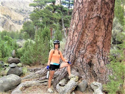
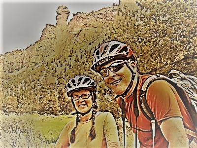
Obligatory sights behind us, now time for some enticing action. We bust out the bikes for a spin on rippin’ single-track – the South Fork Trail in the Three Sisters Wilderness, good for a six-mile roller-coastery round-tripper.

Not another soul encountered nearly to Swampy Lakes and back. After that, hungry and thirsty and with nothing better to do, we return to Bend and find ourselves at another of the 14 craft breweries guaranteed to slake the thirst of thousands of hops fanatics. (“Beer City USA has the most craft breweries per capita in America.”)
At 10Barrel, a hip establishment hoppin’ with locals? tourists? – one and all intermingling, eating, drinking, all eagerly spending money left and right. Hey, I thought the economy was crashing down on everyone? Apparently not, so might as well join in. We’re seated at an elevated bar enjoying a fine oven-fired Margarita pizza and a most quaffable India Pale Ale.

We're having to share intimate counter space (can’t stand it!) with two very nice fellows who can’t help but regale us with their story of why they’re in town – actually down the road in the resort of Sun River – and how, over the years, a large group of like-minded folks convene for camaraderie, story-telling, and mild bacchanalia.

This has been going on somewhere every year to celebrate their – what? – friendship? / connection? – with a certain revered figurehead named LeRoy Lawson. It sounds cool and all, really, but my B.S. detector is on full alert.
And it must be showing, for one of them looks up from his notebook and wink-smiles, “There’s no drinking of Kool-Aid.” Nice guys, but TMI, and our fault owing to us being very good listeners, exceptional sounding boards for people who like to talk about themselves and their thing.
(One perfunctory question was asked of Gambolin’ Man: “And so, what do you do?”)

Well, now what? Three sheets to the wind, absolutely no friggin’ way are we gonna spend another hundred bucks for a silly artificial box to sleep in, nor are we prepared to take our chances in a campground where fires no doubt will be all the rage, choking and smoking and gagging us out.
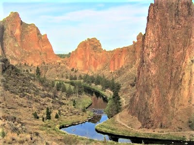
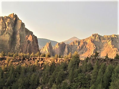
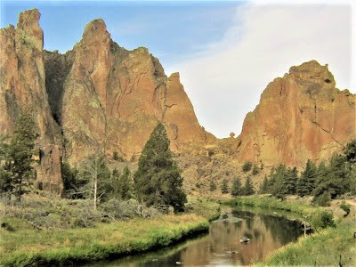
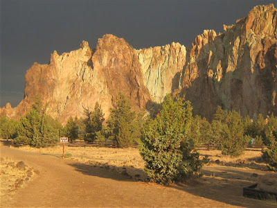
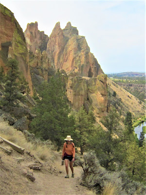
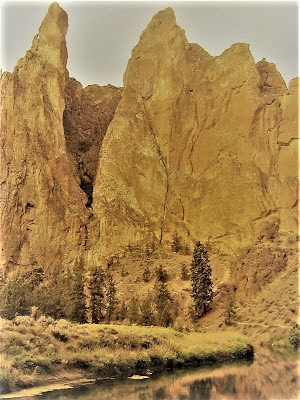
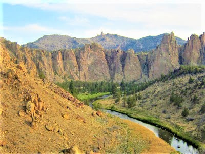
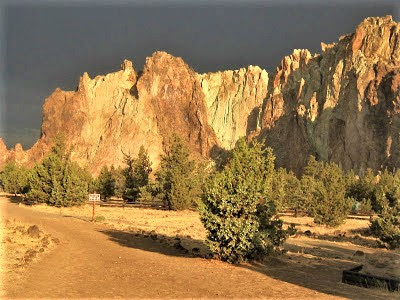
At a café, i-Padding about, Gambolin’ Gal stumbles on an unlikely place called Smith Rock State Park. World famous among serious rock climbers, it must have some cachet, but what catches our eye is the underlined, bold and italicized no fires allowed in the walk-in camping area. Sign us up. It’s where we’ll be spending the next 48 hours watching the Nature Channel.
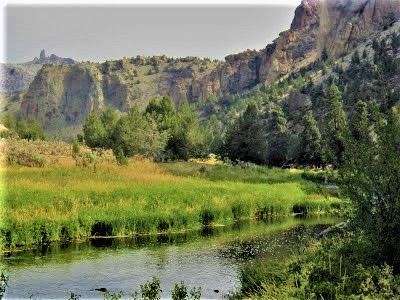
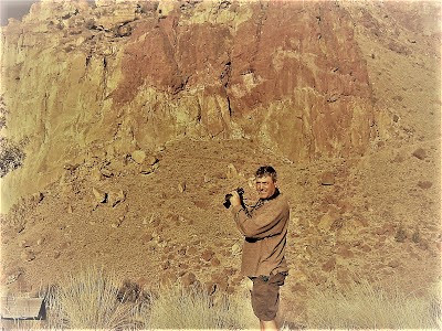
Only 40 minutes northeast of Bend, SRSP is an odd slice of seemingly remote country surrounded by agriculture and communities. Let me just say, though, if I may:
THIS PLACE BLOWS OUR MINDS!
OH, OREGON!

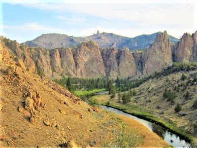
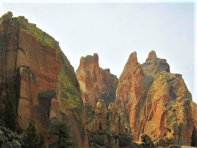
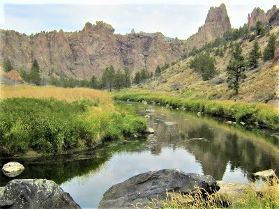
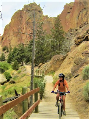
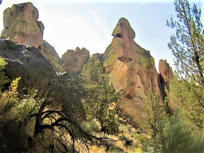
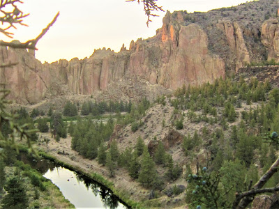
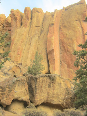
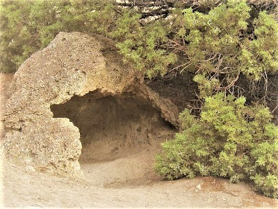
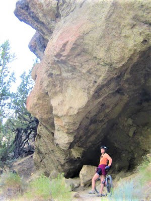
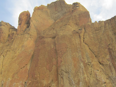
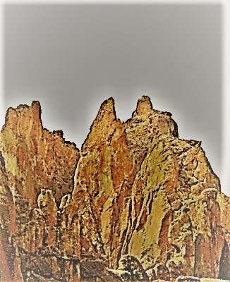
It’s the Southwest married to the Pinnacles with Smith Rock as the offspring! With miles of enticing riverside and rugged high terrain trails covering 651 boundless acres, hiking and biking options are, while not quite endless, definitely exciting and challenging.
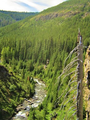
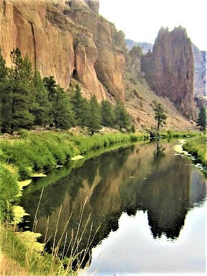
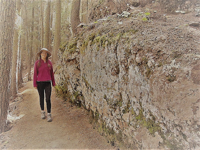
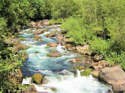
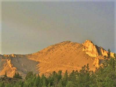
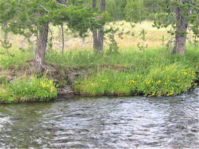
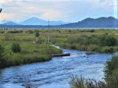
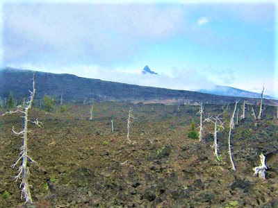
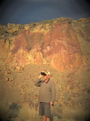
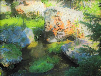
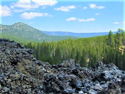
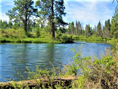
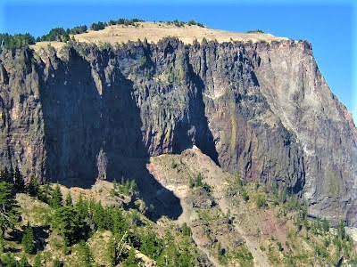
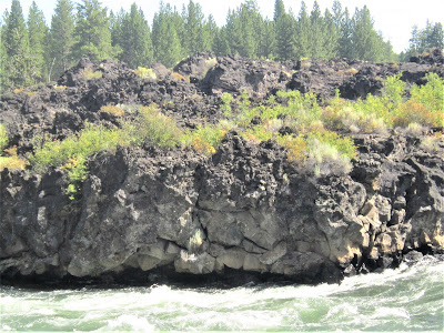
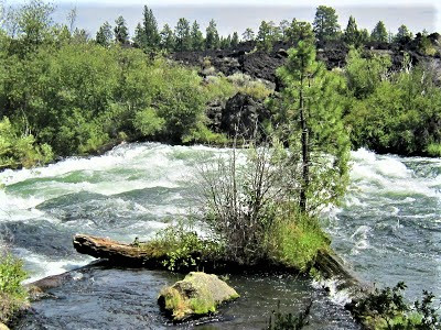
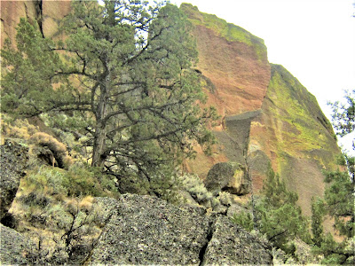
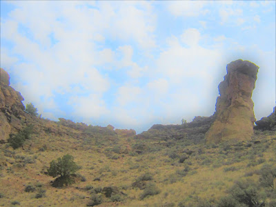
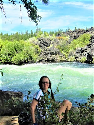
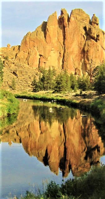
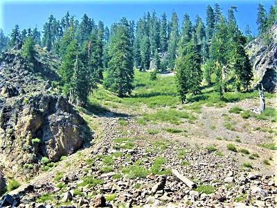
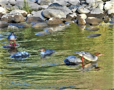
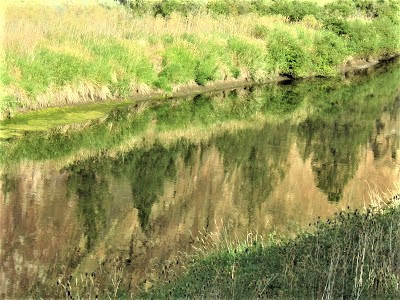
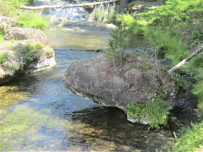
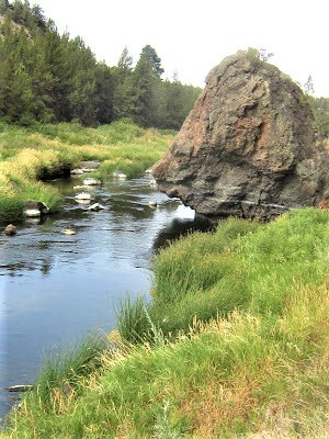
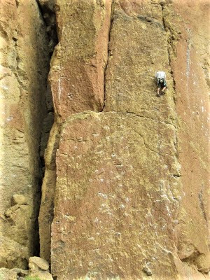
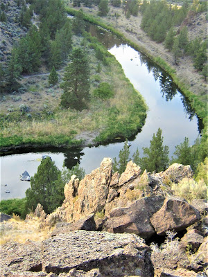
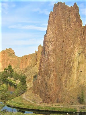
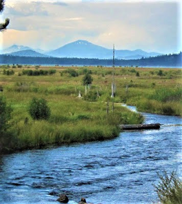
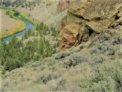
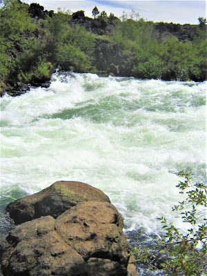
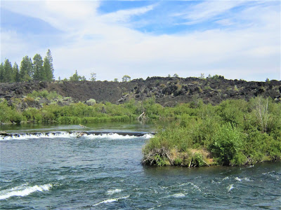
For derring-do scalers of high rock walls, one thousand eight hundred climbing routes are charted. To echo a grungy rock climber I actually overhear saying it, “Awesome, dude!” And that Crooked River – AWESOME DUDE! My oh my! Nothing Gambolin’ Man loves more than riparian splendor in an arid setting of red rock canyon! (But, he’ll gladly settle for a piss-ass nothing little creek in the Berkeley Hills, too.)
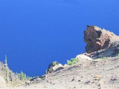
The gentleness of the Crooked River during this low-flow season belies the erosive power of running water, forced by intractable lava flows to carve a sinuous channel through the bloody heart of what was once a steaming volcano.
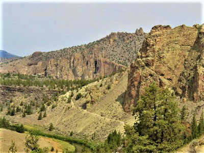
Millennia upon millennia of wearing away, the Crooked River has done what rivers do best – seek their natural course and in the process helped to sculpt the textured, multicolored, jagged formations of “welded tuff” comprising the park’s signature monuments.
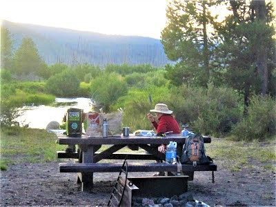
The bivouac area instantly enchants with an exotic setting overlooking this scene. Thankfully, it’s set aside from a central cooking / picnic area in the parking lot. Here rock climbers (half of the 500,000 visitors a year) and regular ol’ folk like us congregate, share convivial conversation, ooh and aah over how pretty it is.
We chill for a while, get the low-down from different people on a variety of things, always starting with and circling back to the volatile weather. Staking out an inordinate claim is a ragtag brigade of hippie / hipster climbers. Although strictly day-use only, the boys have taken over two picnic tables and the shadiest spot. Lookin’ chill and settled in for the long haul, I’d say.

We walk a hundred yards in to our relatively secluded bivouac tucked in amongst stunted juniper trees on a lava bed plain, situated prima donnaly on a high bluff overlooking the fab river. Our mostly unheard neighbors on both sides – including a young cyclist couple with maple leaves emblazoned on their bikes – are respectfully quiet.

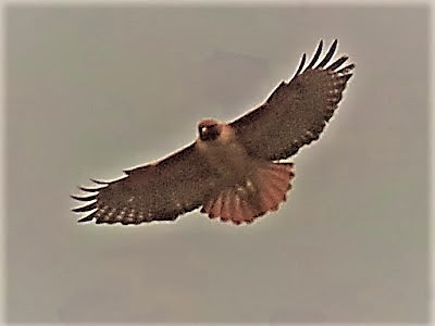
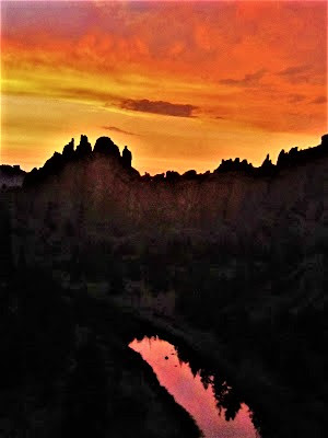
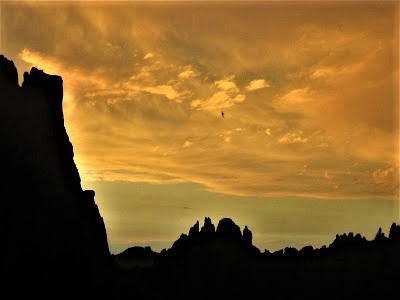
It’s a primo, primo spot that rewards us with a sense of “real wilderness camping” without all the work. Towering red rock spires and the river below are the stars of the Nature Channel’s prime time reality show, now tuning in right at the moment when the Golden Eagles are shooing away ‘ol Baldy.
Can’t get any better as far as bird watching goes. Now, the long day is turning into a golden tangerine evening, dying rays of light lingering until nine, the Crooked River still beautifully reflective of the colorful sunset. Can’t get any better as far as nature watching goes.
Early the next morning, we start off by tackling Canyon Trail, but end up turning back after a few hundred yards, at first dismayed by our wimpy attempt, our stymied progress on this unexpected rough track of roots and rock. So be it. Ain’t gonna fight it.
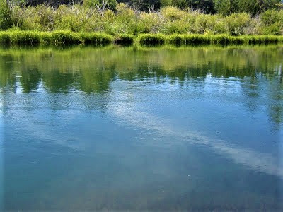
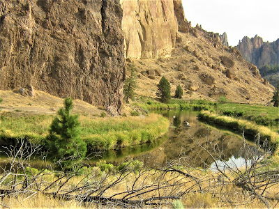
Dropping our bikes, we take stock of a calm early morning vision of heavenliness unfolding before our disbelieving eyes: a Deseret still-life, stark images of soaring canyon walls and delicate tableaus of grassy-edged banks mirrored in stretches of unmoving river.
Lingering endlessly, we do what we do best – silently appreciate the beauty, inwardly absorb the energy, give thanks and praise to be witness to such (un)earthly natural phenomena, deeply engaged in watching for birds, and bird watching – well, make that one of us.
(Seen: Olive-sided Flycatcher, Black-capped Chickadee, Great Blue Heron, Black Phoebe, Raven, Belted Kingfisher.)
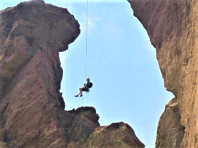
Yet another “can’t pull ourselves away from it” moment. But we do, and re-route across the bridge to the other side where a sweet, sweet ride ‘neath towering ramparts on laughably easy but super-gorgeous River Trail awaits. High above, we see climbers tackling vertical cliff faces, tiny spidery figures attached to filaments of life-saving rope.
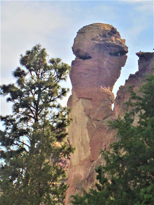
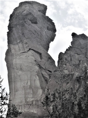
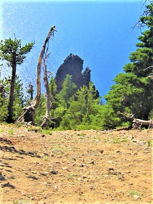
Several miles in, on the far side of Misery Ridge, a monolithic spire comes into view that looks like an evil alien face, but on closer view, it morphs into that of a simian – Monkey Rock. A climber’s playground, ropes are strung across a frightening chasm, with tiny figures, stand-ins for primate teeth, dangling precariously as they attempt to summit the 350 foot tall tower.

Taking in a gorgeous section of the river for several minutes, enchanted beyond “all get out” – we hit on the idea to really get our blood flowing by hiking up the steeply graded Mesa Verde Trail for some lung-busting exercise. Up on top, we marvel at 360 degree views of far-flung East/Central Oh, Oregon! One word: Spectacular!
Toward the end of our somewhat exhausting six-hour outing, we pass the bridge and swing onto Homestead Trail, now following a stretch of real lazy river. No human in sight. So quiet you can hear the hum of the earth.
Filled with a joyous undefined sentiment, evoked by Wallace Stegner, of:
“ . . . pure delight to be where the land lifted in peaks and plunged in canyons, and to sniff air thin, spray-cooled, full of pine and spruce smells, and to be so close-seeming to the improbable indigo sky.”
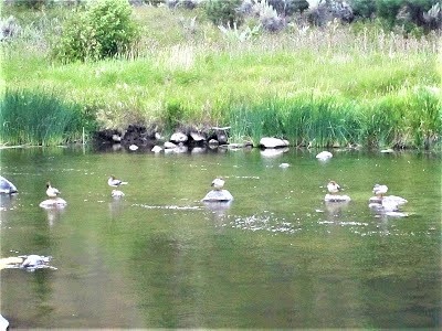
A family of mergansers is hanging out on stepping stones (ducks in a row). A flighty Kingfisher whooshes by like a bullet bird. At a sandy bar, we plop down ‘neath a sentinel sugar cone pine providing shady respite for a few moments of subdued ecstasy.
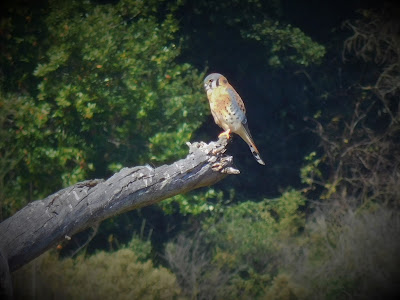
But the sun soon splits, leaving the sky an ominous purple – time to head back to camp and hope for the best. On a lingering return – the threat of rain diminishing by the second! – a Kestrel lands on a dead tree snag surveying his kingdom.

A true American beauty!
Back at our bivouac, we debate taking our chances for the night – an easy decision, really, given another stinky motel room is out of the question, and we love our spot way too much to let a little rain dampen things.
With a forecast calling for a mere 30% chance of precipitation, we resume our perch overlooking the ponderosa pine and nesting eagles, beneath a roiling sky with God beams peeking out from cloud edges, casting alpenglow magic on the peaks.
It simply doesn’t get any better than – THIS!
Moment by moment, the weather changes, now bringing sprinkles boring fifty cent sized indentations into dry, sandy soil. Love it! Bringing drama and a peculiar aroma in the air. Not taking any chances (fretting, anxious, much hand-wringing), we load everything up – backpacks, ground pads, sleeping bags – and stash it in the car.

(Question asked for hundredth time: Uh, so why don’t you have a tent or tarp?)
After some time, not deterred in the least in our bird and nature watching pursuits, things are looking up, weather-wise, so we fetch our gear and set up camp again . . . only to have it begin raining a few minutes later once we’re cozily ensconced in our sleeping bags. Shitsky.

This prompts mild panic and a flurry of activity (more hand-wringing), as we scramble to grab everything in a bundle and scurry for pitiful cover under stunted Juniper trees, trying to get comfortable on meager purchase of rocky slanted ground.

Ah, I’ve always said, give me a rock to lay my head on, just not tonight! Soon – or maybe it’s dreamless hours later – the gentle rainfall abates and we’re able to squeeze in a few hours of shut-eye under that “improbable indigo sky” polka-dotted with dim-twinkling stars peeking through lacy cloud cover.
Come morning, a liquid sunshine effect produces a rainbow bursting colors across a bruised purple sky sharply contrasting against the vermilion-hued canyon walls – meteorological drama reminiscent of painterly tableaus of desert Southwest Canyonlands tempestuous weather scenes.
Hard to leave, impossible to pull yourself away from, with much last-minute gawking at pull-outs along the park road of the dark river against the polychrome rock against that awesomely dark sky.
Notwithstanding, it’s early and already hot, so the sight of a lone woman, seemingly overweight and not carrying water, hiking up Misery Ridge, catches my attentive, concerned eye. I watch her for twenty minutes, before, smartly, she turns around two-thirds of the way to the crest.
Finally, though, willing ourselves away, we return to Bend, looking to enjoy a hearty breakfast at the hippie-dippie delicious Strictly Organic Cafe. Lucky to find a seat there, we can’t help overhear a garrulous old Boomer fart monologue away to a young woman from Boulder about his impending relocation to Ecuador.
The Millennial seems genuinely engaged, looking up every so often from her laptop to nod and smile. Us – me – jangled by coffee, egged on by the prospect of new sights and adventures, we bid Bend adieu and set off to conquer the McKenzie Pass and all things along the way, with no real plan in mind for what we’d see, where we’d go, what we’d do, or where we would end up sleeping for the night. (Such adventure!)
On the road again, cruisin’ the never before cruised McKenzie Highway – a wonderful feeling. We’re following one of those old wagon routes, rollin’ slowly through the bike-crazed, artsy town of Sisters, where (for some reason) we don’t stop but roll right on through, acknowledging to one another its most definitive bike-crazed and artsy, even quaint, character.
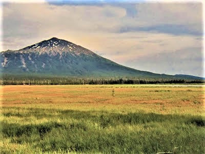
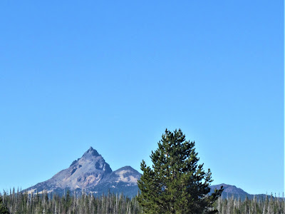
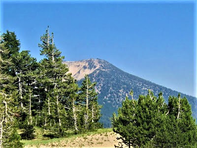
But onward we roll. Cloud-shrouded views of famous ski haven Mount Bachelor and the remoter 10,000+ ft. “Three Sisters” volcanoes – (South, Middle and North) want to dominate, but clearly, or not so clearly, their contours are obscured by inclement conditions.
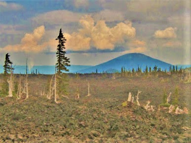
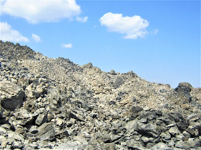
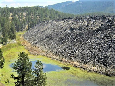
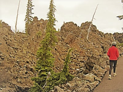
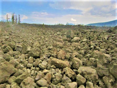
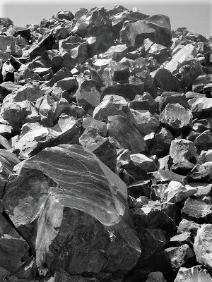
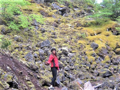
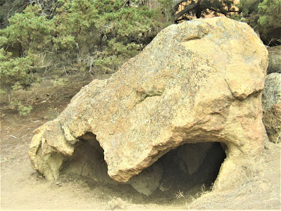
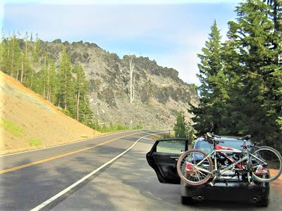
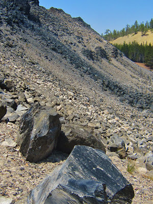
Up at the cloud-cloaked pass (5325 ft.), we stop for the easy mile stretch your legs loop on the Lava River Interpretive Trail at Windy Point. A forbidding 65 square mile basaltic Martian landscape defies life – only the hardiest trees are able to survive in barren rock jumbles.
The paved trail is really a wonderful roadside attraction, a trip into the past, open to people of all abilities, with educational dioramas (got to love ‘em!) informing of the cataclysmic lava flows from Yapoah and Belknap Craters in the not-too-distant geological past that created this expansive chaos of earth’s spewed detritus.
Many an interesting feature was formed, such as lava tubes, gutters and rivers. Beyond, northward looking, for miles and miles all we see is broken, jagged rock, interspersed with the occasional scraggly tree. One large area is forested, having survived the flow’s devastation.
Atop the Dee Wright Observatory, we barely make out the sunken ridgeline of Broken Top, while the eye candy scenery of four of the Cascade’s giants – Mounts Washington, Jefferson and Hood – remains elusive due to massive cloud cover.
The building, constructed by the CCC in 1935, is made entirely of lava rock, with unique tube viewing holes focused on peaks in all directions. But all we can see is white infinity.
We wind our way down the short staircase, read some more informational signs, one about the hardships the poor pioneers faced in their perilous journey westward, another about who was here before, their harmonious lifeway that flourished for millennia and was destroyed in a snap in high-stakes skirmishes, tit-for-tat massacres, and, finally, outright cultural disintegration and military subjugation.
OH, OREGON!
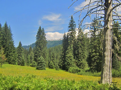
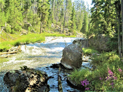
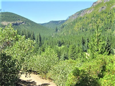
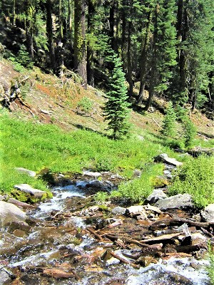
Losing elevation wending our careful way down the hairpin curves of Highway 242, we enter the Willamette National Forest and the west side of the Cascade Range – a lush land of rushing rivers, pretty waterfalls, heavenly lakes, glaciated canyons, big sky meadows.
The word paradise comes to mind.
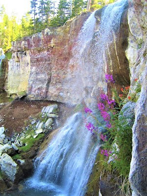
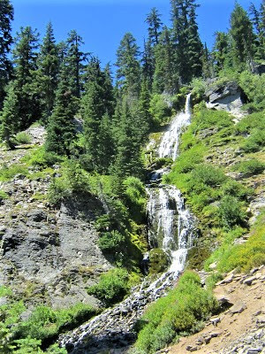
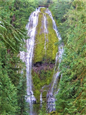
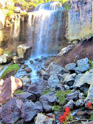
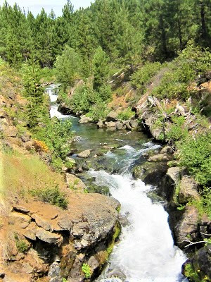
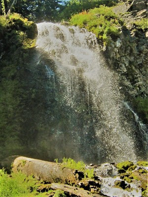
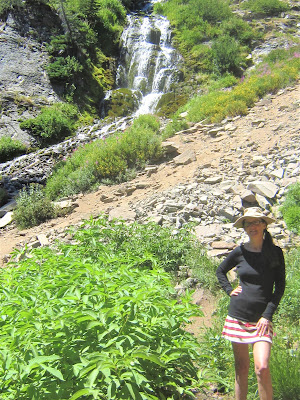
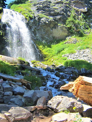
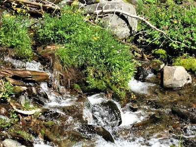
First order of business is a nice loop hike to Proxy Falls though a lava boulder strewn temperate rain forest in the Three Sisters Wilderness – big beautiful water streaming down a 129 foot tall mountainside clogged with moss-covered boulders, logs, and branches. A mysterious aura pervades the primeval green and black, humid, eerily beautiful forest.
Not much to do but sit and admire it for a few minutes, unmotivated or deterred by ankle pain to further explore, before looping back to the car. A nice little bonus side excursion, is all, to get the blood flowing, but – no wait! – it’s another waterfall bagged!
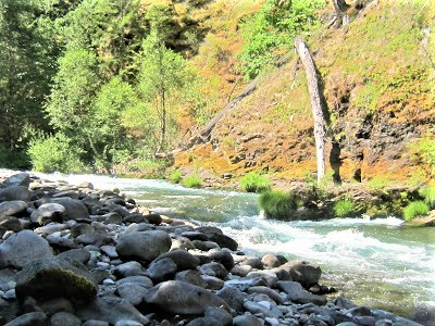
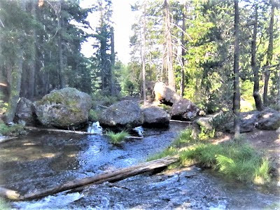
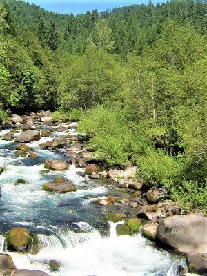
On the South Fork McKenzie River (gotta love it), we pull into a nestled away camping area, loop around, but the only available spot is beside a psychedelic hippie school bus. No one’s about, but it must evidence a commune of dozens, perhaps.
We pass on the chance to be their neighbors, desiring a bit more solitude. Down the road we pull into French Pete’s campground, seemingly absent of campers, but plenty are here we discover, driving a loop looking for a place to call our own.
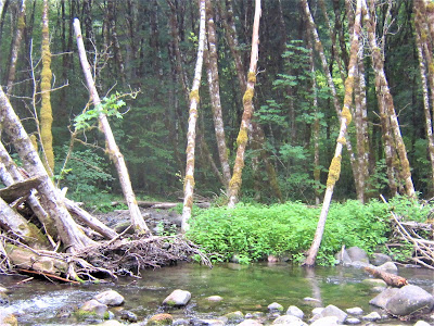
Then bingo! We find a choice spot with reservation tags for the weekend, but for tonight, it’s ours, one of the best sites available, truly a gem fronting the river in a lush setting of Douglas fir, alder, and maple.
It’s peaceful, quiet, and isolated – perfect, fleetingly, for soon, a very nice young couple from Tacoma (we meet them later at the hot springs) pulls in one spot over, a good 50 yards away. Still, when they – yep, you guessed it – busily begin building a fire, we’re terribly dismayed.
Thankfully, though, wind patterns are in our favor and we’re able to enjoy a night of rare smoke-free camping in a National Forest campground.
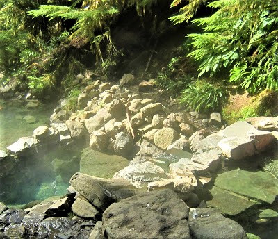
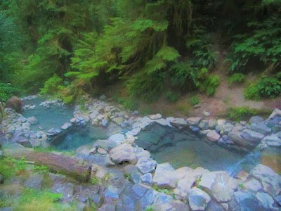
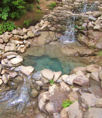
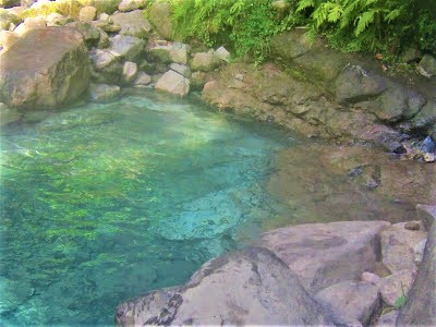
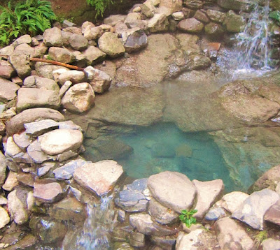
In the vicinity of Terwilliger Hot Springs, we’re up at 5:30 a.m., off 'n runnin' to beat the hot springs loving hordes. At the trailhead, twenty minutes away, we pay the nominal fee, stash the sticker on our dashboard, and hike in a half-mile to the site.
Pure heavenly bliss awaits – cascading pools of blue green, steaming water in a lush forest setting. A couple is already here, but they’re soon a memory and we have the place to ourselves for the next hour to commune in precious togetherness, before two guys (a couple) appear, strip down and slip in – one weather-beaten landscaper celebrating his 60th birthday, the other a roughneck 39 year old recovering drug addict.
An unavoidable aspect of hot tubbing is the social climate. In the right context, it’s cool, but when you want your sacred space . . . apparently, throngs of pot-smoking, mushroom ingesting, moon worshipping hippies and the like flock to the place illegally after hours – despite a $2500 fine if caught.
So, it’s impossible to avoid interacting with them, hearing their encapsulated life stories and forced to share an untoward detail or two about myself as well (can’t stand it). Finally, long time coming, they split. We resume sole stewardship of our private spa, luxuriating in solitude in the nicest, most rustic wilderness hot springs imaginable. Pure chillax, baby!
💕 And I do love you! 💕
Reborn from a complete scraping away of barnacled “carnal encrustations.” I maneuver into a prone, sprawled position at the maw of the tiny cave spewing forth an inexhaustible jet stream of 108 degree water from Mother Earth’s searing womb, and let the healing minerals wash over my neck and back for as long as I can take it.

Then lumbering out, carefully treading on flat slippery rocks to pour cupfuls of iciness over my head from the tiny trickle of a nearby cold spring. Metabolic shock waves. Then back into the pool of liquid heat that melts my brain and renders flesh squishy and limp.
Then again, and over again. And one more time. Truly aaaaahhh-mazing! Not much can compare. Finally, though, weakened and withered, and with more people arriving by the minute, it’s time to move on, as it always is and must be.
We drive and drive and make a largely fruitless detour – a waste of time, declares Gambolin’ Gal – into an unglamorous, little-used section of the Three Sisters Wilderness. We hike a burr-infested, over-grown horse trail for an hour, seeking something exotic, before giving up. (Not even any birds.)

Onward, onward, hoping to catch another waterfall or hot springs or swim in the North Fork Middle Fork of the Willamette – anything – but it’s too hot, we’re hungry, there’s no shade, and the chilly, fast-moving water keeps us on the go, but not before Gambolin’ Man baptizes for a few minutes of spiritual cleansing in a chill pool . . . could not / would not let that opportunity slip!

Farther down the road, at the juncture town of Oak Ridge – a scattered community looking pretty down on its heels – we can’t even find a grocery store, so it’s onward some more to Salt Creek Falls – Oregon’s second highest waterfall.

OH, OREGON!
Can’t wait . . . but on arrival, it’s raining like mad with no hope of letting up, so nothing to post here, and it’s onward, ever onward, more driving and driving (isn’t this what a road trip entails, after all?).
We leave the thunderheads behind on the Willamette Pass, looking, looking, for a decent campground, veering away from big RV lake scenes, passing through a huge charity marathon of hundreds of haggard looking runners, finally completing a big loop – back again on the Cascades Lake Scenic Byway.
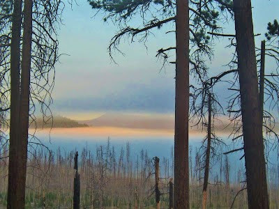
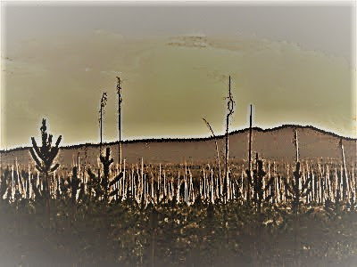
Daylight waning, we take our chances on a remote-seeming campground in the Deschutes National Forest at East Davis Lake. The approach in is a bombed-out and destitute landscape from an apocalyptic flick, owing to the Davis Fire from 2003 that charred 40,000 acres. Dead trees for miles, albeit with a stunning backdrop of Odell Creek and Cascade Range Peaks.

The camping area is largely devoid of people, and we’re greatly relieved to learn from a loquacious Forest Service ranger that campfires have been banned indefinitely due to extreme fire hazard conditions.
I’m sure our neighbors – a multi-generational family of six – are disappointed not being able to build their oh-so-precious fire. We overhear the guy we think is Grandpa say to the little girl we think is his granddaughter, “I was hoping to roast you some marshmallows, honey.”
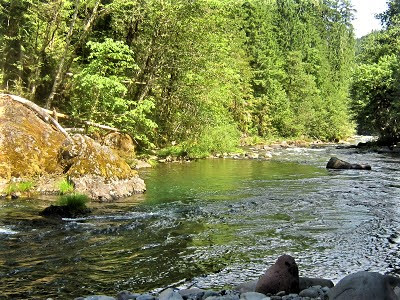
For our part, we're thrilled to have stumbled upon a really sweet spot. Several hours of daylight remain to explore sparkling Odell Creek, sprawling like a miniature delta. Not surprisingly, this is “one of the most productive wildlife areas in Central Oregon” and a “truly special place to visit,” as the Forest Service puts it – lush nesting territory, bird heaven, in other words.
I spend several hours engaged with the binoculars, training them on furtive movements in surviving stands of pine trees behind camp, occasionally zeroing in on a bird I never knew existed, and then turning to focus on Odell Creek, wading into the shallow water, immobilized by the river’s hypnotic swirl and Big West scenery of the jagged crest of the Cascades swathed in misty romance in the distance.
More birds flit about that baffle my ID skills, including a plucky whitish shore bird, perhaps a Sanderling, but can it be (?) and four other species to add to my Life List: Red Crossbills, Black and White Warblers, Lesser Nighthawks, and best of all, a brief peek at a magnificent little fella – a Golden-crowned Kinglet! The bird darts razor-sharp fast into a sheltered nook of the creek’s bank, gaining momentary purchase on a little root snag.
For about two seconds only, I am face to face (binocular-wise) with an unknown entity, a creature never before seen in my life, an elusive little bird weighing a mere five ounces, with a fiery orange cap and downy white black-striped face. Nothing can compare, can’t explain it, not multiples sightings of cousin Ruby-crowned or even the eagles squabbling over cutlets in the treetop nest at Smith Rock.
As dusk takes over, clouds move in and temperatures plummet. We happen to be in a huge depression that sucks cold air and moisture right down, finding out this little fact after enduring a tough night weathering drenching fog. Morning couldn’t come soon enough.
We awaken to near freezing temperatures – it did freeze, as evidenced by ice crystals on my plastic map left out on the picnic table – and our bags are soaked. Just a tough, tough night, not much sleep, and now it’s too cold to stick around for coffee and oatmeal, or enjoy the early morning river or the eerily beautiful forest of burnt trees blanketed in a misty cloak. We scurry to pack things up and split the scene. Seems like we’ve done a lot of that on this road trip.

Saturday, August 3, our final day.
OH, OREGON!
We circle back around just south of Bend to pay homage to Newberry National Volcanic Monument. Who knew? Jonesin’ for a bike ride around the perimeter of pretty Paulina Lake, we’re ready to roll when – psssssssssssss! – we hear a deflating sound coming from near my trusty old-school Gary Fisher – a rattlesnake?
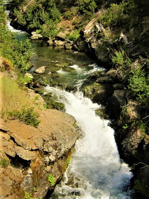
No, just air gushing out of the front tire from a shot valve. No matter, turns out bikes aren’t allowed on the lakeside trail anyway, so our only option is to visit can’t miss Paulina Falls. A rushing mountain stream flanked with wildflowers and lava rock cuts through thick forest.
Ever on the lookout for a new bird, I spot a Western Tanager, a flamer not seen all that often. It makes my day. At Paulina Falls, we’re greeted with a scene of tremendous beauty. Not many people are around to appreciate it, either.
Soaking it up, we revel and explore like giddy little kids, agog at the creek’s bifurcating plunge into a chaotic heap of boulders sixty feet below. Forceful flows, eating away at eroding cliffs, has created a sculptural work of art, just geology doin’ its job, just another “can’t take my eyes off it” kind of place.

But with so much left to explore before the eight hour drive home, we tear ourselves away to see what all the fuss is about at Paulina Lake. A pretty trail skirts the edge along sedge and pine forest.
But the silence and serenity we find is quickly obliterated by a fisherman’s noisy motorboat revving up and spewing rank exhaust fumes, which of course, wouldn’t you know it, find their immediate way into our respiratory systems.

OH, OREGON!
Time to head back to our homie state of California. We’ve done and seen a lot, but also missed a ton. The good news is, barring a cataclysmic extinction event from Mount Mazama, it will all still be here on our return.
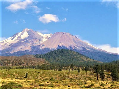
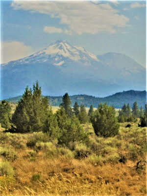
Down we drive on Highway 97, to Klamath Falls, past the vast lake system and wildlife refuges that will just have to wait for another day. Approaching Weed with spectacular views of Mount Shasta rising like some ultramontane mirage.
A quick stop-over for yummy but overpriced Thai food. Then, putting ‘er in cruise control, we kiss it all goodbye, with deep intentions to return one day soon, and perhaps forever.
OOOH, OREGON!
AAAH, OREGON!
Bonus videos of Oregon:
posted by Gambolin' Man at Wednesday, August 28, 2013
![]()


2 Comments:
These pictures look fake they're so perfect. Too bad smoke dogged you just about the whole time. But other than that, wow, what a great trip!! Glad you had such a good time.
I love hiking in Oregon. It's one of the things that kept me there so long (13+ years). I'm glad you had a great time.
Post a Comment
<< Home