THE SECRET WORLD: A Spirited Ramble Through the Historic Gold Run Diggings to Canyon Creek & the Washed-Out Bridge
Gold Run Diggings is a place you’ve never heard of, yet you’ve driven by it on numerous occasions via Interstate 80, east of Auburn, California, no doubt headed for “bigger and better” places, truckin’ to Truckee, jammin’ hard to North Tahoe and Reno.

Ha!
How many times has Gambolin’ Man himself blown right on by, barely deigning to cast a semi-admiring glance out toward the seemingly nondescript foothills off to the unglamorous looking south, cruise controlin’ at 80 miles per hour in a hurry for some “real” High Sierra sights and adventure.
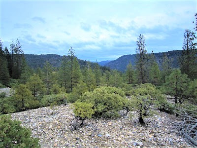
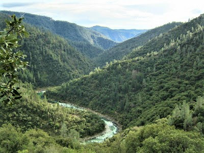
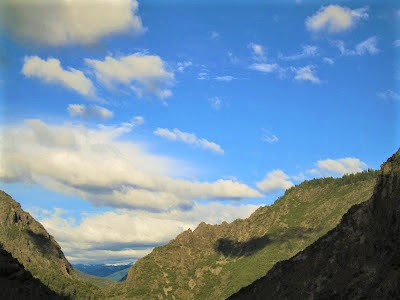
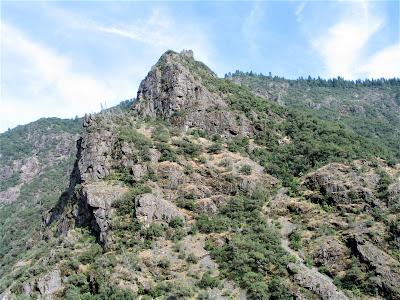
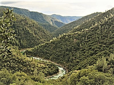
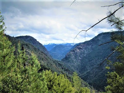
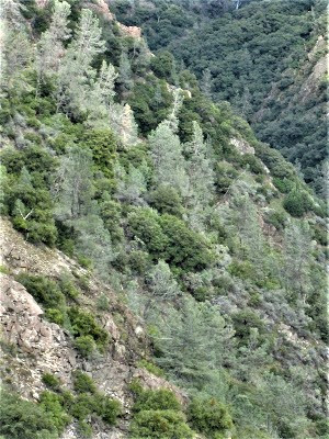
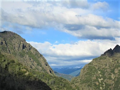
It took me years to learn about The Secret World – that just yonder, no farther than a raven can fly in a couple of minutes, is Big River Canyon Country, a geological wonderland and ecological jewel situated in a matrix of interconnected ridge systems characterized by kick-your-butt rugged terrain involving sharp topo relief, inaccessible gorges, steep cut canyons, deep forest.
And, most notably, its many fabled celadon rivers whose plunging waterfalls, cascades, chutes, channels, and emerald pools of cold fire entice with a Siren call of hard-won thrills and adventure.
That only a raven or some such similar winged creature can easily and instantly get to unlike us, the ponderous earth-bound two-legged critter. Thus, it will always be and will always remain The Secret World.
A perfect climatic elevation zone, ranging from 1200 ft. to 4500 ft. above sea level, tilts my preference to this wondrous and magical setting over inhospitable and harsh redoubts of some stark, mosquito-infested alpine Sierra Nevada settings I’ve frozen my ass off in over the years.
Such austere places are without peer, but North Fork and Middle Fork American River Canyon Country is the place you want to be for hot weather river gorge scrambling, world-class pool and waterfall action, and sensational beauty literally stopping you in your tracks, so difficult is it to negotiate and navigate this nearly impenetrable land.
Dating back to the early 1850s and before, gold-hungry men applied brawn, sweat, tears, blood and brains to conquer this land; they lived in squalor, got injured, suffered from diarrhea and rotten teeth and a host of other ailments and had terrible diets.
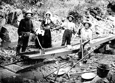
But they built trails and dug tunnels and did whatever it took to get the mule loads of supplies across intractable cliff faces and down to the canyon depths.
A land smack dab in the middle of authentic Gold Rush Territory – exploited ruthlessly for its abundant natural resources, its unimaginable gold wealth that fueled the state’s rise to prominence at a huge ecological cost and loss of human life.
Today, the land is what it is – in recovery still – and the ghosts of those who met their fate here, haunted, desperate specters, roam aimlessly up and down the river, wailing of murderous treachery, of accursed reversal of fortune, seeking everlasting atonement for avaricious transgressions committed in this sacred land.
Listen hard enough and you may hear plaintive Chinese violins of a quiet evening on the river funereally lamenting some forsaken spirit, or you may be spooked by the gobbledygook chatter of so many lost souls seeking egress from their lengthy purgatory in the ruins of the gold pits.
Perhaps it’s just buzzing in your brain, scaredy-cat nighttime auditory hallucinations, but ah, if you just pause to really tune in – what mysterious voices emanate from the river’s babbling tongue!

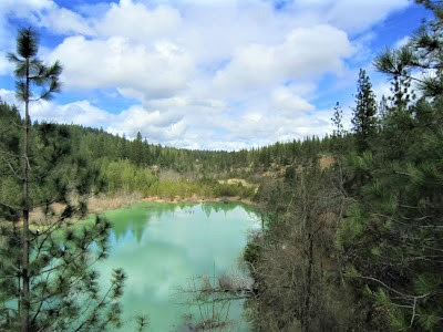
North Fork American Canyon Country is a blip on Google Earth but zoom in and you are virtually THERE – cyber witness to an unpopulated pristine paradise (except for the very real mercury contamination from the old tailings).

The tortured topography contributes to a sense of extreme isolation, while one endures exceptional hardship in getting to choice spots pretty much anywhere in NFAR country.

That always makes such a place pretty much off-limits for the casual or even avid hiker, because the choice spots are always terribly tough miles away and agonizingly difficult thousands of feet down and back up again on impossibly steep trails – a sure deterrent for most people who want “drive-up” beauty or easily attained vistas on not too challenging loops or out and back hikes.

Yet people do make it here – on our hike we encountered a lone female hiker in her late fifties. I was impressed. When you chance upon another hiker in these rarefied realms, it’s a kindred soul encounter, because only a very impassioned individual would torture him or herself.
Because the reality is: it is a difficult, lung-busting, ankle-twisting, knee-knocking, poison oak-infested, rattlesnake-hissing pilgrimage to some of the crazy remote places of incalculable natural beauty and raw power found in NFAR canyon country (or any country!) with elevation drops of 2000 ft. in two miles not uncommon.

All for the thrill and glory of seeking out the most alluring of splendors – some of the American West’s loveliest glacial and spring sourced canyon-carving rivers, gathered together in a tangle of arteries in the Dutch Flat Quadrant of the Tahoe National Forest.
You’ve heard of the famous rafting and kayaking venues of the North Fork American River and the Middle Fork American River, but how about those princesses’ lesser known and appreciated but equally attractive sisters,
The North Fork of the Middle Fork of the American River, the North Fork of the North Fork American River, the Rubicon, and Monumental Creek, jokingly referred to by the late scholar, historian and explorer extraordinaire of the area, Russell Towle, as:
“ . . . the North Fork of the East Fork of the North Fork of the North Fork of the American River. The NFEFNFNFAR, as it were.”

He posted about the same hike a half dozen times, yet wrote passionately with refreshed powers of observation, as though experiencing the splendor, charm and beauty for the first time.
For Russell, it was always “Difficulties Be Damned” when it came to feasting on North Fork beauty. And for a compilation of essays, writings, fulminations and inquiries about the area, no one can equal Russell’s output of over 300 postings at his legacy website.
Requiescat in pace, Russell!

It’s been a half dozen years since my last visit to Gold Run Diggings and Canyon Creek Trail. The first was in 2003, nine years ago already, when Russell and a friend, CanyonSpirit, invited me along on an unforgettable outing when:
🌞 🌞 🌞 🌞 🌞 🌞 🌞
“ . . . bright sun blessed us all day long.”
🌞 🌞 🌞 🌞 🌞 🌞 🌞
These old Canyon Creek hands absolutely delighted in turning me on to a place that was so near and dear to them and so secret and spectacular to me – they reveled in my childlike, overly exuberant reaction to Capital E Everything.
As Russell noted! “You ain’t seen nuthin’ yet,” he ribbed me, the city-slicker Gambolin’ Man from Berkeley, with each new revelation.
Indeed, that day my eyes were popping out of my skull as a myriad of sensations and unexpected splendors left me, not quite speechless, but certainly breathless.
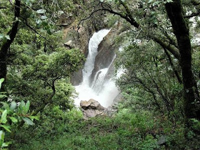
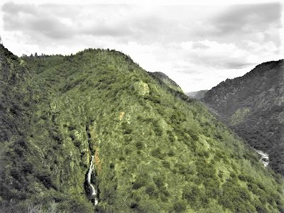
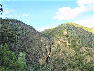
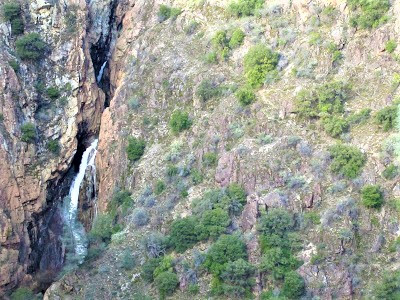
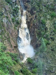
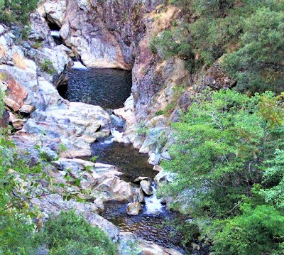
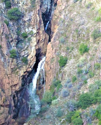
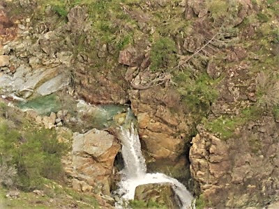
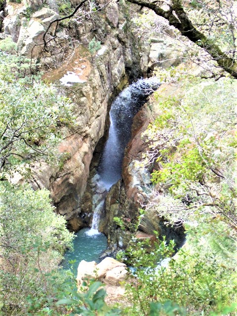
A 150 ft. waterfall leaping from a solid rock face; a chute of ferocious water plunging from an unseen corkscrew inner gorge; dramatic cliffs, high bluffs and pinnacle crags and Lover’s Leaps; historic lost trails, old mossy walls and tunnels; wildflower garden displays; artifact and relics from another age.

And the raging waters of Canyon Creek were to boom in my mind forever and ever, etched in memory with Russell's poetic words describing the:
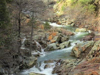
“ . . . loud, boisterous, surging clear green water with long stretches of frothing white rapids.”
We had taken a different approach in through the Digging, down Potato Ravine and Indiana Hill Ditch, dating back to the early 1850s, then the bridge crossing at the creek, a footbridge which Russell and company rebuilt after the torrent of 2006.
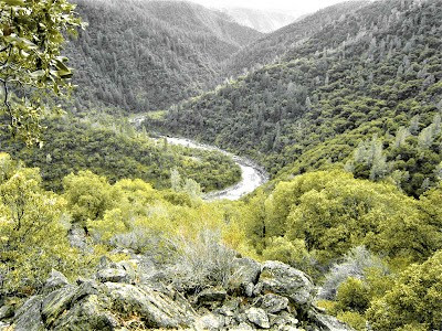
Then, the 1600 ft. descent on the plunging trail to the North Fork American River carving a mighty significant S through the thickly forested canyon. At stops along the way we paid homage to the lone sentinel that Russell, during one particularly memorable foray, described as the:

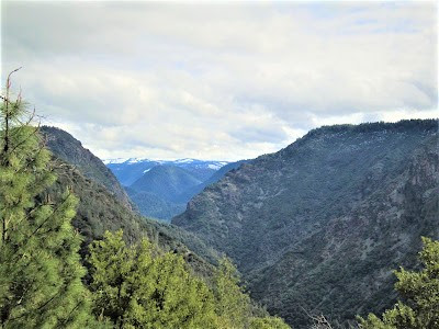
“ . . . politically-incorrect Blasted Digger, that lightning-struck pine on the rocky ridge east of Canyon Creek, that wondrous spot which offers awesome views into Giant Gap, and even beyond, to the freshly snow-dusted mountains around the head of the North Fork of the North Fork.”

“ . . . a strangely level thread of a path which can be followed miles up the canyon into the heart of Giant Gap. It is a relict of the Giant Gap Survey, a scheme of a hundred years past to divert waters of the North Fork for San Francisco's water supply. The schemers put men at work to rough in the line of the proposed canal, and they dutifully blasted out narrow ledges from the cliffs, and drove a couple of tunnels through the flaring rock spurs below Lovers Leap.”
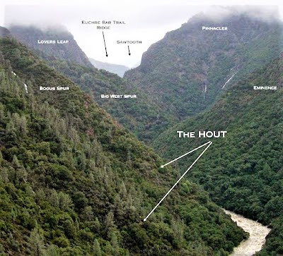
For Russell, getting his feet muddy and hands dirty on the HOUT was field work, integral to his understanding the mystery story and being able to piece together the fragmented bits of documents, deeds, maps, letters, journals, and newspaper clippings offering insight into the mining and settlement history of Placer County.

Russell (and Ron) pretty much solved the mystery and brought back the HOUT from the brink of oblivion and extinction.
One time at Canyon Creek, thinking I knew the place by heart after a visit or two, Brock Stoker (of “Boys’ Trip” notoriety) and I made the approach by illegally accessing the trailhead on mountain bikes cutting through private holdings.
(Russell always railed that Placer County should be renamed Parcel County!)
Since that was the only way I knew in, we took our chances and made it to the trailhead. (Today, it’s best to take the route in from Garrett Road at BLM land along jeep roads and eventually the Paleobotany Trail.) We ditched our bikes at the trailhead and encountered a guy with a fishing pole who pleaded with me to “lead” him down to the river.

I’m thinking, hell no, bro, find your own way down, but this Jack Black look-alike was so insistent that I finally relented, making it clear that it was a tough-ass trail that at one point simply erodes into the rocky hillside, so it would be rough going and I was not responsible for him. Capiche, bro?
He assented, and off we set – Gambolin’ Man, of course, stormin’ out front while Brock obligingly kept the fisherman dude company for a while until a point at which I stopped to wait for them. And that's when he never showed up.
I circled back up and around to the Higher Terrace Trail, scanning the turbulent Canyon Creek below with binoculars; nothing. Finally, I concluded that somehow he must be below me – it was the only scenario that made sense.
.jpg)
So I hustled all the way down to the river, one thousand feet of hard lost elevation, where to my surprise the fisherman dude had made it in one piece, having passed by me when I was looking for Brock on the Terraces Trail. He was thoroughly engaged in casting his rod in the swift-moving river.

When I yelled out to him over the din of the splashing rapids, he turned to regard me through coke-bottle lenses, rolling his magnified eyes with a who-cares shrug when I asked if he’d seen my friend. Last he said he saw of him was up there (pointing). Okay, so now, it’s like WTF in the Twilight Zone. Where could Brock Stoker be?
Lost . . . or dead! . . . in Canyon Creek!
That’s where!
I was utterly spent but very worried about my friend and didn’t want to ponder the very real possibility that something semi-serious could happen to the loving husband and father of three. How on earth could we have separated and lost sight of one another?
Of course, Gambolin’ Man gets the blame.

Man oh man! Was I ever beat!

But no Brock was to be found at the trailhead, so now I had little choice but to head 1000 ft. back down the trail, thinking all the while that, shit, maybe he already was waiting for me at the trailhead and because I never showed up, he headed on up and out through the Diggings, via Indiana Hill and Potato Ravine.
Simply not possible, I concluded. Hardly plausible even. Barely considerable.
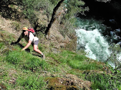
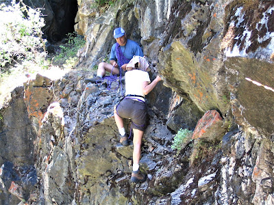
Finally, I was back near the area where the separation had occurred. I carefully negotiated the insanely narrow, slick, rocky promenade – the Six-Inch Trail – with its deadly 300 ft. drop-off to my immediate left, and scouted out again the inner gorge and its profound depths, to no avail.

So I reconnoitered another area and came up empty there as well, but thankful for not having to bear the guilt and agony of spotting Brock’s battered body hundreds of feet below in a lifeless heap on jagged rocks. Finally I gave up all hope, figuring my best bet was to go back to the TH and wait for him there.
Along the way I scrawled some rah-rah notes and left them under strategically placed rocks for Brock to find on the trail; sure enough, the plan worked, for after about a five-hour separation ordeal, Brock had managed to find his way back to the main trail.
It begs the question – where oh where had Brock strayed to? You guessed it! Onto the indistinguishable, indistinct High Old Upper Trail! Somehow he had detoured off Canyon Creek Trail onto the HOUT without even knowing it! In my zeal to plow down the hill, I had missed the hard-to-spot spur trail, even though I had just been shown it a few weeks prior.
But here was Brock, just ambling along in his own groove, and he somehow managed to stray off the very distinct Canyon Creek Trail and onto the very indistinct High Old Upper Trail! I would never in a million years have suspected he would be on the HOUT, because never in a million years would I have suspected he would or could have found it; which explains why I didn’t go looking for him on the HOUT.
“ . . . east, on an intricate path, through groves of Canyon Live Oaks, through heavy old brush, and across cliffs and rockslides, on and on and on, in the full heat of the sun.”
It was during one of his dozens of scouting expeditions to piece together parts of the trail, that at times just dropped off below ten or twenty feet to pick up anew; and Brock, bless his heart, had followed that faint line about a mile out. Not seeing Gambolin’ Man in sight, he figured he HAD to be down at the river by now, so what did Brock do?
He veered yet again, this time off the secondary HOUT and negotiated a harrowing bushwhack of a descent to the river (in deck shoes, no less!), where he reported resting up and waiting on a big polished boulder in the sun, sure as shit that Gambolin’ Man was about to pop up around a bend in a second flat, laughing and mocking his fears and insecurity.
Where else could he be? And isn’t that what he would do – it would all be so welcomingly funny!
When two hours passed and no Gambolin’ Man turned up, Brock started thinking, well, maybe Gambolin’ Man didn’t make it to the river after all. Which meant he HAD to be back up THERE.
So, with the day waning, Brock snapped out of his poolside (sans cocktail) reverie, hopped to it, and scrambled back up the steep, slippery mountainside, nearly falling to his death, he reported, at one point, clinging to a fingerhold of crumbling rock.
And finally, back on Canyon Creek Trail, thankfully on firm navigable ground again, he made the right decision and headed up canyon toward the trailhead, along the way finding my reinvigorating notes which, he reported, were like manna from heaven for his depleted psyche.
I had gone back to the trailhead to wait, but despite my fatigue I couldn’t remain still, so down I went again looking for him, when we finally met on the trail – not quite a Livingston and Stanley moment, but still!

These memories are heavy on the mind as our party saunters through the Gold Run Diggings, an 800 acre swathe of private property twenty minutes east of Auburn, depending on how fast you’re driving and how tough the traffic is.
If you really want to learn details about the history of this fascinating place, read Russell’s informative essays about this recovering wasteland once controlled and managed by the Gold Run Ditch and Mining Company.
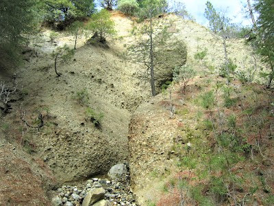
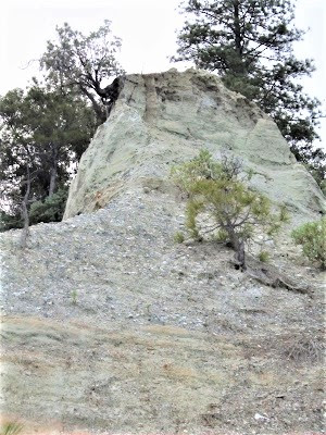
This earth-raping enterprise extracted tons of gold as the land was rent asunder and landscapes were environmentally devastated, forever altered by tunnel and ditch construction and huge swathes of hillside eroded away into hoodoo and goblin shapes, courtesy of hydraulic action of the miners’ big blasting hoses in operation a century and a half ago. (Remember that scene in Pale Rider?)
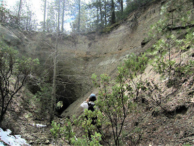
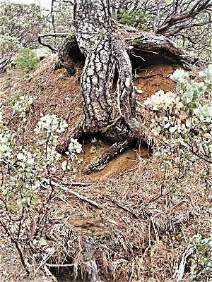
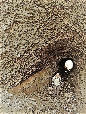
Along the trail, we approach an old miner’s tunnel, dynamited in 1852, forcing a subterranean traverse along a stream flowing through. Very cool! Another part of the hike takes us along an old diversion ditch, beneath “an arched grotto of manzanita,” as Russell described it, where water was once channeled to the cannons used to blast to smithereens the hillsides in order to wrest gold from deep in the bosom.
And where the sluice boxes took run-off and other stream diversions down into the fine extraction pits, where miners spared nothing in their zeal to coax the precious metal out of every nook and cranny of the Gold Run Diggings.
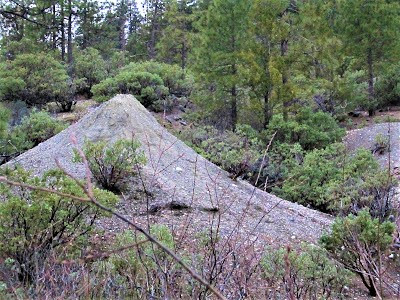
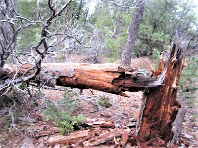
Throughout the historic setting of the Gold Run Diggings, one finds scattered evidence here and there, testament to the indefatigable efforts of the Forty-Niner Miners, of a bustling hydraulic mining past – trenches, sluice boxes, ditches, pits, caves, tunnels, old cables and pulleys, dilapidated cabins, and boulders piled high by gold-obsessed miners not content to leave one stone unturned.
Not so well known as Malakoff Diggings (State Park) near Nevada City, the Gold Run Diggings is an area of keen interest and odd curiosity, a place you could explore endlessly and never know what you might come upon – how about remnants of petrified wood.
Russell characterized his "Secret World" as:

“ . . . a wild and beautiful land with two trails. The Canyon Creek and Pickering Bar trails - giving access to the North Fork American Wild and Scenic River Corridor.”
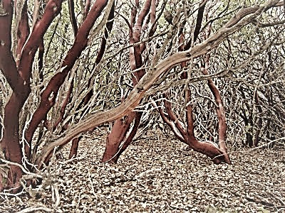
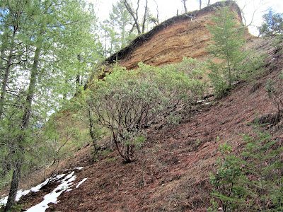
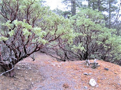
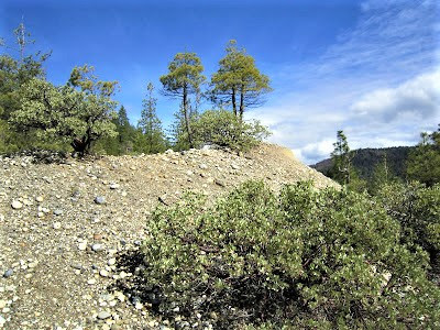
Today, poor soil conditions have led to straggling vegetation, gray pines and hardy manzanita trees, a landscape on the mend, for sure.
Russell dug up the following nugget:
“James Stewart the Younger owned most of the Diggings for many years. His father, James Stewart the Elder, had been a hydraulic mining superintendent in the olden days. The younger Stewart was a friend of Jack London and Franklin Delano Roosevelt. It is said that London used to stay at Stewart's house in the Diggings, and did some writing there. His short story, All-Gold Canyon, may have been written at Gold Run.”

I just knew there had to be a Jack London / FDR connection!
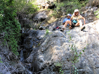
Our hike on this day had been planned a month in advance, perfectly prognosticated, chosen randomly and happening to fall in between days of heavy rainfall. March 21 greets us with blue skies and puffy clouds, about an even 72 degrees – in other words, a perfect day! (Hey, guys, why aren’t you in your shorts?)
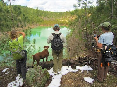
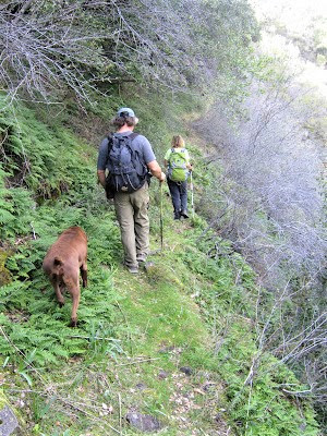
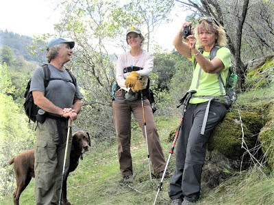
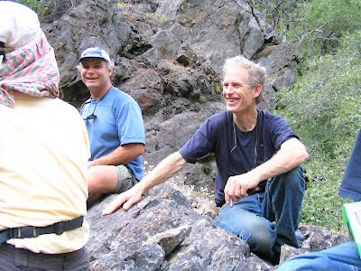
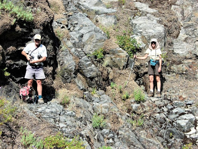
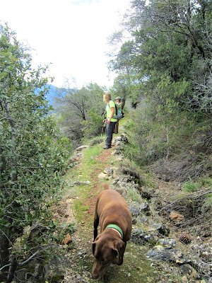
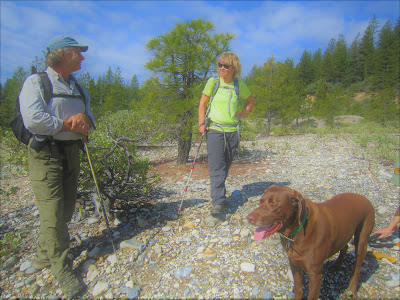
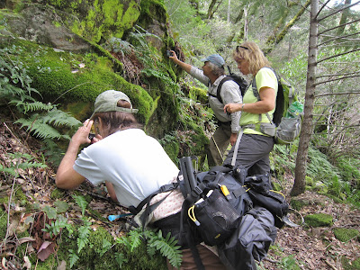
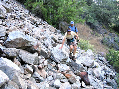
We’re hiking some BLM jeep connector trail into the Diggings proper. I never could have located or set bearings once in the Diggings – had it not been for Ron Gould, tireless trail advocate, friend and hiking bud, who knows the area like the back of his hand.
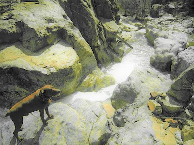
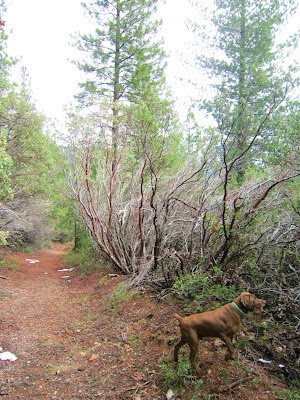
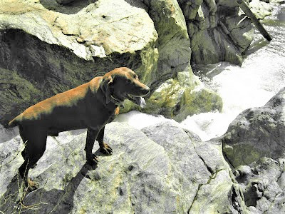
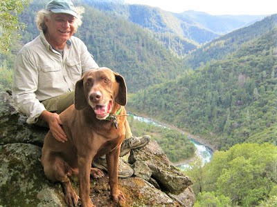
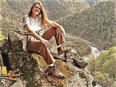
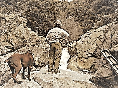
Pleasant company in tow is the effervescent and witty CanyonSpirit, a friend now of ten years already; and (first time meeting) fun-loving, inquisitive Mary of the (now inactive) SheepShepherdess blog. Oh, and the most ardent enthusiast of us all, Otis – Ron’s faithful good-natured hundt, always in lockstep with us on these outings, sniffer working overtime.

But don’t all Canyon Creeks rock?
We’re a lively chattering group, conversing non-stop about a hundred things, but making sure to pipe down often enough to feast our gazes on the long views and take in every perceived miracle around us.
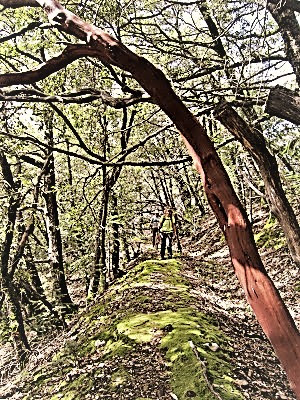
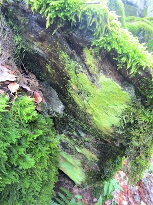
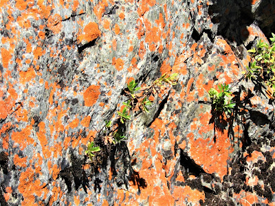
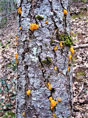
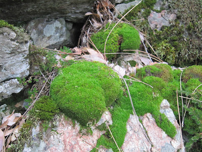
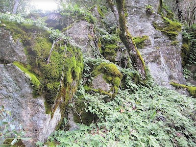
During these moments, every little thing along the way captivates our attention, is cause for great celebration, wonder and discussion, giving way to many such little detours and way-lays – to minutely investigate and photograph a flourishing colony of fern, lichen, algae and moss in a rock outcrop.
To stoop over and admire a sprig of fairy-capped ‘shrooms popping up from a rotted limb; to stare at the ground litter, an artist’s palette of color and mixed media – pine duff and needles, tiny grasses, sticks, pebbles, Lilliputian ferns – a colorful mosaic to be unceremoniously trampled beneath our feet but not before commenting enthusiastically about it for twenty minutes.
I think at one point I ask (facetiously?), “Is this art?”

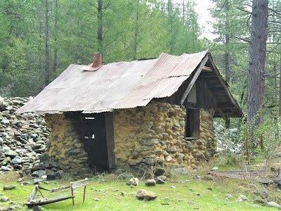
We pause, reflect and move on, soon chancing upon a miner’s cabin, replete with an unknown history and plenty of ghosts bustin’ out in the nighttime . . . and only Russell would know about it:
“In the Secret World is a small stone cabin, built I believe by one Byron Emric, maybe in the 1930s. He used clay for mortar, and gleaned some corrugated sheet iron for a roof.”
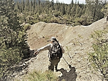
Next we stride on a real neat section of trail following the old ditch line, by-passing a little spur trail leading down to the so-called Diving Board Ridge where canyon views open up east and west.
We debate going down the 600-foot slippery descent over just a half mile and decide (thankfully) against it, given our ambitious agenda to hike all the way down to the river, or all the way out the HOUT, or knowing Ron and my indefatigable hiking partners, both.


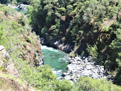
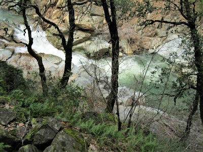
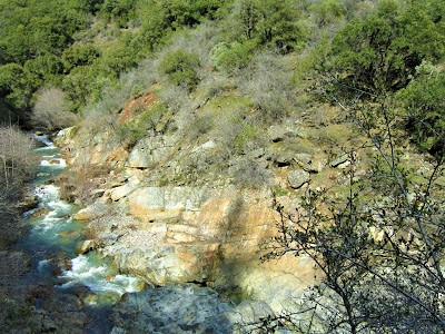
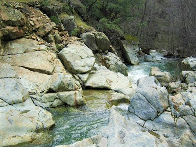
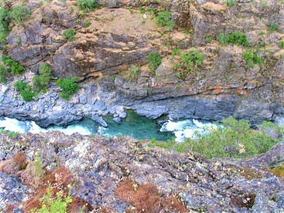
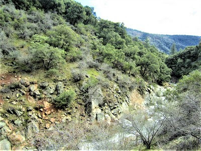
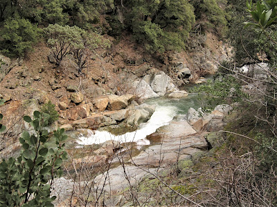
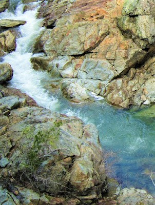
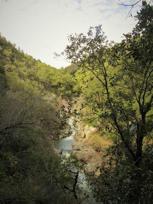
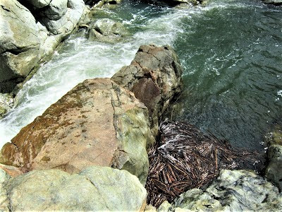
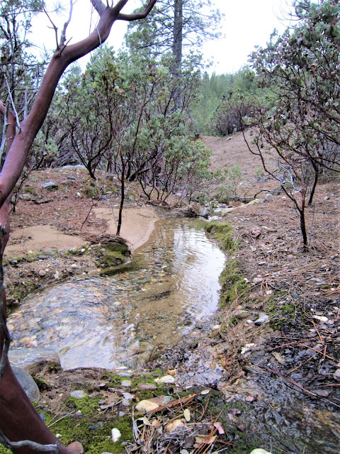
Finally, we are within earshot of the creek’s symphonic crash of water booming through a tight rock channel, eager to get on the Gold Rush era system of trails built between 1865 and 1882:
“ . . . when Canyon Creek was fitted with sluice boxes and undercurrents, extracting fine gold from the tailings of the Gold Run hydraulic mines.”
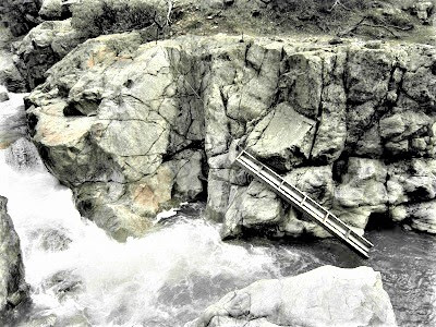
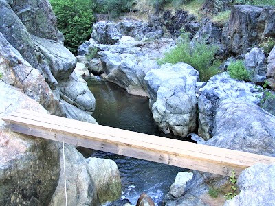
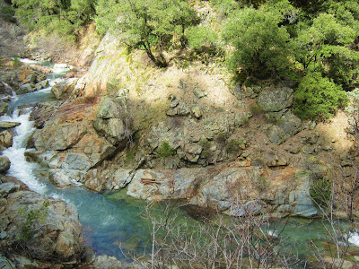
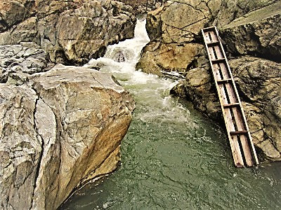
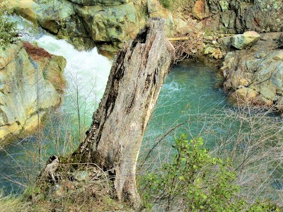
Suddenly, Ron lets out a “Whoa!” – equal measure surprise and dismay – to announce that the bridge had been washed out by the swollen creek from heavy rains several nights ago – a reminder of nature’s raw power – wiping out our only way across the little chasm.
Ron points down at a battered wooden plank hanging on by a thread of a cable as roaring waters lash it to and fro against the rocks. So here we are – met with the same fate as Russell, back in ’06, when a raging torrent took out the bridge then and thwarted his hiking party’s further progress.
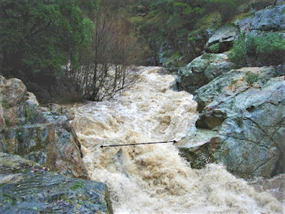
“The bridge was gone. And there could be no merry romp down the Canyon Creek Trail to the river.”
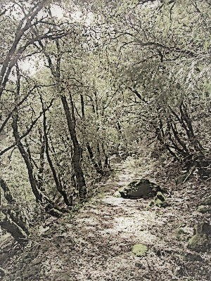
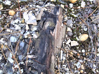
The camaraderie and banter carry on, the oohs and aahs unceasing. Finally, though, with the day slipping away, we begin our hike back the way we came, now traversing the very cool named Paleobotany Trail, eyeballs peeled for some honest to goodness petrified wood.

Unless you know about, it’s impossible to spot. Ron locates it after a brief circuit off-trail, informing us it’s just a fraction of what once was here. Several years ago, some idiotic and arrogant guy actually came in here with a backhoe and dug out 200 to 300 pound chunks of the paleobotanical treasure-trove, including, as reported by Russell:

“ . . . the very last petrified log of any size exposed at the surface, around fifteen feet long and two to three feet in diameter.”
Just who in the hell did this guy think he was? How in the hell did he manage to gain access with a backhoe? And why in the hell was he never prosecuted? In a rare instance of lacking information, I suppose, Russell did not provide any answers, that I could find at least, regarding who this guy was and if he was ever caught. What appalling chutzpah!
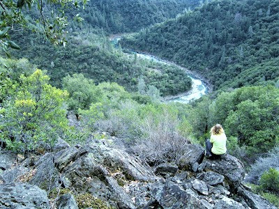
Late in the afternoon, with light to spare, we straggle back to the vehicle at the same time as the lone female hiker appears, safe and sound from her long perambulation to the wash-out at the creek, then down to the river and back up on the not-for-sissies Pickering Bar Trail. Otis is beat and sprawls out on the ground while we bid adieu to The Secret World and prepare to face the Real World.
As Russell always liked to end his posts with a simple sign-off, I shall, too, by proclaiming in his very own words:

" . . . it was another fine, fine and altogether too short of a day in the great canyon."
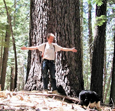
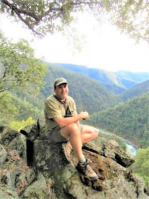
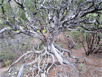
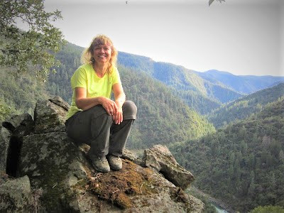
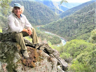
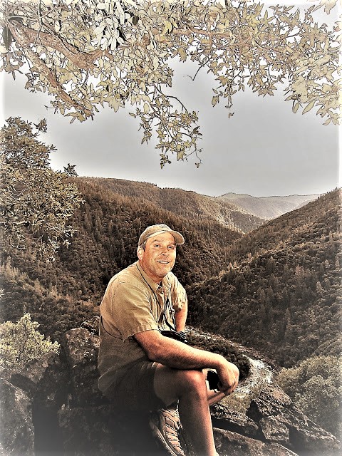
Photo of Russell loving his trees by Gay Wiseman.
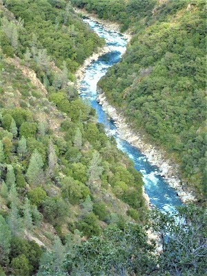
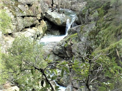
Map photo of HOUT (in narrative); gushing Canyon Creek with arrow crossing it showing where bridge had been washed out the year before (in narrative); and raging plunger waterfall of Canyon Creek (below) - all courtesy of Russell Towle legacy photos.
Postscript from Russell Towle on Ron Gould:
“Ron has developed quite an interest in this area; he sees that an irreplaceable resource hangs, so precariously, in the balance, that one of the most beautiful trails in the Sierra is ‘For Sale’, that the Bureau of Land Management (BLM) has had a mandate to purchase critical parcels there, since the creation of the North Fork of the American Wild & Scenic River, in 1978, but that nothing has been purchased; Ron saw these things, and decided to do something positive. So, in a variety of ways, he has worked to bring Gold Run and the Canyon Creek Trail to the attention of the movers and shakers, the decision-makers, the responsible officials, and really, anyone who could help secure this incredibly beautiful and historic area for We the People and our posterity. I deeply appreciate Ron's efforts.”
Honoring Russell Towle:

Check out more Gambolin' Man adventures in California's great American River canyons:

Bonus Coverage – Live from Canyon Creek!
posted by Gambolin' Man at Friday, April 20, 2012
![]()


1 Comments:
This is a great find for me ! - Loved watching this. I came to this video because I have just written a novel based on a story about a waterfall - and the image of Leaper falls by Gombolin' Man would be ideal for the front cover of my E-book, If you would allow me to use this photograph I would be enormously grateful and a link to your blog would be arranged.
Post a Comment
<< Home