MOUNT DIABLO STATE PARK: Traipsing & Scrambling in Wild Oat Canyon (Donner Falls Loop in Six Miles & Six Hours)
On a sunny day, after freshening rains, no place is more alluring than our ancient local Mountain called “Tuyshtak” long ago by Ohlone people.
It means “at the dawn of time”, and the imposing 3,849 foot land mass was the Center of the Universe then, and today remains the geological centerpiece of landscapes near and beyond the Bay Area.
Also referred to, disparagingly, as “Devil’s Mountain” (evidently a linguistic botch job), Tuyshtak stands out alone in a range of lesser East Bay peaks and dominates the surrounding views.
.jpg)
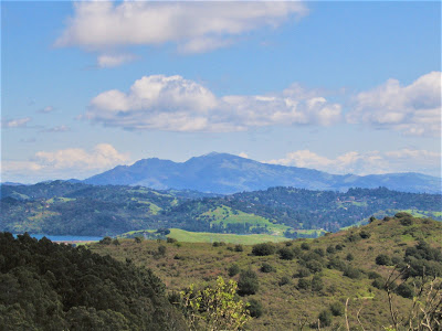
From the summit, take in spectacular vistas of the Sacramento – San Joaquin River Delta and snow-capped Sierra peaks on a clear day. As though you can see forever.
.jpg)
A visit to the Mountain, especially at this time of year, of wildflowers and waterfalls, is certain to charm and enthrall . . . but if not careful, if not prepared, if acting with undue hubris, a visit to the Devil’s Mountain can also end up debilitating, injuring, or killing you. (I kid you not.)
Nothing excites Gambolin’ Man more than a springtime ramble in our beautiful Mount Diablo State Park. Less than an hour’s drive away, no place within a 100+ mile radius – certainly no place, on second thought, other than Sunol Regional Wilderness – offers such bountiful promise of unbridled adventure and boyish fun in a big wild playground.
.jpg)
The guarantee of thrilling challenges in rugged areas, whether hiking, biking, scrambling, paragliding, or rock climbing, and the anticipation of seeing many animals and few people no matter how many cars are parked at the trailhead. (Except after big rains, usually not that many.)
.jpg)
Ya gotta love Mount Diablo! Minutes into a hike and you’re in your own private nature sanctuary, utterly lost to the prevailing world out there – big, bad, barely containable East Bay suburban sprawl extending out twenty miles from beyond the Berkeley Hills, up from Livermore to the south.
There, big, bad, unsustainable development crunching up against the park boundaries on all sides, threatening to gobble up remaining open space parcels unless organizations such as Save Mount Diablo can raise money and act quickly to purchase vital “connector” greenbelt corridors.
(Most recent victory: completion of a significant acquisition of 333 acres – Irish Canyon – helping to link Mount Diablo State Park and Black Diamond Mines Regional Preserve, an old coal mining region.)
.jpg)
Beset by extensive Contra Costa County urban development, rare and endangered flora and fauna find habitat and refuge in the preserved ecosystems of the still-wild Diablo Range.
Truly, it’s a miracle they have survived, but thankfully, since 1932, 89,000 acres of pristine land has been set aside, preserved, protected, all because a dedicated group of people believed (and continue to believe) so fervently in the cause of saving this precious and unique “resource” for everyone’s benefit.
.jpg)
Mount Diablo nature sometimes reminds me of Sierra foothill country in Placer County (the two locales share many flora and fauna) or, with a little stretch of the imagination, desert-style badlands in one season, lush near-tropical splendor in another.
When you’re in the bosom of the magnificent Mountain, deep in a forested canyon, euphonious bird song and rippling water livening the pulse of the day, and sun beating down while the rest of the Bay Area is drenched in fog, with nothing on your agenda but this!
Yes, you know you’re somewhere different and special.
.jpg)
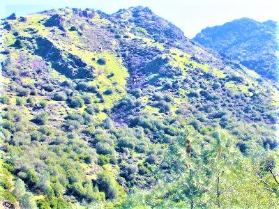
Try to explain this insatiable love and infatuation for all things Tuyshtak! For starters, it is a world unto its own. Rocks, boulders, erosion patterns, geological formations, all are unique and whose very presence evidences a volatile and complex history of a local earth in severe upheaval.
.jpg)
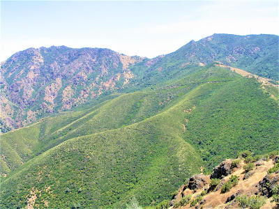
The all-encompassing possible environments, or eco-zones, found from top to bottom define the flora, fauna and weather patterns of its broad contours. Fact is, Tuyshtak is a chunk of Earth as big as some Sierra mountains, making it as bio-diverse, ecologically complex, and geologically dynamic as any place on earth.
.jpg)
Over 400 plant species have been identified and, with a world-famous reputation for avian sightings, at least as many bird species. It is significant habitat for hundreds of animals. It is a place where Donner Falls and other stunning redoubts of nature exist to challenge your concepts and preconceived notions and definitions of what constitutes:

TRUE WILDERNESS!

Barring definitions involving the word “roadless”, I proclaim my love of true wilderness right in our backyard. To call it anything else is to diminish the tireless efforts of selfless preservationists who have fought and won hard-earned battles to save Mount Diablo and bequeath to generations of human visitors and animal denizens its wild and glorious splendor for all time.
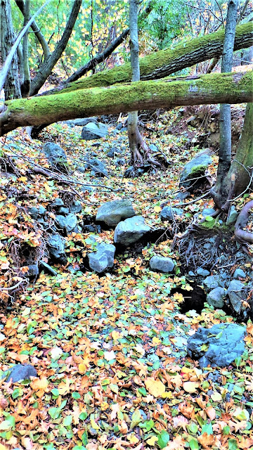
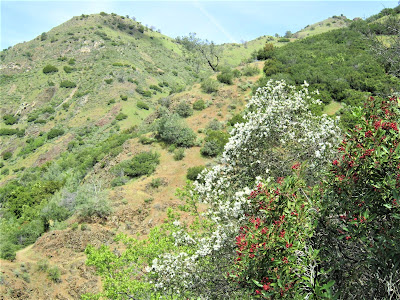
Nowhere in the mountain’s vast acreage of open spaces, grasslands, ridges, riparian woodlands, rock-strewn highlands, and rugged peaks is a more truly “exotic locale” found than Wild Oat Canyon – home to Donner Creek and the famous local gusher, Donner Falls, our destination on this day.
.jpg)
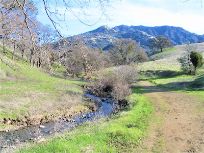
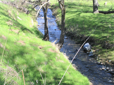
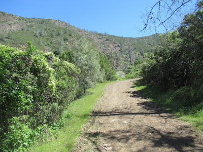
We set off hiking up Donner Road. The first thing you notice is Donner Creek off to the left, glinting steely blue in sun-dappled stretches, merrily burbling along with a respectable cargo of water.
How prettily it wends through large rolling hills in a green riparian corridor lined with healthy oaks, buckeyes, sycamores, California laurel, and big leaf maples, coupled with splendid views of the two imposing peaks of Mount Diablo’s massif.
.jpg)
You think – how perfectly lovely! You want to roll out sheet and open up the picnic basket and just lay there contemplating sweet divine nothingness in mindless bliss.
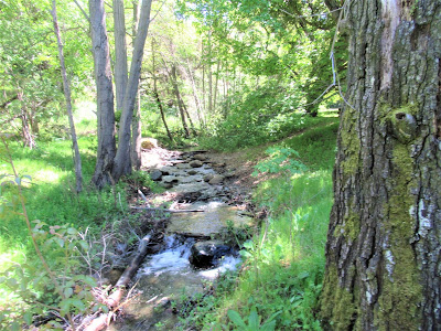
That’s how much Donner Creek charms and mesmerizes, but in an oh-so-subtle way. You could mistake it for a “nothing little crick”, for it does strike one as a somewhat narrow artery for the big drainage job it has.
.jpg)
Miles-wise, it originates very close, but elevation-wise, it must first start seeping out of a hole in the earth perhaps three thousand feet high up on the Mountain‘s flanks. In this near vertical journey, the creek bears down hard with the full force of gravity to cut beautiful, narrow gorges in a short distance.

And now, at the outset of the hike, the creek has made a pleasant bed for itself in the form of an anfractuous ribbon of water flowing through low rolling hills and meadows, in its eventual, mostly unknown about 15-mile journey to drain obscurely and unnoticed by 99.9% of humanity into Suisun Bay.
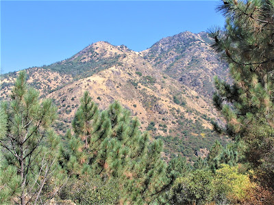
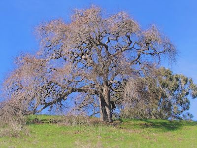
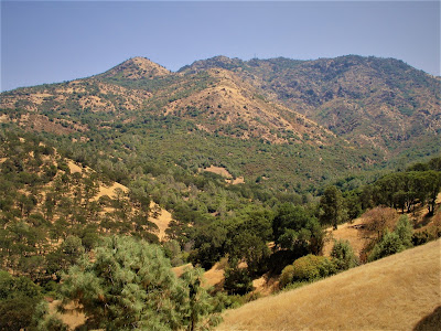
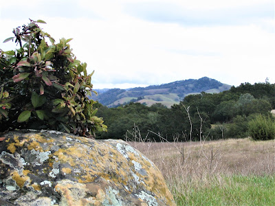
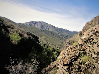
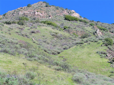
Opposite the creek, to the west, venerable oaks reign in solitary splendor high up on green, grass-swept hillsides. Tuyshtak’s big North Peak, at 3557 ft., and smaller Olympia Peak, at 2946 ft., dominate ahead. I admire this inspirational scene for a few seconds.
Then, barely visible about 50 ft. up a terraced slope, I spot a young coyote laying down in the grass. First time I’ve seen a wild canid hanging out, sniffing the air nonchalantly, looking around, checking us out, taking in the day, just being true to his lazy dog nature.

Just an old Diablo tail-banger, as my dear departed dad might have said.
.jpg)
Donner Road gradually gains in elevation – we will climb a not insignificant 1300 ft. in under three miles, so this hike, although doable by people of all ages, is not for the lazy, faint-hearted or weak-limbed. We detour on our favorite cut-off – Hetherington Loop Trail – which, oddly, nine out of ten people by-pass in favor of (or out of ignorance of) the main fire road trail.
%20(1).jpg)
Hetherington leads up to a higher point on Donner Road, winding up through a very pretty riparian corridor, a charming back hollow, that threatens to turn the tough six-mile round-trip hike into yet another series of dilatory, way-laid episodes of stymied enchantment at the beauty unfolding all around in a pristine, isolated world.

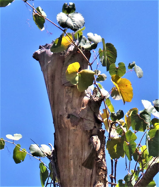
The nameless water course (Hetherington Creek?) that cuts the ravine fascinates with its miniature thunder, its colorful, dense, textured rocks ajumble in the sensuous stream bed; the flawless forest of venerable, gnarly blue and coast live oak trees gleaming like cyclopean creatures opening up to the sun.
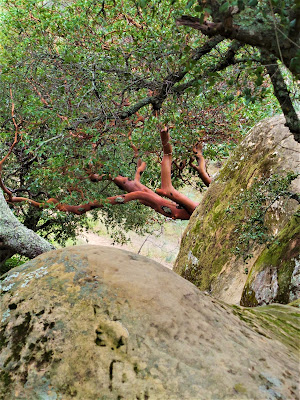
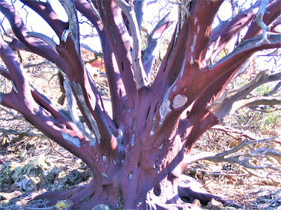
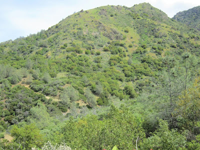
We pass through one of the most beautiful stands of manzanita in all of the Bay Area.
Looking out at an opening, Olympia’s soaring features frame the backdrop to the east, while prominent North Peak looms to the south.
You wonder: where am I?
Smack dab in the middle of California suburban sprawl, that‘s where!
After about two miles of hiking and who knows how much elevation gain, but enough to make you start to feel it, we crest out, to begin the Wild Oat Canyon Loop. We take Middle Trail, a serpentine, dipsy-do track leading into the back reaches of the small, aptly named Wild Oat Canyon, still hundreds and hundreds of feet beneath the big Diablo peaks.
Middle Trail continues on for less than a mile, changing names to Falls Trail, where it connects with Cardinet Oaks Road and back to the juncture at Donner Road, but not before passing over, up, around, and through several significant ravine / waterfall drainages.
.jpg)
Then in a heady rush attaining magnificent views from scary prominences, and capping it off with a breakneck scramble up the creek and scree slope to find myself prostrate at the spraying plunge pool of Donner Falls – a perspective not many get due to the semi-technical nature of the short but risky scramble.
.jpg)
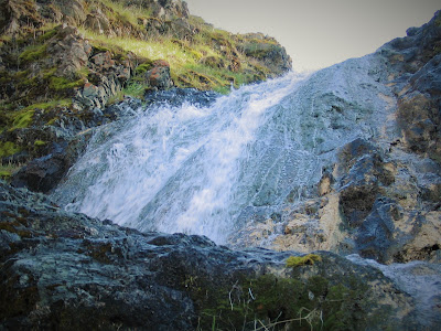
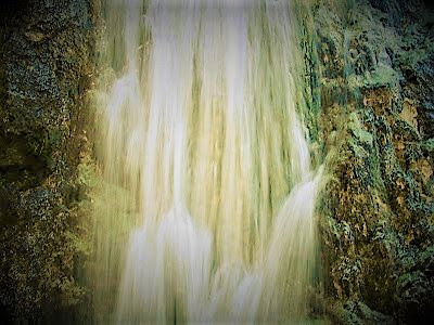
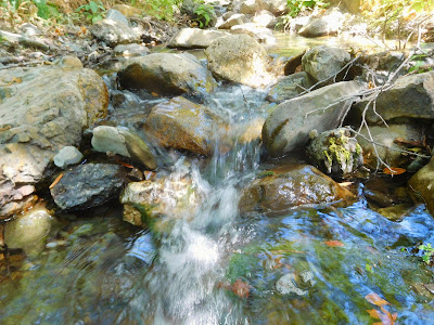
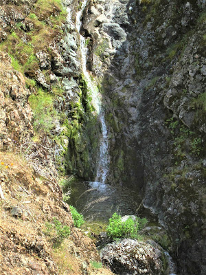
Although not the gusher seen in previous years, a respectable amount of water is plummeting from the brooding lip of the falls. Well, you know me, I want to see what’s above the level of this lower 15 ft. drop / plunge pool.
So, I get it in my mind to scale the falls’ 20 ft. wide slimy mossy wall, with the intention to hoist myself up and over the lip to see, perhaps, an even more wondrous sight.
After a couple of false starts, I finally manage to climb up about eight feet through breaks in the water flow, which doesn’t seem like much, but it’s high enough and slippery enough to make me immediately want to get down.
But not before snapping a few photos of Donner Falls gracefully carving out a polished chute through bedrock gorge, so much water coming from Goddess only knows where, swirling through the earth in a rhythmic pulsation of rainbow spray and mist and thunder.
.jpg)
I can’t see above or beyond, but I sense it’s an ever-upward series of waterfalls, pools, more drops and swirling water courses cutting deeper and deeper into the Mount Diablo’s north flanks.
In all its tiny glory of discovery, its unnoticed majesty of revelation, Donner Falls up close and personal is probably the prettiest sight I’ll see all season.
.jpg)
Getting down from my untenable throne requires a botched sequence of sketchy maneuvers that tweak my arm and twist around my sore foot. I can't safely climb back down, so it seems.
In a spurt of impulsive energy, I madcat leap, from where I'm clinging for my life on the edge of the wall, to a scree slope about six feet below me, and happen to land decently enough, but bang my arm up some more and bruise my knee.
.jpg)
Dusting myself off, I now have to get up and out of the bowl like depression of high rock walls down in the falls’ small amphitheater of water crashing down into the plunge pool.
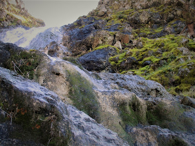
I'm able to make my way back down Donner Creek, the easy egress, the way I came up, except, you know me, I prefer to take another, harder way back to the top – a slippery scramble of 30 ft. up the soft scree slope and then over a spine of sheer soaring rock.
.jpg)
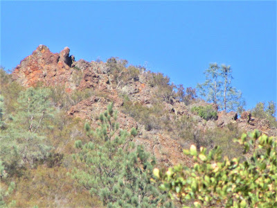
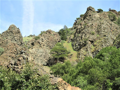
Proving to be doable, I get to the top of a spiny ridge of a small prominence from which to view – dizzyingly! – the unfolding Diabloan panorama. I soak this in for a few seconds, catch my breath, drink to the falls.
.jpg)
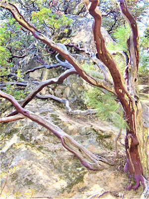
I admire the several stunted California Junipers (cypress family) in my presence, looking every bit as tough as Bristlecone Pine in the inhospitable heights of the White Mountains in the Eastern Sierra Nevadas.
.jpg)
Hours must pass in my mind before startling to the realization that I’ve left my hiking partner behind, and so must continue, without further delay, down the nastiest part of the scramble.
It's about 100 ft. down a rock-strewn, rutty, poison oak-infested, steep, narrow defile where I take a finger-jamming and leg-abrading stumble, nearly damage my camera, and get a bit more bloodied up. No big deal, just a few more souvenirs from Tuyshtak.
.jpg)
A bit worse for the wear, twenty minutes later, I’m reunited with Gambolin’ Gal, who has been patiently waiting for me in the sun, next to a peaceful zen waterfall scene, motionless but alert in a silent spell of meditative reverie.
Something yin / yang going on here between her and me!
Hand in (my one good) hand, we set off on the continuation of our loop, through the land of big chocolate rocks hundreds of millions of years old, passing beneath neck-craning high slopes dotted with wildflowers, gazing out to distant views, and ever more water flowing out of the Mountain.
.jpg)
It’s a slow, gimpy hike back, but no matter – things are more charming and enthralling than before! If it weren't for those minor annoyances of hunger, thirst and aching bodies, we‘re ready to do it all over again!

And, at the day, should fortune shine on us – we shall!
.jpg)
Praise be almighty Tuyshtak!
.jpg)
Check out more Gambolin' Man posts on the magic, mystery and majesty of Mount Diablo & environs:

Read bird-related posts wandering about the riparian nooks and crannies of Mount Diablo State Park:
Check out a trove of Gambolin' Man videos of Mount Diablo State Park's beauty, charms, wonders, magic & mystery:

posted by Gambolin' Man at Saturday, March 31, 2007
![]()


0 Comments:
Post a Comment
<< Home