ROBERT LOUIS STEVENSON STATE PARK: Lackadaisical Amble on Table Rock Trail Leads (Eventually) to Impressive Volcanic Bluff Overlooking Fabulous Wine Country
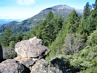
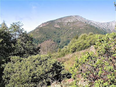
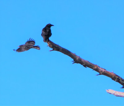
Two fitness walkers pause long enough on the frosty morning trail to greet us and mention to be on the lookout for the Peregrine falcons nesting in a hidden eyrie on the precipitous edges of the 200 ft. volcanic bluff known as Table Rock, in the purview of 4343 ft. Mount Saint Helena, the Bay Area's highest peak.
%20158%20(2).jpg)
Table Rock – an unassuming name for the odd-shaped boulders and hardened lava formations dominating the environs – provides the perfect habitat for the elegant and still endangered hawks to thrive.
Approaching the edge of the first big cliff, we look out and are instantly rewarded with a sighting of the couple, soaring together in a billowy sky over a deep green valley, gracefully swooping and looping in perfect unison, then flying out of sight, quite ecstatic mating companions for life, it appears, which could extend to twenty years.
I suggest a spontaneous escape to Sonoma wine country for the day, but not before an invigorating hike at “Bob L. Stevenson” park. Bob L. who? Bob L. where? I mean none other than unheralded and off-beat Robert Louis Stevenson State Park in Napa County, north of mineral springs mecca Calistoga.
%20151%20(2).jpg)
A quick Google search turns up, well, not much on Table Rock Trail’s many splendors. I’m guessing it’s one of those local “best kept secret” places, to be not talked up too, too much, for (rightfully so) fear of it being overrun by the hiking hordes. No fear of that – we see all of four people on a recent splendid Friday outing.
%20192%20(2).jpg)
I once mountain biked to Mount Saint Helena’s twin summits, challenged by the 8-mile, 2000 ft. elevation gain climb to the top, amazed by the expansive, 360 views of the Calistoga / Napa / Sonoma / Lake Valleys unfolding beneath me. That was a fun, beautiful experience.
.jpg)
But . . . it was on a sketchy gravel road, and the huge transmission tower complex at the summit didn’t make for the most inviting of surroundings. Looking beyond to the east, toward the rampart of volcanic rock outcroppings known as the Palisades, I knew I’d return to check it out, but didn’t know it would take three years!
%20177%20(2).jpg)
Today’s plan is to hike 1.8 miles on Table Rock Trail to Palisades Trail, then hike Palisades out 'n back 4 miles, for a total of 7.6 miles. A cakewalk. What can beat it, especially on such a beautiful day promising a classic springtime gambol.
.jpg)
It’s an ambitious agenda, though, given our propensity to amble, pause frequently, check out every little thing in exaggerated and endless fascination, not to mention nursing a lower extremity injury, and, ultimately, the powerful motivation to hit the cellars in time for a leisurely oeno-tour later in the day.
.jpg)
I’m mildly disappointed, because I want it all, now! Alas, Palisades Trail will just have to wait.
%20006%20(2).jpg)
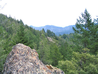
Table Rock Trail does not disappoint or let down despite its relatively short length of less than two miles. The hike satisfies every addicted craving of the Gambolin’ Man for big views, pretty California scenery, sacred running water, character-rich rock formations.
Add the challenge of being a moderately strenuous 3.6 miler, and Table Rock Trail surrenders up hours' worth of physical exertion, serendipitous discovery, meditative tarrying, and impulsive urges to seek out – poison oak be damned! – the most wonderful and delightful secretive worlds in the nooks and crannies of nature.
We – me and beautiful wife, best friend, and hiking partner, Gambolin’ Gal – park at about 2100 ft. at a hairpin turn-off on super-busy CA 29, the jammed artery connecting Calistoga / Napa with Middletown / Lake County. 2100 ft. is modest as elevations go, but at 9 am, it‘s surprisingly cold.
%20041%20(2).jpg)
The trail immediately starts climbing through a shaded mixed conifer, madrone, and manzanita forest. At an opening fifteen minutes into the hike, sunlight pours through, a veritable Goddess-send.
Snow-dusted Mount Saint Helena rises to impressive stature to the west – a novel panorama of an unknown landscape. Pushing on, the semi-frozen trail crunches with each step – icy patches and light snow blanket the land.
.jpg)
In half a mile, we climb several hundred feet, now plenty warmed up. I strip down – the day is suddenly one of those priceless, warm, winter / spring California days, in between rains, where you can see forever, and a boundless promise of optimism and good tidings is carried in the air like the fresh scent of lemony sage.
%20020%20(2).jpg)
You want to holler and whoop, in some sort of savage outburst of unbridled wild passion (your basic "barbaric yawp").
So you do: YAWP!

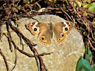
As the day continues to warm up, a few wildflowers have popped out to brighten things evermore. Lovely Painted Ladies appear out of nowhere in large numbers, fluttering around us in a magical, ethereal dance.
%20089%20(2).jpg)
Skittish Western fence lizards dart here and there. Birdsong fills the air. Everything’s coming to – LIFE! It’s a golden moment, you’re fully grateful to be alive, blessed to be healthy, happy to be enjoying the great California outdoors.
And not a soul in sight!
The morning, unfolding like a brilliant revelation, promises a wonderful and unexpected respite from the gloomy weather predicted for this day. We are thrilled to be here, someplace familiar but new, commonplace but exotic, far away but close enough to be on the trailhead in just ninety minutes – and a hop, skip and jump away from world-class wineries!
%20133%20(2).jpg)
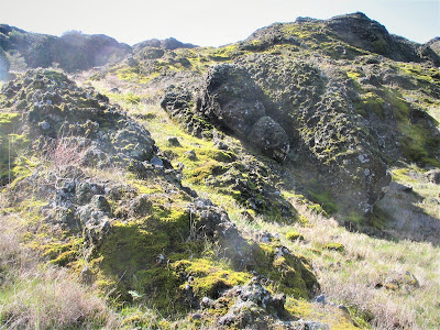
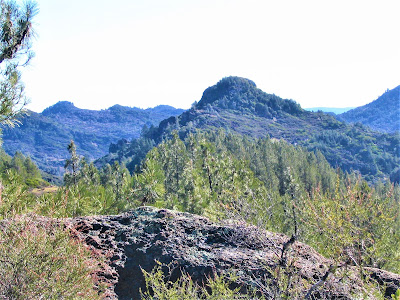
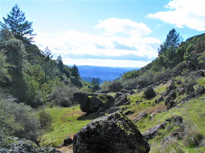
Imagine my pleasant surprise at our first rest stop, Table Rock overlook. I love rocks, and this is one big odd-shaped jumble of Earth’s bones, but still, compared to the real Table Rock, below us, it’s easy to dismiss it as a modest outcrop.

We seek purchase atop the big rocks for a brief respite, to gulp down some water, eat something, and take in sweeping views of lands beyond, a new viewscape, unseen, far-flung, wild California.
The knife-sharp ridges of Cache Creek Natural Area to the northeast, the rugged Clear Lake watersheds to the north / northwest, and beyond that, the twin summits of massive Snow Mountain (over 7,000 ft.) in the Mendocino National Forest; even our beloved Mount Diablo’s famous profile is clearly visible far to the south.
.jpg)
Definitely a WOW! moment!
.jpg)
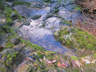
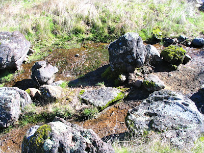
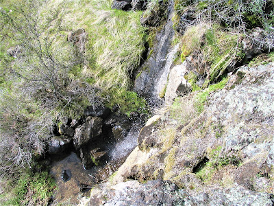
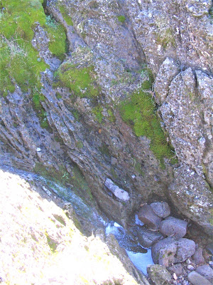
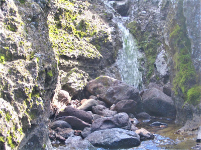
Winding, winding, down a rocky, rutted ravine path which improvises as a bedrock-cutting water course channeling the previous night’s considerable rains to a larger gully creek.
This makes the going a bit slippery, a tad more technical, yet at the same time, creating evermore enchanting conditions as we make our way down the micro river canyon of orange and alabaster bedrock.
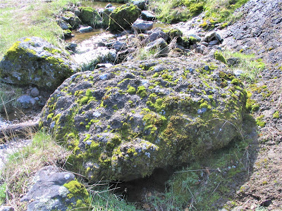
At the drop in elevation, the trail flattens, opening up to a broad area, a lovely boulder garden in a desert Southwest kind of environment. Another WOW! moment. To the north, the far-off rugged coastal ranges are blanketed in snow, a mirage against the cerulean expanse. I can’t take my eyes off the big, deep blue Cache Creek ridges.
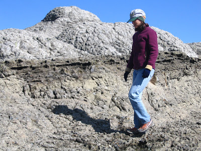
The immediate surroundings are reminiscent of that special desert-like ecosystem near Mount Diablo, specifically at 2000 ft. or so in the “island in the sky” at Las Trampas Regional Wilderness, only rockier.
It’s all unexpectedly very, very pretty! – scatterings of odd-shaped rocks, plastered with colorful lichen species glistening wet in full sunlight.
.jpg)
Tall cairns and a labyrinth wandering pagans have constructed; the non-stop views; the sound of nature’s music all around in the birdsong that fills the air and the gentle gurgling mantra of miniature rivers – it's all unexpectedly very, very pretty!
We walk the labyrinth, rejoicing in a moment of silence, of peace, of love and purity, all alone, together, in this special place and time.
An OM! (or OMG!) moment!
.jpg)
The rock garden ain't goin' nowhere. But we surmise that three punks, who pass us later in the day, must have been the ones who knocked over the tall cairn we find in ruins on our way back.
.jpg)
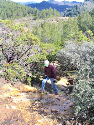
The trail turns cantankerous, dipping another couple of hundred feet down into a secluded gulch area. You’re absolutely lost to the world down in this paradise gully.

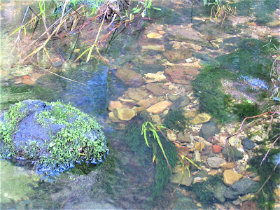
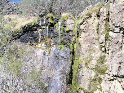
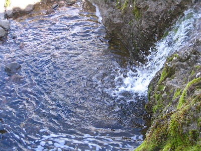
The sound of water gathering and gaining steam livens my pulse, makes me want to scurry off-course in a bushwhacking foray to find the outlet of the water course emerging from the dense brush in a back hillside.
.jpg)
There, we stop at a sunny elbow bend, and kick back in the warm rays, bathed in delightful sun, charmed by the tinkly gurgle of small water flowing, supremely enjoying a perfect sans souci moment – ticks be damned!
But we’re only halfway to our destination, and it’s getting on. I hate to leave this precious spot . . . But it ain’t goin’ nowhere, now, is it (?) . . . So got to keep moving.
.jpg)
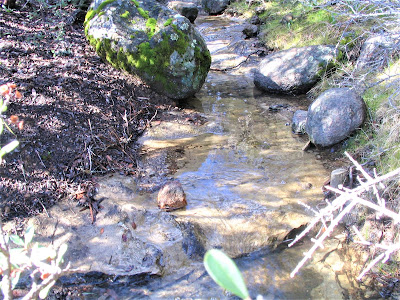
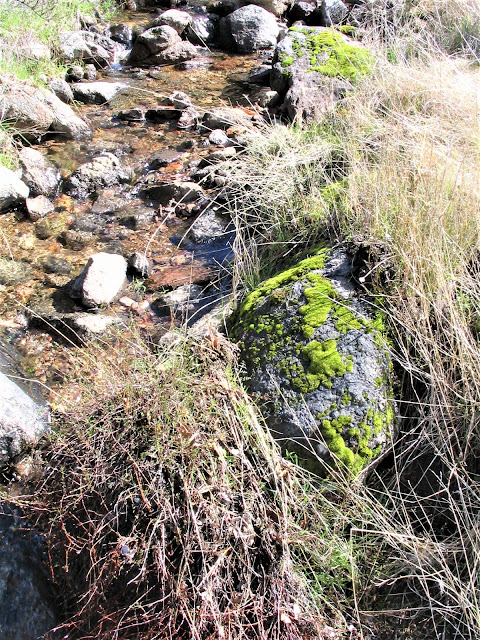
One surprise after another as we continue to drop down the steep trail. Now the freshets keep gaining momentum and join up with other small gully tributaries to create beautiful swirling arteries of water cascading in pools and riffles in a magical journey through the classic California landscape.
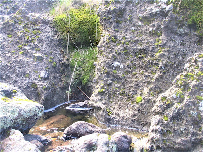
All such a beautiful attractive biota: scrub oak, western redbud, giant western fern, dogwood, budding buckeye trees, then back up through the chaparral community. Here we are at the overlapping landscapes of two major eco-zones, the magical intersection of the north coastal and Diablo ranges.
Just before the final push to the top of Table Rock bluff, the trail diverts to follow the course of another enchanting waterway spilling out of a Diabloesque rocky gorge. Here is the kind of natural sanctuary where I go to pray – to meditate – to give thanks and praise.

Here, I experience strip-my-soul-bare humility and a heart-felt rush of gratefulness for being alive, for having the will, the passion, the desire, to always seek out that which most people bypass without a second glance or consideration.

There, I’ll find the magic in the prosaic, the exotic in the pedestrian.
By now, it’s 1 p.m. and we’ve hiked only about two miles in four hours! (That’s a lively pace of about a half-mile per hour!) Our attention today, on this short two-mile stretch, has shifted – less about “how many miles can we cover” and more about “how much is seen, heard and experienced along the way.”
%20198%20(2).jpg)
For our mild-mannered exploits, we have been rewarded with spectacular views in all directions, wonderfully changing environments at different elevations, and the spellbinding beauty of flowing water.
At the volcanic bluff, we while away a good half hour espying the Peregrine Falcons and other birds, admiring distant mountain ranges to the west, and poking about in wind-carved caves and solution pockets among the high rocky terrain.

I’m impressed. Definitely a culminating WOW! moment, one Jack London himself might have enjoyed during his honeymoon here way back in 1880 when it was a wild, romantic setting.

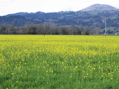
Time to head back, pronto, double-time! Visions of cozy wine cellars spur us on to reap the reward of sweet, luscious grapa. We make it in time to visit a couple of wineries, our favorite being Quivira, a small sustainable vineyard in the Dry Creek growing area near Healdsburg. Sheer loveliness, this world-class winery situated in sight of Mount Saint Helena.

Their explosive bouquet of zin samplings caps a truly magnificent day!

And, how nice, we’re home by seven, a bit sore and depleted, but safe and sound.
posted by Gambolin' Man at Monday, March 12, 2007
![]()


1 Comments:
How exactly do you get to the trail head of table rock? I've heard that it's the parking lot directly across the Mt. Saint Helena parking lot/base, but have not yet looked into it.
Post a Comment
<< Home