CACHE CREEK NATURAL AREA: A Strenuous Romp Up Untamed Cortina Ridge to Summit Glascock Mountain
You've got a day on your hands, and you're itching for an invigorating nature outing. You're willing to drive a couple of hours to get there, because you want a taste of wilderness beyond the purlieus of the Bay Area.

You want a rugged, expansive watershed, but near enough where you can knock it out in seven or eight hours and be home at a decent hour.
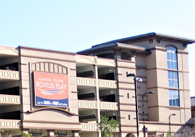
Or try to "win a ton" and be waylaid an additional seven or eight hours at the Rumsey Band of Wintun Indians' super-glitzy and extraordinarily out of place looking Cache Creek Casino Resort in the heart of their ancestral lands in bucolic Capay Valley.

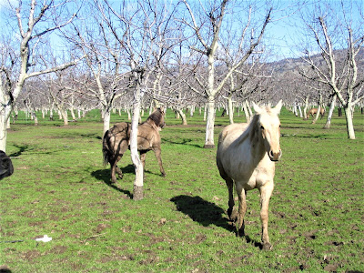
You want your adventure to be amid beautiful environs – in this case a mixture of picturesque farms and orchards in a big fertile valley hemmed in by high ridges and rolling hills – preferably in a never explored landscape, where you'd sooner encounter a mountain lion than a human.
You want to do something strenuous and no-nonsense, because, after all, you're alone – so you decide to climb up the side of a formidable ridge to see what you can see. You've chosen to tackle the off-beat and surprisingly spectacular Cortina Ridge.
Located in Yolo County, in the heart of the Cache Creek Natural Area, this fab venue is part of the larger Putah-Cache Bioregion, which is further a sub-region of the Central Valley Bioregion, encompassing hundreds of square miles of unexplored (for Gambolin' Man that is) wildlands.

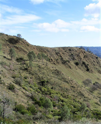
Okay, so what if it is scarred from centuries of human use and abuse in the name of survival, recreation, exploitation, and capital gain? It's still beautiful and remote. Blue Ridge and Fiske Peak crest out at nearly 2900 ft. across the canyon that is Highway 16 and Cache Creek.

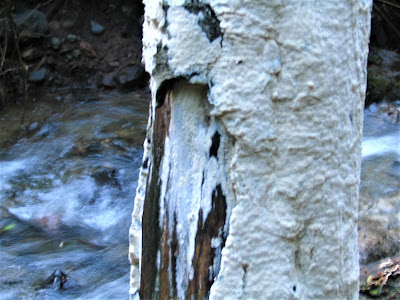
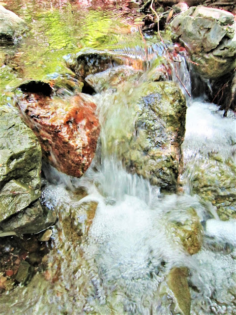
The road through the gorge rises suddenly out of the valley floor – the creek's muddyish waters are flowing furiously from recent rains. Cache and Blue Ridges stand out like a true mountainous spine of uplifted and tortured rock.
.jpg)
You really wanted to climb Blue Ridge, but because its trailhead remained inaccessible due to the raging waters of Cache Creek, you've "settled" for 2541 ft. Glascock Mountain on the lesser hiked Cortina Ridge.

By now, at a bright and early 7:30 am, you're eager for the thrilling prospect of adventure. You get out of the car, stretch, look around, breathe in crisp, clean air. The day will be perfectly Mediterranean, your nose tells you. Yet, just in case, you strap on to your Camelbak your lightweight Gortex jacket.

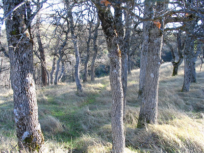
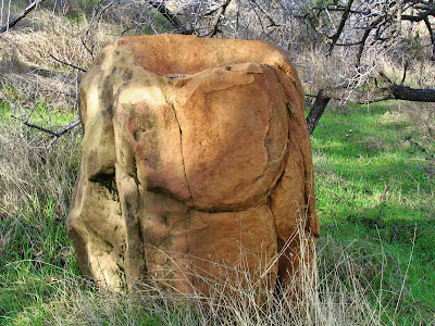
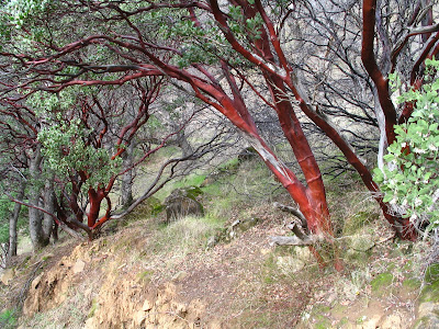
Within the first 50 feet, you realize why Cortina is the lesser of the hiked ridges. The trail – not too muddy, but pretty washed out with ruts and slides – immediately begins to wend inexorably upward through a beautiful blue oak forest punctuated by stands of shiny manzanita.

But you're fresh and excited, so you don't even realize you're climbing your ass off already. You stop after twenty minutes and maybe 500 feet to catch your breath, strip off layers, take a drink, snap some photos, eat a tangerine, make an offering to the spirits.
.jpg)
My GOD! you're thinking, this place is so remote and isolated you won't pass another perambulating soul the entire day, yet you're in state of forty million people and close enough to be in S'acto in an hour or two.
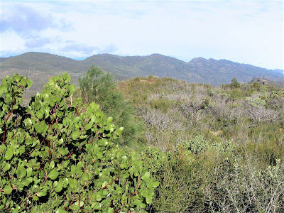
You look out and take in the hills, draped in many arboreal species classically representative of central California coastal range habitat – blue, live, coast oak, madrone, manzanita, willow, bay, sycamore . . . the riparian alternating with grasslands and chaparral.
You're hiking in a special place: as the Navaho would say, "in beauty you walk." Attaining the semi-rarefied heights of Glascock Peak requires more of a scramble than a walk; actually, you're really doggin' it up most of the way. You can't believe this motherhumper of a trail. It just keeps relentlessly grinding up, averaging grades of 25 to 50 percent.

You're thinking, this is ridiculous (weren't you having more fun drinking a beer and playing blackjack at 6 am?). You continue huffing and puffing, cursing the grade while marveling at Cortina Ridge's tough terrain and rugged Southwest-like features.
Sure, you could have driven another hour and accessed the easier, longer trailhead, but no, you have to do it the Sisyphean way – 2,000 feet of elevation gain in two miles.

A real bear. But you don't care – in beauty you dog it. Before you know it, you've knocked out most of the vicious stretches. The day has heated up. You're sweating profusely.
Along the way, you've encountered a family of deer, a curious skunk poking around in a pile of natural debris, several aerial predators, bobcat prints (you have to check your paw print cheat sheet), and evidence, you think, of wild boars on the rampage.
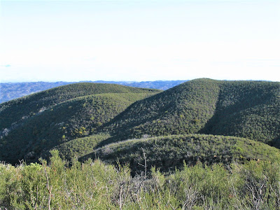
Before you know it, the world is unfolded at your feet, expanding in all directions like a Google satellite image. You're at the top of Cortina Ridge! The reward for those burning lungs?

Far-flung, top of the world views of endless miles of roller-coastery, heavily forested hills, resplendent landscapes your tired legs and soaring spirit long to explore. So off you go on a ridge top ramble, truly life's a gambol.
.jpg)
Now, it's sweet hiking – strolling merrily along dipsy-doo trails as though on the back of some kind of natural megafauna. You've slooooooooowed waaaaaay down, you're taking it alllllllll in, breathing deeeeeeeeply, reflecting on nature's bountiful beauty.

You stop to listen to a symphony of birdsong, admire a cloud worn view, walk mindlessly, or mindfully, along, amazed at the scenery, in awe of the sacred nature of the place – and not a single solitary soul in sight!
.jpg)
Is California so big that you might never have made it here, like all the rest, except for that unquenchable urge to seek out those semi-remote, difficult and obscure adventure spots? Time to head back down; clouds have appeared, the wind has picked up – and the going is rough. Remember those two thousand friggin' feet? Now, you're gonna really pay.
.jpg)
The descent turns into a lot of wildman downhill leaping and bounding. At the steeper pitches, you discover a "two-heeled" technique where you're literally bouncing down in great ten-foot strides and landing on your heels, toes up, in berms, or soft mounds of dirt layered crosswise on the trail – sounds nuts, but for someone with sore feet, you've found a relatively painless way down the absurd gradients.
.jpg)
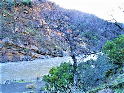
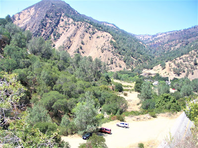
Once down, you go check out Cache Creek, no longer a mere silvery thread snaking through the canyon and Capay Valley. Now, it's a torrential river. You devour the remainder of your food while checking out the map.
You look upstream, imagining the higher headwater areas, east and south of Clear Lake, look downstream at the creek rushing to its confluence with the Sacramento River.
.jpg)
It's an unimaginably large wilderness area, this Cache Creek Natural Area – a designated "primitive area" of 70,000 acres of places you'll never visit. You've been to parts, rode your mountain bike on Red Bud Trail once, and was duly impressed.
.jpg)
There is where the protected bald eagles nest and feed on catfish and carp during their winter stay-over. There is where you may encounter a rare herd of tule elk. There is where you have a chance to spot hundreds of varieties of birds, if you're quiet and patient.
.jpg)
There, if you're lucky, you may see a bobcat, scare up some wild Toms or quail, or come upon evidence of mountain lions, bears, coyotes, grey foxes, badgers, skunks, weasels, or get a glimpse of the playful river otter.
.jpg)
Returning to the heartland of the primitive area will have to wait, but you know you'll get there, so you're fine with the day's mild-mannered adventure. And, hey, it's only four o'clock.
So, Gambolin' Man, what's next on the agenda?
.jpg)
Time for a little payback at the other Cache Creek?
posted by Gambolin' Man at Thursday, February 16, 2006
![]()


0 Comments:
Post a Comment
<< Home